McCreary County is a county located in the U.S. state of Kentucky. As of the 2020 census, the population was 16,888. Its county seat is Whitley City. The county is named for James B. McCreary, a Confederate war soldier and two-time Governor of Kentucky. During his second term as governor, McCreary County was created by the Legislature and was named in his honor.

Pine Knot is an unincorporated community and census-designated place (CDP) in McCreary County, Kentucky, United States. The population was 1,380 at the 2020 census, down from 1,621 in 2010.

Stearns is an unincorporated community and census-designated place (CDP) in McCreary County, Kentucky, United States. The population was 1,365 at the 2020 census. It was founded by Justus Smith Stearns.

The Big South Fork of the Cumberland River is a 76-mile-long (122 km) river in the U.S. states of Tennessee and Kentucky. It is a major drainage feature of the Cumberland Plateau, a major tributary of the Cumberland River system, and the major feature of the Big South Fork National River and Recreation Area.
Confidence is a small unincorporated community in Wayne County, Iowa, United States. Located in south central Iowa, the community lies along County Highway J18 in the northeastern corner of its county, just west of Rathbun Lake.

The Big South Fork Scenic Railway is a heritage railroad in Stearns, Kentucky.

The Big South Fork National River and Recreation Area, commonly known as Big South Fork, preserves the Big South Fork of the Cumberland River and its tributaries in northeastern Tennessee and southeastern Kentucky.
Austin is an unincorporated community, considered a ghost town, in Grant County, Oregon, United States. It is located north of Oregon Route 7, near the Middle Fork John Day River in the Malheur National Forest.
Stone is an unincorporated community and coal town in Pike County, Kentucky, United States. It was established in 1912. Stone was a mining community named for Galen Stone, head of the Pond Creek Coal Company which was based in Stone. In 1922 the Pond Creek Coal Company was sold to Fordson Coal Company, which was a subsidiary of Ford Motor Company. In 1936 Fordson sold the mine at Stone to Eastern Coal Company.

Constructed in 1907, the McCreary County Museum is housed in the former Stearns Coal and Lumber Company corporate headquarters in Stearns, Kentucky. The building served as the company's office headquarters in the Southern United States, and maintains the company president's office as an exhibit. The town where the museum is located was called the Stearns Empire of the South, and the museum continues to preserve and display the area's history from the Indian and pioneer times into the town's peak at the height of the coal and lumber industry boom. The exhibits include significant coverage of Appalachian life in McCreary County, including an exhibit on moonshine.

Kentucky Route 92 (KY 92) is a 112.485-mile-long (181.027 km) state highway Kentucky. The route is split into two segments by Lake Cumberland, one of a few state routes in Kentucky with two discontinued segments on both sides of a body of water. The western segment, which is 17.221-mile-long (27.715 km), runs from Kentucky Route 55 west of Joppa to a dead end on Lake Cumberland south of Jamestown via Joppa, Montpelier, Esto, and Jamestown. The eastern segment, which is 95.264-mile-long (153.313 km), runs from a boat ramp on Lake Cumberland northwest of Monticello to U.S. Route 25E west of Fourmile via Monticello, Barrier, Stearns, Carpenter, Timsley, and Ingram.
Galena is an unincorporated community in Grant County, Oregon, United States, about 20 miles (32 km) from Austin Junction in the Blue Mountains. It is on the Middle Fork John Day River in the Malheur national forest. The former gold mining camp is considered a ghost town.

Ethel is an unincorporated community in Logan County, West Virginia, United States. Ethel is located on West Virginia Route 17, 4.5 miles (7.2 km) east-northeast of Logan. Ethel has a post office with ZIP code 25076.
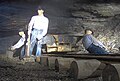
Barthell is a former coal town in McCreary County, Kentucky, United States. It was established in 1902 and was the first of 18 mining camps to be built by the Stearns Coal and Lumber Company. It now serves as an open-air history museum, which is open from April through Thanksgiving.
Yamacraw is an unincorporated community and coal town in McCreary County, Kentucky, United States. It was also known as Big South Fork. Their post office closed in 1950. The Lonesome post office was associated with the Yamacraw area.
Scuddy is an unincorporated community and coal town in Perry County, Kentucky, United States. Scuddy started mainly as a lumber community, but lumber gave way to coal. After trains entered Perry County in 1912, coal mining surpassed logging. In the 1920s nearby Hazard became the major mining center in the southeastern coalfields. A steadily progressive coal industry continues today. Long before Scuddy became a Coal town, Lumber Baron Ralph Hindo, who also had a hand in founding the town of Ridgway, PA, helped establish a lumber camp in what is now modern day Scuddy. The first such lumber camp was located where the current "Primitive Appalachian Woodwork Home Goods Store" is located but closer to the Carr Fork River. Hindo also, operated a local Haberdashery before closing camp and shop and moving to Ridgway, PA.
Horse Creek is a tributary of Goose Creek river in Clay County in the U.S. state of Kentucky. The Cumberland and Manchester Railway built a spur line up the creek, and it has been the site of operations of at least eight coal mining companies. The name comes, according to local tradition, from the proliferation of "horseweed" in the creek valley.

Tercio is a ghost town and former coal mine in Las Animas County, in the U.S. state of Colorado. The GNIS classifies it as a populated place. A post office called Tercio was established in 1902, and remained in operation until 1949. The community was the third coal mining community established by the Colorado Fuel and Iron company, hence the name.
Consumers is a ghost town in Carbon County, Utah, United States. It is located in the Gordon Valley near several other former coal mining communities that also are now ghost towns. It is less than a mile from the ghost town of National, and also quite near to Clear Creek.