Kentzou | |
|---|---|
Commune and town | |
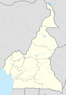
 Kentzou Location in Cameroon | |
| Coordinates: 4°10′N15°02′E / 4.167°N 15.033°E | |
| Country | |
| Region | East |
| Department | Kadey |
| Time zone | UTC+1 (WAT) |
Kentzou | |
|---|---|
Commune and town | |
| Kentzou Location in Cameroon | |
| Coordinates: 4°10′N15°02′E / 4.167°N 15.033°E | |
| Country | |
| Region | East |
| Department | Kadey |
| Time zone | UTC+1 (WAT) |
In the first months of 2014, the town became a destination for refugees fleeing violence in the Central African Republic.
The border town of Kentzou was amongst the areas most heavily affected as refugee arrivals peaked between February and March. According to Emmanuel Halpha, the prefect of the Batouri area in the east of Cameroon, Kentzou’s population “tripled in record time”. [1]
UNHCR Cameroon estimated that as of May 5, 2014, 11,971 people had crossed into Cameroon at Kentzou. [2]
According to IRIN, some of the refugees in Kentzou are third country nationals.
Unlike refugees who are protected by international conventions, third-country nationals (TCNs), who neither belong to the country of refuge or the one they fled, are not covered by any global rights conventions. It is often up to their governments to look after them and arrange for their repatriation. [3]
As of June 2014 in Kentzou, "embassy delegations have visited their nationals, including Malians, Nigerians, Nigeriens and Senegalese, offering cash and other donations of basic necessities, but not flights back home." [3]
The history of the Central African Republic is roughly composed of four distinct periods. The earliest period of settlement began around 10,000 years ago when nomadic people first began to settle, farm and fish in the region. The next period began around 1,000 to 3,000 years ago when several non-indigenous groups began to migrate into the region from other parts of the continent. The third period involved the colonial conquest and rule of the country by France and Germany which spanned from the late 1800s until 1960 when the Central African Republic became an independent state. The final period has been the era during which the Central African Republic has been an independent state.

François Bozizé Yangouvonda is a Central African politician who was President of the Central African Republic from 2003 to 2013.

Bertoua is the capital of the Eastern Region of Cameroon and of the Lom-et-Djerem Department. It has a population of 88,462, and is the traditional home of the Gbaya people. It is home to an airport and Mission Cameroon of Polish Dominican Order.

The Central African Republic Bush War was a civil war in the Central African Republic between Union of Democratic Forces for Unity (UFDR) rebels and government forces. The rebellion began after François Bozizé seized the nation's presidency in 2003. Actual fighting began in 2004. Around 10,000 people were displaced because of the civil unrest.
Batouri is a town and commune in the East Province of Cameroon. It is the second largest municipality in the province after the provincial capital Bertoua. It is located on the main road connecting Bertoua to the Central African Republic and to the Cameroonian town of Yokadouma. It had an estimated 33,500 inhabitants as of 2012.
Mayo-Rey is a department of North Province in Cameroon. The department covers an area of 36,529 km2 and as of 2001 had a total population of 242,441 .The capital of the department lies at Tcholliré.
Fotokol is a town and commune in Logone-et-Chari Department, Far North Region, Cameroon. It is home to Fotokol High School.

Garoua-Boulaï is a town and commune in Cameroon. The town is on the border with the Central African Republic. Across the border, the nearest CAR settlement on the road is Baboua.
Ngaoui is a town and commune in Cameroon.
Touboro is a town and commune in North Region Cameroon.
The Dongo conflict was a minor conflict centered in the town of Dongo, on the left bank of the Ubangi River in Sud-Ubangi District, Democratic Republic of the Congo. Violence initially broke out in late October 2009 after a local dispute over fishing rights. This destabilised the region and led to a spiral of violence, and an exodus of civilians attempting to flee from the fighting. By December 2009, this conflict was one of the biggest conflicts of the United Nations Mission in the Democratic Republic of Congo (MONUC) and the United Nations; more than 168,000 people had fled their homes, many of them crossing into the neighbouring Republic of the Congo. An intervention by the Congolese army and MONUC brought the conflict to an end by 13 December 2009.

The Central African Republic Civil War is an ongoing civil war in the Central African Republic (CAR) involving the government, rebels from the Séléka coalition, and anti-balaka militias.
The Popular Front for Recovery was a militia from Chad. It destabilized northern Central African Republic from 2008 to 2012.
Lolo is a village in Kadey Department, East Region, Cameroon, which had a population of about 2,000 in 2013.
As of 31 August 2020, Cameroon hosted a total refugee population of approximately 421,700. Of these, 280,500 were from the Central African Republic, driven by war and insecurity. In the Far North Region, Cameroon hosts 114,300 Nigerian refugees, with the population sharing their already scarce resources with the refugees.
Nigerian refugees are persons originating from the country of Nigeria, but seeking refuge outside the borders of their native country.Nigeria has a refugee crisis which has extended for almost a decade,this contributed too mainly insurgency in Nothern Nigeria by the faceless Boko Haram.
Gbiti is a border town in the East Province in Cameroon.
Mbilé, or Mbilé Refugee Camp, is located near the village of Lolo in Kadey Department, East Region, Cameroon.
The following lists events that happened during 2006 in the Central African Republic.

The Cameron–Central African Republic border is 901 km in length and runs from the tripoint with Chad in the north to the tripoint with the Republic of the Congo in the south.
Coordinates: 4°10′N15°02′E / 4.167°N 15.033°E
| | This Cameroon location article is a stub. You can help Wikipedia by expanding it. |
