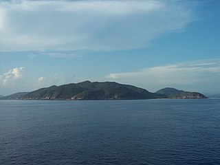
The South China Sea is a marginal sea of the Western Pacific Ocean. It is bounded in the north by South China, in the west by the Indochinese Peninsula, in the east by the islands of Taiwan and northwestern Philippines, and in the south by the Indonesian islands of Borneo, eastern Sumatra and the Bangka Belitung Islands, encompassing an area of around 3,500,000 km2 (1,400,000 sq mi). It communicates with the East China Sea via the Taiwan Strait, the Philippine Sea via the Luzon Strait, the Sulu Sea via the straits around Palawan, and the Java Sea via the Karimata and Bangka Straits. The Gulf of Thailand and the Gulf of Tonkin are part of the South China Sea.

The Riau Islands is a province of Indonesia - not to be confused with neighbouring Riau Province from which the islands were separated in 2002. The capital of the province is Tanjung Pinang and the largest city is Batam. It shares a maritime border with Riau and Jambi to the east, Bangka Belitung Islands to the south, Singapore to the northeast, Malaysia and West Kalimantan to the west, and Vietnam and Cambodia to the north. It comprises a total of 1,796 islands scattered between Sumatra, Malay Peninsula, and Borneo including the Riau Archipelago. Situated on one of the world's busiest shipping lanes along the Malacca Strait and the Natuna Sea, the province shares water borders with neighboring countries such as Singapore, Malaysia, and Brunei. The Riau Islands also have relatively large potential mineral resources and energy, as well as marine resources.

Natuna Regency is an islands regency located in the northernmost part of the Province of Riau Islands, Indonesia. It contains at least 154 islands, of which 127 of them are reported as uninhabited. This archipelago, with a land area of 1,978.31 km2 out of a total area of 264,198.37 km2 area, contains 15 districts, including the island district of Pulau Laut, Bunguran/Greater Natuna Island, the island district of Pulau Tiga, the island district of Midai, the island district of Subi, and the island district of Serasan.
Belitung is an island on the east coast of Sumatra, Indonesia in the Java Sea. It covers 4,800.6 km2 (1,853.5 sq mi), and had a population of 309,097 at the 2020 Census. Administratively, it forms two regencies within the province of Bangka-Belitung Islands. The island is known for its pepper and for its tin. It was in the possession of the United Kingdom from 1812 until Britain ceded control of the island to the Netherlands in the Anglo-Dutch Treaty of 1824. Its main town is Tanjung Pandan. The United Nations Educational, Scientific and Cultural Organization has declared 17 tourist attractions in the Belitung Geopark as world geoparks.

Anambas Islands Regency is a small archipelago of Indonesia, located 150 nautical miles northeast of Batam Island in the North Natuna Sea between the Malaysian mainland to the west and the island of Borneo to the east. Geographically part of the Tudjuh Archipelago, it is administratively a regency within the Riau Islands Province. It covers a land area of 590.14 square kilometres (227.85 sq mi) and had a population of 37,411 at the 2010 Census and 47,402 at the 2020 Census; the official estimate as at mid 2022 was 50,296. The administrative centre is at Tarempa on Siantan Island.

Bunguran Island or just Bunguran is the main island of the Middle Natuna Archipelago, which is part of the Riau Islands Province in Indonesia. It is also called Great Natuna Island.
South Natuna is an archipelago off the west coast of the island of Borneo, the southernmost group of the Natuna Islands in the South China Sea. Geographically it is part of the Tudjuh Archipelago, and administratively part of the Riau Islands Province of Indonesia.

China and Indonesia established formal diplomatic relations in 1950, more commonly referred to as Sino-Indonesian relations. Prior to this, for many centuries, the two countries maintained a variety of relations mainly in informal trade. Under Sukarno’s presidency, from 1945 to 1967, relations with China deepened, as in the early 1960s Sukarno embarked on a series of aggressive foreign policies under the rubric of anti-imperialism and personally championed the Non-Aligned Movement. These developments led to increasing friction with the West and closer relations both with China and the USSR.

The Natuna Island surili is a species of primate in the family Cercopithecidae.

Sky Aviation was a regional airline based in Jakarta, Indonesia. It started service in 2010 and suspended operation in 2014.
The East Natuna gas field is a large natural gas field located in the South China Sea off northern Natuna Island, Indonesia. It is within the disagreed area claimed by China.

Ranai Kotalit. 'Ranai City' is the capital of the Natuna Regency archipelago in the Riau Islands, Indonesia. It has one airport and can be reached by boat. It is located on Bunguran Island, in East Bunguran District, which had a population of 29,777 in mid 2022.

The Natuna Sea is an extensive shallow sea located around the Natuna Regency, extending south of the Riau Islands, east of the Lingga Regency and west of Borneo, to the Bangka Belitung Islands. The islands of the Badas and Tambelan Archipelago are located at its center. Mostly located within Indonesian territorial waters, it is the southernmost portion of the South China Sea, and geologically part of Sunda Shelf. It communicates with the Java Sea to its southeast via the Karimata and Gaspar Strait east and west of Belitung, and with the Strait of Malacca to the west via the Berhala and Singapore Strait.

KRI Tjiptadi (381) is a Parchim-class corvette currently operated by the Indonesian Navy. Prior to 1996, the Tjiptadi was part of the East German Volksmarine, as the Bergen (213).

Indonesia has the sixth-largest exclusive economic zone in the world with 6,159,032 km2 (2,378,016 sq mi). It claims an EEZ of 200 nautical miles (370 km) from its shores. This is due to the 13,466 islands of the Indonesian archipelago. It has the 3rd largest coastline of 54,720 km (34,000 mi). It is located in Southeast Asia between the Indian Ocean and the Pacific Ocean.

Ansar Ahmad is an Indonesian politician who served as the governor of Riau Islands following the 2020 gubernatorial election. He had previously served as a member of the People's Representative Council, and before that he served 10 years as regent of Bintan Regency.
Wahai Airport, is an airport in Wahai on the northern coast of Seram Island, Maluku, Indonesia.

The North Natuna Sea is a shallow body of water located north of Natuna Regency. Named by the Indonesian government in July 2017, Indonesia changed the northern part of its Exclusive Economic Zone in the South China Sea to the North Natuna Sea, bordering the southern part of Vietnam's Exclusive Economic Zone. The North Natuna Sea lies between the Natuna Islands and the Natuna Sea and Cape Cà Mau south of the Mekong Delta in Vietnam.


