Oregonia is an unincorporated community in northwestern Washington Township, Warren County, Ohio, United States, on the east shore of the Little Miami River about five miles northeast of Lebanon and six miles south of Waynesville. Today, it is considered a ghost town.

Erlach District was one of the 26 administrative districts in the canton of Bern, Switzerland. Its capital was Erlach. The district had an area of 96 km² and consists of 12 municipalities:

Hall Island is a small island located 3.5 miles (5.6 km) to the northwest of St. Matthew Island in the Bering Sea in Alaska, United States. It serves as a haulout site for Pacific walrus. It is 5 miles (8.0 km) in length and has a land area of 6.1758 square miles (15.995 km2). The highest point is 1,610 feet (490 m). Hall Island is uninhabited. It is part of the Bering Sea unit of the Alaska Maritime National Wildlife Refuge. It is one of three hall islands.

Romanów is a village in the administrative district of Gmina Przeworno, within Strzelin County, Lower Silesian Voivodeship, in south-western Poland. Prior to 1945 it was in Germany.

Karolewo is a village in the administrative district of Gmina Dobrcz, within Bydgoszcz County, Kuyavian-Pomeranian Voivodeship, in north-central Poland. It lies 6 kilometres (4 mi) north-west of Dobrcz and 23 km (14 mi) north of Bydgoszcz.

Apaga is a town in the Armavir Province of Armenia.

Aşağı Seyidəhmədli is a village in the Fizuli Rayon of Azerbaijan.

Wymysłów is a village in the administrative district of Gmina Włoszczowa, within Włoszczowa County, Świętokrzyskie Voivodeship, in south-central Poland. It lies approximately 10 kilometres (6 mi) east of Włoszczowa and 38 km (24 mi) west of the regional capital Kielce.
Romany-Janowięta is a village in the administrative district of Gmina Krzynowłoga Mała, within Przasnysz County, Masovian Voivodeship, in east-central Poland.

Wesoła is a village in the administrative district of Gmina Rybno, within Sochaczew County, Masovian Voivodeship, in east-central Poland. It lies approximately 4 kilometres (2 mi) south of Rybno, 11 km (7 mi) west of Sochaczew, and 62 km (39 mi) west of Warsaw.
The canton of Pernes-les-Fontaines is a French administrative division in the department of Vaucluse and region Provence-Alpes-Côte d'Azur.

Błotowo is a settlement in the administrative district of Gmina Studzienice, within Bytów County, Pomeranian Voivodeship, in northern Poland. It lies approximately 8 kilometres (5 mi) east of Studzienice, 14 km (9 mi) east of Bytów, and 69 km (43 mi) south-west of the regional capital Gdańsk.

Gulbity is a village in the administrative district of Gmina Pasłęk, within Elbląg County, Warmian-Masurian Voivodeship, in northern Poland. It lies approximately 7 kilometres (4 mi) north-east of Pasłęk, 21 km (13 mi) east of Elbląg, and 62 km (39 mi) north-west of the regional capital Olsztyn.

Kania is a settlement in the administrative district of Gmina Polanów, within Koszalin County, West Pomeranian Voivodeship, in north-western Poland. It lies approximately 1 kilometre (1 mi) south-east of Polanów, 36 km (22 mi) east of Koszalin, and 159 km (99 mi) north-east of the regional capital Szczecin.

Swadzim is a village in the administrative district of Gmina Barlinek, within Myślibórz County, West Pomeranian Voivodeship, in north-western Poland. It lies approximately 7 kilometres (4 mi) west of Barlinek, 18 km (11 mi) north-east of Myślibórz, and 58 km (36 mi) south-east of the regional capital Szczecin.

Summit Village is an unincorporated community in El Dorado County, California. It lies at an elevation of 633 feet.
Lauvkollen is a mountain in the municipalities of Sande in Vestfold and of Drammen in Buskerud, Norway

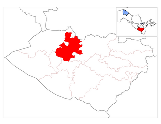
Koson District is a district of Qashqadaryo Region in Uzbekistan. The capital lies at Koson.
Reager is an unincorporated community in Norton County, Kansas, in the United States.

Yinhu station is a Metro station of Shenzhen Metro Line 9. It opened on 28 October 2016.


