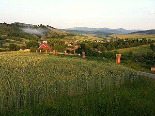
Čenkovice is a small village in the Pardubice Region of the Czech Republic. It has around 190 inhabitants.

Cardenete is a municipality in Cuenca, Castile-La Mancha, Spain. It has a population of 727.

This is a list of the extreme points of Azerbaijan, the points that are farther north, south, east or west than any other location.

Tabdi is a village and municipality in Bács-Kiskun county, in the Southern Great Plain region of southern Hungary.

Pusztamérges is a village in Csongrád county, in the Southern Great Plain region of southern Hungary.

Fülesd is a village in Szabolcs-Szatmár-Bereg county, in the Northern Great Plain region of eastern Hungary.
Blăgești is a commune in Bacău County, Romania. It is composed of five villages: Blăgești, Buda, Poiana Negustorului, Țârdenii Mari and Valea lui Ion.

Obârșia-Cloșani is a commune located in Mehedinți County, Romania. It is composed of two villages, Godeanu and Obârșia-Cloșani.

Vorța is a commune in Hunedoara County, Romania. It is composed of seven villages: Certeju de Jos (Alsócsertés), Coaja (Kózsa), Dumești (Dumesd), Luncșoara (Lunksora), Valea Poienii (Füzesdbogara), Visca (Viszka) and Vorța.

Wrogocin is a village in the administrative district of Gmina Drobin, within Płock County, Masovian Voivodeship, in east-central Poland. It lies approximately 7 kilometres (4 mi) south of Drobin, 27 km (17 mi) north-east of Płock, and 85 km (53 mi) north-west of Warsaw.
Yuxarı Fərəcan is a village in the Lachin Rayon of Azerbaijan.
Qardili is a village and municipality in the Salyan Rayon of Azerbaijan. It has a population of 1,263.
Dükanlar is a village in the Shusha Rayon of Azerbaijan.

Worniny is a village in the administrative district of Gmina Ostróda, within Ostróda County, Warmian-Masurian Voivodeship, in northern Poland. It lies approximately 4 kilometres (2 mi) south-east of Ostróda and 34 km (21 mi) west of the regional capital Olsztyn.
Vvedensky, Vvedenskaya, or Vvedenskoye is the name of several rural localities in Russia.

Sănătăuca is a village in Florești District, Moldova.

Elbeyli is a village in Erdemli district of Mersin Province, Turkey. At 36°41′N34°01′E it is inj the forests of Toros Mountains. Distance to Erdemli is 46 kilometres (29 mi) and to Mersin is 82 kilometres (51 mi). The population of Elbeyli was 504 as of 2012. The village was founded in 1800s by Turkmen people. The main econoımic activity of the village is farming. Tomato, cucumber and beans are produced.
Aksenov/Aksyonov or Aksenova/Aksyonova is the name of several rural localities in Russia.

Kisbárkány is a tidy village in Nógrád County, Hungary with 161 inhabitants (2014). The village is located in a narrow valley between the wooded hills of the Cserhát. The population is Hungarian but the village also has some house owners from Western European countries. In the wide valley adjacent to Kisbárkány, at the end of a dead end road lays Bedepuszta, a small hamlet used as event village for international events, like Sziget Detox/Sziget Retreat.


