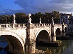
Kharaba Bridge

Last updated
Kharaba Bridge
Coordinates 32°33′04″N36°26′00″E / 32.551093°N 36.433285°E / 32.551093; 36.433285
CrossesWadi Zeidi
LocaleClose to Bosra, Syria
Characteristics
Design Arch bridge
Material Basalt blocks
Width4.52 m
Longest span3.8 m
No. of spans3
Location
Kharaba Bridge

The Kharaba Bridge is a Roman bridge in the village of Kharaba in the fertile Hauran region of Syria, close to the city of Bosra (ancient Bostra).

Contents

The bridge crosses the Wadi Zeidi, a tributary of the Yarmuk, 3.5 km northwest of Bosra. [1] It has three semi-circular arches, each 3.8 m clear, that rest on 2.4 m wide piers with a height of 2.5 m to the springing level. [1] The bridge width is 4.52 m. [2] At the eastern side exists a small squarish floodway which is supported by a column with capital. [3] The vaults and the covering are predominantly built with black greenish basalt ashlar; overall, the ancient structure is still in a fairly good condition. [3]

There are at least two more Roman bridges crossing the Wadi Zeidi: the Gemarrin Bridge and one at Al-Taybah. [4]

See also

Related Research Articles

Roman bridge Bridges built by ancient Romans

The ancient Romans were the first civilization to build large, permanent bridges. Early Roman bridges used techniques introduced by Etruscan immigrants, but the Romans improved those skills, developing and enhancing methods such as arches and keystones. There were three major types of Roman bridge: wooden, pontoon, and stone. Early Roman bridges were wooden, but by the 2nd century stone was being used. Stone bridges used the arch as their basic structure, and most used concrete, the first use of this material in bridge-building.

Bosra Town in Daraa, Syria

Bosra, also spelled Bostra, Busrana, Bozrah, Bozra and officially called Busra al-Sham, is a town in southern Syria, administratively belonging to the Daraa District of the Daraa Governorate and geographically part of the Hauran region.

Hauran Region in Syria and Jordan

The Hauran also spelled Hawran or Houran) is a region that spans parts of southern Syria and northern Jordan. It is bound in the north by the Ghouta oasis, eastwards by the al-Safa field, to the south by Jordan's desert steppe and to the west by the Golan Heights. Traditionally, the Hauran consists of three subregions: the Nuqrah and Jaydur plains, the Jabal al-Druze massif, and the Lajat volcanic field. The population of the Hauran is largely Arab, but religiously heterogeneous; most inhabitants of the plains are Sunni Muslims belonging to large agrarian clans, while Druze form the majority in the eponymous Jabal al-Druze and a significant Greek Orthodox and Greek Catholic minority inhabit the western foothills of Jabal al-Druze. The region's largest towns are Daraa, al-Ramtha and al-Suwayda.

Alconétar Bridge Cultural property in Garrovillas de Alconétar, Spain

The Alconétar Bridge, also known as Puente de Mantible, was a Roman segmental arch bridge in the Extremadura region, Spain. The ancient structure, which featured flattened arches with a span-to-rise ratio of 4–5:1, is one of the earliest of its kind. Due to its design, it is assumed that the bridge was erected in the early 2nd century AD by the emperors Trajan or Hadrian, possibly under the guidance of Apollodorus of Damascus, the most famous architect of the time.

Pont sur la Laye

The Pont sur la Laye or Pont roman de Mane is an old stone arch bridge across the stream Laye in the French Provence close to the town Mane.

Gemarrin Bridge

The Bridge of Gemarrin is a Roman bridge in the village of Jemarrin near the ancient city of Bosra in southern Syria. The bridge belonged to the Roman road to Soada Dionysias (As-Suwayda), crossing the Wadi Zeidi some kilometers north of Bostra.

The Bridge at Nimreh is a Roman bridge in the vicinity of Shahba, Syria, dating to the 3rd or 4th century AD. Its transversal arch construction derives from old building traditions of the Hauran region and is arguably unique in Roman bridge building.

Bridge near Kemer

The Bridge near Seydikemer was a Roman segmental arch bridge near the ancient city of Xanthos in Lycia, in modern-day southwestern Turkey. Its remains are located on the upper reaches of the Xanthos river, 4 km upstream from the town of Seydikemer, at a site where the gravel river bed reaches a width of 500 m. Only a 29 m long and 4.5 m wide section on the right river bank, outside the inundation zone, is left today, having once served as approach to the bridge proper. Despite its near-complete destruction, the bridge represents a noteworthy example of the early use of segmental arches and hollow chambers in bridge building.

Karamagara Bridge Submerged bridge in Turkey

The Karamagara Bridge is a Byzantine or late Roman bridge in the ancient region of Cappadocia in eastern Turkey, and possibly the earliest known pointed arch bridge.

Arapsu Bridge

The Arapsu Bridge is a Roman bridge in Antalya, Turkey. The well-preserved footbridge lies in the Arapsuyu district, 5–6 km west to the city center, at the foot of an ancient mound which is associated with the Greek colony of Olbia.

Band-e Kaisar

The Band-e Kaisar, Pol-e Kaisar, Bridge of Valerian or Shadirwan was an ancient arch bridge in Shushtar, Iran, and the first in the country to combine it with a dam. Built by the Sassanids, using Roman prisoners of war as workforce, in the 3rd century AD on Sassanid order, it was also the most eastern example of Roman bridge design and Roman dam, lying deep in Persian territory. Its dual-purpose design exerted a profound influence on Iranian civil engineering and was instrumental in developing Sassanid water management techniques.

Al-Qurayya is a town in southern Syria, administratively part of the al-Suwayda Governorate, located south of al-Suwayda. Nearby localities include Bosra to the southwest, Hout to the south, Salkhad to the southeast, al-Kafr, Hibran and Sahwat al-Khudr to the northeast, Sahwat Bilata and Rasas to the north and 'Ara and al-Mujaymer to the northwest. According to the Syria Central Bureau of Statistics (CBS), al-Qurayya had a population of 6,789 in the 2004 census. The town is also the administrative center of the al-Qurayya nahiyah which consists of four towns with a combined population of 9,892.

Transjordan, the East Bank, or the Transjordanian Highlands, is the part of the Southern Levant east of the Jordan River, mostly contained in present-day Jordan.

Al-Sahwah ; also known as Sahwat al-Qamh or Sehwet el-Kamh is a village in southern Syria, administratively part of the Daraa Governorate, located east of Daraa. Nearby localities include al-Jiza to the southwest, Ghasm to the south, Maaraba, Daraa to the southeast, Umm Walad to the northeast, al-Musayfirah to the north and Kahil to the west. According to the Syria Central Bureau of Statistics, al-Sahwah had a population of 3,950 in the 2004 census, making it the least populous locality in the al-Musayfirah nahiyah ("subdistrict").

Melkite Greek Catholic Archeparchy of Bosra and Hauran is an archeparchy of the Melkite Greek Catholic Church with its territory located in Syria. It is currently governed by Archeparch Nicolas Antiba, BA.

Jamrin is a village in southern Syria, administratively part of the Daraa Governorate, located east of Daraa and immediately north of Bosra. Other nearby localities include Maaraba to the west, Kharaba to the northwest, al-Mujaymer to the north and al-Qurayya to the east. According to the Syria Central Bureau of Statistics (CBS), Jamrin had a population of 1,000 in the 2004 census.

Al-Taybah is a Syrian village in Daraa District in Daraa Governorate. According to the Syria Central Bureau of Statistics (CBS), Al-Taybah had a population of 7,969 in the 2004 census.

Wadi Zeidi is a river in Syria, which flows west for 101 kilometres (63 mi) in a wadi by the same name. It rises from the slopes of Jabal al-Druze and terminates in the Yarmouk River near Zayzun.

References

  1. 1 2 O’Connor 1993 , p. 131
  2. Kissel & Stoll 2000 , p. 115
  3. 1 2 Kissel & Stoll 2000 , p. 117, Fig. 12
  4. Kissel & Stoll 2000 , p. 110, Fig. 1b

Sources