Verkhoyansk is a town in Verkhoyansky District of the Sakha Republic, Russia, located on the Yana River in the Arctic Circle, 92 kilometers (57 mi) from Batagay, the administrative center of the district, and 675 kilometers (419 mi) north of Yakutsk, the capital of the Sakha republic. As of the 2010 Census, its population was 1,311. Verkhoyansk holds the record for both the hottest and the coldest temperatures ever recorded above the Arctic Circle, with 38.0 °C (100.4 °F) and −67.8 °C (−90.0 °F) respectively. The heat record is shared with Fort Yukon, and the cold record is shared with Oymyakon.

Nakhodka is a port city in Primorsky Krai, Russia, located on the Trudny Peninsula jutting into the Nakhodka Bay of the Sea of Japan, about 85 kilometers (53 mi) east of Vladivostok, the administrative center of the krai. Population: 159,719 (2010 Census); 148,826 (2002 Census); 160,056 (1989 Census).

Provideniya is an urban locality and the administrative center of Providensky District of Chukotka Autonomous Okrug, Russia, located on Komsomolskaya Bay in the northeastern part of the autonomous okrug, across the Bering Strait from Alaska, and very close to the International Date Line. The population has declined in recent decades: 1,970 (2010 Census); 2,723 (2002 Census); 5,432 (1989 Census).

Pechora is a town in the Komi Republic, Russia, located on the Pechora River, west of and near the northern Ural Mountains. The area of the town is 28.9 square kilometres (11.2 sq mi). Population: 43,105 (2010 Census); 48,700 (2002 Census); 64,746 (1989 Census).
Apsheronsk is a town and the administrative center of Apsheronsky District of Krasnodar Krai, Russia, located on the Pshekha River. Population: 40,225 (2010 Census); 39,608 (2002 Census); 34,505 (1989 Census); 33,400 (1968).

Goryachy Klyuch is a town and a balneological resort in Krasnodar Krai, Russia, located on the Psekups River 65 kilometers (40 mi) south of Krasnodar, the administrative center of the krai. Population: 30,126 (2010 Census); 27,693 (2002 Census); 25,610 (1989 Census); 20,000 (1970).

Torbeyevo is an urban locality and the administrative center of Torbeyevsky District in the Republic of Mordovia, Russia. As of the 2010 Census, its population was 9,373.

Kurilsk is a town and the administrative center of Kurilsky District of Sakhalin Oblast, Russia, located on the island of Iturup. Population: 2,070 (2010 Census); 2,233 (2002 Census); 2,699 (1989 Census).

Udachny is a town in Mirninsky District of the Sakha Republic, Russia, located on the Markha River, 508 kilometers (316 mi) from Mirny, the administrative center of the district. As of the 2010 Census, its population was 12,613.
Egvekinot is an urban locality and the administrative center of Iultinsky District in Chukotka Autonomous Okrug, Russia. Population: 2,790 (2010 Census); 2,413 (2002 Census); 5,478 (1989 Census).

Ust-Omchug is an urban locality and the administrative center of Tenkinsky District of Magadan Oblast, Russia, located at the 271-kilometer (168 mi) mark of the highway to the northwest of Magadan. Population: 3,914 (2010 Census); 4,867 (2002 Census); 11,343 (1989 Census).
Olyokminsk is a town and the administrative center of Olyokminsky District in the Sakha Republic, Russia, located on the left bank of the Lena River, 651 kilometers (405 mi) southwest of Yakutsk, the capital of the republic. As of the 2010 Census, its population was 9,494.
Mys Shmidta is an urban locality in Iultinsky District of Chukotka Autonomous Okrug, Russia, located about 5 kilometers (3 mi) southeast of the cape of the same name on the shore of the Chukchi Sea, south of Wrangel Island, about 650 kilometers (400 mi) from Anadyr, the administrative center of the autonomous okrug. The cape, but not the settlement, was formerly known as North Cape. Cape Billings is located to the west of it and Cape Vankarem is to the east. As of the 2010 Census, its population was 492; down from 705 recorded in the 2002 Census.
Yerbogachen, sometimes written Erbogachen or Erbogachene, is a rural locality in Irkutsk Oblast, Russia, located on the Nizhnyaya Tunguska River. It is the administrative center of Katangsky District. Population: 1,965 (2010 Census);

Chernushinsky District is an administrative district (raion) of Perm Krai, Russia; one of the thirty-three in the krai. Municipally, it is incorporated as Chernushinsky Municipal District. It is located in the south of the krai and borders with Uinsky District in the north, Oktyabrsky District in the east, the Republic of Bashkortostan in the south, Kuyedinsky District in the west, and with Bardymsky District in the northwest. The area of the district is 1,676 square kilometers (647 sq mi). Its administrative center is the town of Chernushka. Population: 50,593 (2010 Census); 53,746 (2002 Census); 51,743 (1989 Census). The population of Chernushka accounts for 65.8% of the district's total population.

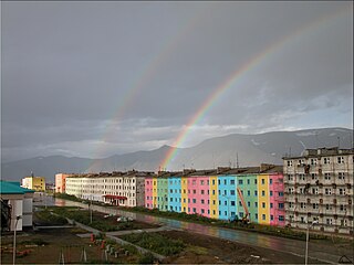
Omsukchan is an urban locality and the administrative center of Omsukchansky District of Magadan Oblast, Russia, located 576 kilometers (358 mi) north of Magadan. Population: 4,157 (2010 Census); 4,529 (2002 Census); 9,873 (1989 Census).

Ust-Tsilma is a rural locality and the administrative center of Ust-Tsilemsky District of the Komi Republic, Russia, located where the Tsilma River enters the Pechora River. Population: 4,877 (2010 Census); 5,081 (2002 Census); 5,344 (1989 Census).
Olenyok is a rural locality and the administrative center of Olenyoksky District in the Sakha Republic, Russia, located on the bank of the Olenyok River inside the Arctic Circle. Population: 2,273 (2010 Census); 2,228 (2002 Census); 2,133 (1989 Census).
Vilyuysk is a town and the administrative center of Vilyuysky District in the Sakha Republic, Russia, located on the Vilyuy River, about 600 kilometers (370 mi) from Yakutsk, the capital of the republic. As of the 2010 Census, its population was 10,234.

Satis is an urban locality in Nizhny Novgorod Oblast, Russia. Population: 1,640 (2010 Census); 1,899 (2002 Census); 2,430 (1989 Census).