Killiney Castle

Last updated

Killiney Castle
Killiney Castle.jpg
19th-century illustration, titled "Mount Malpas", from the Dublin Penny Journal (May 1835)
Killiney Castle
Alternative namesMount Malpas, Rocksborough, Loftus Hill, Fitzpatrick Castle Hotel
General information
TypeCastellated manor house
Architectural styleGothic revival
AddressKilliney Hill Road
Town or cityKilliney, County Dublin
CountryIreland
Coordinates 53°16′09″N6°06′48″W / 53.2693°N 6.1133°W / 53.2693; -6.1133
Year(s) builtc.1740 (original Georgian house), c.1840 (Gothic remodelling)
Design and construction
Architect(s)Sandham Symes (1840s remodelling) [1]
Designations Protected structure [2]

Killiney Castle, also known as Mount Malpas, [3] Rocksborough, [3] or Loftus Hill, and now known as Fitzpatrick Castle Hotel, is an 18th-century manor house near Killiney in County Dublin, Ireland. Subsequently converted into a hotel, [4] it has operated as one since 1971. [5]

Contents

History

As of the 13th century, the lands on which Killiney Castle was later built, was reputedly under the control of the Talbots of Malahide. [6]

18th century development

Colonel John Malpas constructed Mount Malpas, now known as Killiney Castle, in 1740. An advertisement in Falkiner's Dublin Journal of 1752 suggests that Malpas may have rented the castle in its early years: "Roxborough, formerly called Mount Malpas, containing 150 acres of land enclosed by a stone wall and a new well-furnished house of six rooms and two large closets on a floor with offices". [7] The original Mount Malpas was a Georgian mansion, with two-storeys over a basement.

By the mid-18th century the estate was known as "Loftus Hill" and associated with Henry Loftus (MP for Bannow in County Wexford and later Viscount of Ely). [4] By the 1780s, the leaseholder was Humphrey Minchin. [4]

Bourchier (1797-1834)

Early in the 1700s, Northamptonshire soldier Thomas Bouchier/Bourchier settled in County Tipperary. His descendants later intermarried with other Irish families. By the beginning of the 19th century, their primary home was Killiney Castle in County Dublin. A descendent of Thomas Bourchier, also known as Thomas Bourchier, was the Clerk of the Crown, Hanaper, and Usher of the Black Rod in the Irish House of Commons. He was a resident of Killiney Castle, and his relocation to the area may have coincided with his appointment as deputy clerk in July 1797. [4] In the Tithe Applotment Book of 1826, the owner and occupier of "Mount Mapas" is listed as Thomas Bourcheir Esq. [4] An entry in the Dublin Penny Journal, dated to August 1834, describes the main house as: [4] [8]

The residence of some foolish city Goth who has contrived to make a burlesque upon castellation by affixing certain indentures to the top of his house like the toothed deed by which he himself was bound over to an attorney or dealer; and with the accompaniments of slashes in the walls and things like mustard pots and pepper castors at the corners, has turned a good old plain country mansion into a Babel building, where all art is confounded, taste abused and there it stands like a fool upon a cock-horse; nonsense set upon a hill.

Dublin Penny Journal, August 1834

Warren Era (1834-1872)

Holy Trinity Church was built on the demesne of Killiney House (castle) in 1848 Holy Trinity Church, Killiney - geograph.org.uk - 1762080.jpg
Holy Trinity Church was built on the demesne of Killiney House (castle) in 1848

By the mid-19th century, the estate was associated with Robert Warren, a solicitor and developer who had made a fortune selling land to the Dublin and Bray Railway. Warren's home, Killiney House, was renamed Killiney Castle after it was given crenellations. These works were completed c.1840 and are attributed by several sources, including the Dictionary of Irish Architects , to Warren's relative, architect Sandham Symes. [9] [1] The works included the installation of castellations, fake medieval corner towers, turrets, battlements and a Gothic porch. [10] A Church of Ireland church, dedicated to the Holy Trinity, was also built on the demesne in 1859. [11]

Warren had influence with the railway company since he owned the coastal lands along the rail route from Dalkey to Bray and beyond. [12] After some negotiation, a tunnel was built, allowing the line to open. As part of the agreement, Obelisk Hill Halt was built on Warren's land, increasing the value of his holdings and quickening the rate of local development. [12]

By the early 1870s, a number of Warren's investments and development projects had failed and, in 1871, the Landed Estates Court obliged him to sell the Killiney land at auction to pay off related debts. [4] Following the auction, in which Victoria Castle was purchased for £5,000-0-0 by Humphrey Lloyd, the provost of Trinity College at the time, Warren had enough money to pay off his main creditors. After he gave the court more than £11,000-0-0, the remaining properties were taken out of the auction. He remained in Killiney Castle, passing it to his son, Robert Warren (junior), by 1873. [4]

Jesuit house

By the mid-1870s, the house had been purchased by the Jesuit Order in Ireland, for use as a "villa [holiday] house". [13] The Jesuits occupied the house between 1877 and 1880. [4]

Thomas Chippendall Higgin

Thomas Chippendall Higgin purchased the house around 1880. He built a half-octagonal castellated tower, a cut-stone doorway, and an entrance porch to the front of the castle. The door-case is in the style of the seventeenth century and has a carved plaque. Higgin was buried atop Dalkey Hill in 1906, where a broken cross is inscribed with the words "Dust thou art, to dust returneth, Was not spoken of the soul". [4]

20th century

The castle was used as a base by the Black and Tans in the Irish War of Independence (1919–1921) and by the Irish Republican Army (IRA) during the Irish Civil War (1922–1923). [7] Subsequently burned and largely abandoned, the castle was reputedly used as a base, for the IRA's campaign of sabotage and bombings, in the 1930s. [4] [14] The building was requisitioned and used as billets for Irish Army during The Emergency (1939–1945). [7]

Subsequently acquired by the Fitzpatrick family, [15] the castle was converted and opened as a hotel in the early 1970s. [7]

Demesne

The obelisk on Killiney Hill has an inscription mentioning John Mapas (dated 1742) and a plaque marking its restoration by then estate owner Robert Warren (dated 1840) Killiney Hill Obelisk.jpg
The obelisk on Killiney Hill has an inscription mentioning John Mapas (dated 1742) and a plaque marking its restoration by then estate owner Robert Warren (dated 1840)

At the time of its construction in the 18th century, the 150-acre Killiney Castle estate was surrounded by a stone wall, with the exception of the sea, "where nature had sufficiently enclosed them". [4] Originally known as Mount Mapas, the surrounding demesne and gardens were planted with assortment of flowers and fruit trees. [4]

According to Peter Wilson's Dublin Directory of 1768, Henry Loftus, undertook several enhancements to the home and gardens. Described as being "enclosed with high stone walls, stocked with the best fruit trees, and such a collection of flowers as must captivate the most insensible eye", Loftus reputedly laid a new carriage road around Killiney Hill, blasting rock outcrops and filling them in with earth, and planting a variety of trees and shrubs on the hill's west side. Wilson adds that although Loftus had planned to construct a banqueting house in the woods, he instead devoted his energies to works at Rathfarnham Castle. [4] [17]

Bourchier's Obelisk, within Killiney Hill Park, is listed in Dun Laoghaire Rathdown County Council's Record of Protected Structures. [18] This may be the smaller obelisk (compared to the Killiney Hill Obelisk) mentioned in Francis Erlington Ball's History Of The County Dublin, in which it is reported that "in 1796 [..] a memorial was about to be placed on the hill, in pursuance of the will of the last Mr. Mapas, who left a large sum for the erection of a monument to his family". Thomas Bourchier (d.1832) seems to have completed this task. [18] [19]

Related Research Articles

<span class="mw-page-title-main">Blackrock, Dublin</span> Suburb of Dublin in Dún Laoghaire-Rathdown, Ireland

Blackrock is a suburb of Dublin, Ireland, 3 km (1.9 mi) northwest of Dún Laoghaire. It is named after the local geological rock formation to be found in the area of Blackrock Park. In the late 18th century, the Blackrock Road was a common place for highway robberies. The Blackrock baths, provided for by the railway company in 1839, became popular in the 19th century but Blackrock is now a tourist destination.
<span class="mw-page-title-main">Shankill, Dublin</span> Outlying suburb of Dublin, Ireland

Shankill is an outlying suburb of Dublin, Ireland, on the southeast of County Dublin, close to the border with County Wicklow. It is in the local government area of Dún Laoghaire–Rathdown and had a population of 14,257 as of the 2016 census. It runs from the coast, between Loughlinstown and Bray, inland towards the foothills of the Dublin Mountains. Shankill borders Rathmichael, as well as Loughlinstown, Killiney, Ballybrack and Bray in County Wicklow. It is part of the civil parish of Rathmichael and contains the formerly separate district of Shanganagh, and in its southern parts, the locality of Crinken.

<span class="mw-page-title-main">Dublin Bay</span> Inlet of the Irish Sea around Dublin, Ireland

Dublin Bay is a C-shaped inlet of the Irish Sea on the east coast of Ireland. The bay is about 10 kilometres wide along its north–south base, and 7 km in length to its apex at the centre of the city of Dublin; stretching from Howth Head in the north to Dalkey Point in the south. North Bull Island is situated in the northwest part of the bay, where one of two major inshore sand banks lay, and features a 5 km long sandy beach, Dollymount Strand, fronting an internationally recognised wildfowl reserve. Many of the rivers of Dublin reach the Irish Sea at Dublin Bay: the River Liffey, with the River Dodder flow received less than 1 km inland, River Tolka, and various smaller rivers and streams.

<span class="mw-page-title-main">Dalkey</span> Suburb of Dublin, Ireland, in Dún Laoghaire–Rathdown

Dalkey is an affluent suburb of Dublin, and a seaside resort southeast of the city, and the town of Dún Laoghaire, in the county of Dún Laoghaire–Rathdown in the traditional County Dublin, Ireland. It was founded as a Viking settlement and became an active port during the Middle Ages. According to chronicler John Clyn (c.1286–c.1349), it was one of the ports through which the plague entered Ireland in the mid-14th century. In modern times, Dalkey has become a seaside suburb that attracts some tourist visitors.

<span class="mw-page-title-main">Monkstown, County Dublin</span> Suburb of Dublin. Ireland

Monkstown, historically known as Carrickbrennan, is a suburb in south Dublin, located in Dún Laoghaire–Rathdown, Ireland. It is on the coast, between Blackrock and Dún Laoghaire.

<span class="mw-page-title-main">Killiney</span> Suburb of Dublin in Dún Laoghaire-Rathdown, Ireland

Killiney is an affluent suburb in the southern coastal part of County Dublin, Ireland. It lies south of Dalkey, east and northeast of Ballybrack and Sallynoggin and north of Shankill. The place grew around the 11th century Killiney Church, and became a popular seaside resort in the 19th century. The area is notable for some famous residents, including two members of U2, and Enya.

<span class="mw-page-title-main">Dún Laoghaire (Dáil constituency)</span> Dáil constituency (1977–present)

Dún Laoghaire is a parliamentary constituency represented in Dáil Éireann, the lower house of the Irish parliament or Oireachtas. The constituency elects 4 deputies on the system of proportional representation by means of the single transferable vote (PR-STV).

<span class="mw-page-title-main">Booterstown</span> Suburb of Dublin, Ireland

Booterstown is a coastal suburb of the city of Dublin in Ireland. It is also a townland and civil parish in the modern county of Dún Laoghaire–Rathdown. It is situated about 7 km (4.3 mi) south of Dublin city centre.
<span class="mw-page-title-main">Dalkey Hill</span>

Dalkey Hill is the northernmost of the two hills which form the southern boundary of Dublin Bay. Dalkey Hill is 140 metres high and has views over the surrounding areas : Dublin to the northwest; the Irish Sea and the mountains of Wales to the east and southeast; and Bray Head and the Wicklow Mountains to the south.

Events from the year 1741 in Ireland.
<span class="mw-page-title-main">Manderley Castle</span> Castellated mansion near Dublin, Ireland

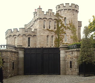
Manderley Castle, formerly "Victoria Castle" and "Ayesha Castle," is a large castellated Irish mansion built in Victorian style, in Killiney, County Dublin, Ireland. It has been owned by the singer, Enya, since 1997.

<span class="mw-page-title-main">Killua Castle</span> Building

Killua Castle, and the nearby Raleigh Obelisk, are situated near Clonmellon, County Westmeath, Ireland. The present house was built in about 1780 by Sir Benjamin Chapman and consisted of a hall, dining room, oval drawing room, breakfast parlour and front and back stairs. There was also a stable yard, barn and haggard. From here, the Chapmans administered the surrounding farm lands of some 9,000 acres (36 km2) in the 18th century. In a ruinous condition, it was renovated in 2006.

<span class="mw-page-title-main">Mount Loftus</span>

Mount Loftus is a country estate in the civil parish of Powerstown in County Kilkenny, Ireland. It was originally home to the Loftus baronets, the baronetcy being extinct since the death of the third baronet in 1864. The original 18th century manor house was demolished in 1906. The current house on the estate, built in the early 20th century, was rebuilt from staff accommodations after a fire in the 1930s. This house, and several of its outbuildings, are included on Kilkenny County Council's Record of Protected Structures.

<span class="mw-page-title-main">R119 road (Ireland)</span> Road in Ireland

The R119 road is a regional road in Dún Laoghaire–Rathdown, Ireland.

<span class="mw-page-title-main">Killiney Hill</span> Hill on Dublin Bay, Ireland

Killiney Hill is the southernmost of the two hills which form the southern boundary of Dublin Bay, the other being Dalkey Hill. These two hills form part of Killiney Hill Park.

Kill is a civil parish in the barony of Rathdown. It is located in the county of Dún Laoghaire–Rathdown, Ireland. It is named after Kill of the Grange, a townland itself named after a church now in ruins. Other townlands in the parish are Ballinclea, Cabinteely, Cornelscourt, Deansgrange, Foxrock, Galloping Green South and North, Johnstown, Mulchanstown, Newpark, Newtownpark, Rocheshill, Rochestown Domain, Scalpwilliam or Mount Mapas, Thomastown, Tipperstown, and Woodpark.

29 Martello towers and battery installations were constructed or partially constructed in the Greater Dublin Area between 1803 and 1808. The towers were intended to act as a deterrent against a foreign invasion by Napoleon and his French Armies as well as being used as general lookout posts. In later years, towers were also used as coast guard stations, lookout stations to prevent smuggling and as other general purpose military installations by various British and Irish defence forces.

<span class="mw-page-title-main">Dalkey Castle</span> Municipal building in Dalkey, Dublin, Ireland

Dalkey Castle, formerly known as Goat Castle, is a medieval structure in Castle Street, Dalkey, Dublin, Ireland. The complex currently accommodates the Dalkey Heritage Centre, which is in the castle itself, and Dalkey Town Hall, which is formed by a single storey extension behind the original building.

References

  1. 1 2 "Works: Symes, Sandham". Dictionary of Irish Architects. Irish Architectural Archive. Retrieved 30 January 2024.
  2. Record of Protected Structures/Record of Monuments and Places/Architectural Conservation Areas (PDF), Dún Laoghaire-Rathdown County Council, p. 64, retrieved 30 January 2024
  3. 1 2 Stokes, G.T. (1895). "The Antiquities from Kingstown to Dublin". The Journal of the Royal Society of Antiquaries of Ireland. Royal Society of Antiquaries of Ireland. 5 (1): 5–15. JSTOR   25508193.
  4. 1 2 3 4 5 6 7 8 9 10 11 12 13 14 "Killiney Castle, previously called Mount Malpas, Rocksborough and Loftus Hill". killineyhistory.ie. Killiney History. Retrieved 29 January 2024.
  5. "Celebrating 50 Years of Tradition at Fitzpatrick Castle Hotel". hotelnews.ie. 20 December 2021. Retrieved 30 January 2024.
  6. Michael McShane. The Killiney Houses of the Talbot estate. Killiney History. Retrieved 29 January 2024 via youtube.com.
  7. 1 2 3 4 "Castle Hotel History, Killiney Castle | Fitzpatrick Castle". www.fitzpatrickcastle.com. Retrieved 29 January 2024.
  8. Dunne, Margaret, "Landmarks In Our Neighbourhood", Newsletter - No 515 - Volume 27 - February 2021 (PDF), Dalkey Community Council, archived from the original (PDF) on 9 February 2024
  9. "1840 – Killiney Castle, Killiney, Co. Dublin". archiseek.com. 2015. Retrieved 30 January 2024.
  10. Edge, Amy (7 April 2022). "Castles of Ireland". Embrace the Journey Travel. Retrieved 30 January 2024.
  11. "Holy Trinity, Killiney - History". holytrinitykilliney.ie. 14 January 2014. Retrieved 15 February 2024.
  12. 1 2 Michael McShane. The Killiney Castle Estate of Robert Warren 1834-1869. Killiney History. Retrieved 30 January 2024 via youtube.com.[ better source needed ]
  13. "Irish Jesuit community houses - Killiney Castle, Dublin". jesuitarchives.ie. Retrieved 15 February 2024.
  14. "A Rebels' Bomb Factory at Fitzpatrick Castle". storiedcollection.com. 27 February 2023. Retrieved 30 January 2024.
  15. "The generation game". businessandfinance.com. 2 February 2015. Retrieved 30 January 2024.
  16. Thom's Directory of Ireland. 1850.
  17. Pearson, Peter (1998). Between the Mountains and the Sea. O'Brien Press. pp. 58–59. ISBN   0862785820.
  18. 1 2 "Obelisk". killineyhistory.ie. Killiney History. Retrieved 30 January 2024.
  19. "Obelisk on Killiney Hill". The Dublin Penny Journal. 3 (150): 364. 1835. ISSN   2009-1338. JSTOR   30003580.