Kiruhura, Uganda

Last updated
Kiruhura
Uganda location map.svg
Red pog.svg
Kiruhura
Map of Uganda showing the location of Kiruhura
Coordinates: 00°12′53″S30°46′12″E / 0.21472°S 30.77000°E / -0.21472; 30.77000
Country Uganda
Region Western Region
Sub-region Ankole sub-region
District Kiruhura District
Population
 (2020 Estimate)
  Total6,900
Time zone UTC+3 (EAT)
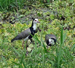
Kanyaryeru Kiruhura District Weather in Kanyaryeru Kiruhura District.jpg
Kanyaryeru Kiruhura District

Kiruhura is a town in the Western Region of Uganda. It is the largest town in Kiruhura District and the site of the district headquarters.

Contents

Location

Kiruhura is approximately 69 kilometres (43 mi), by road, northeast of Mbarara, the largest city in the Ankole sub-region. [1] It is approximately 265 kilometres (165 mi), by road, south-west of Kampala, the capital and largest city of Uganda. [2] The coordinates of the town are 0°12'53.0"S, 30°46'12.0"E (Latitude:-0.214709; Longitude:30.769999). [3]

Population

In 2002, the national population census put the town's population at about 10,240. In 2010, the Uganda Bureau of Statistics (UBOS) estimated the population at 13,500. In 2011, UBOS estimated the mid-year population at 14,000. [4] In 2012, UBOS projected the town's population at 14,300. [5] In 2020, UBOS estimated the midyear population of Kiruhura Town at 6,900, of whom 3,600 (52.2 percent) were male and 3,300 (47.8 percent) were females. [6]


Points of interest

The following additional points of interest lie within or close to the town limits:

See also

Related Research Articles

<span class="mw-page-title-main">Mbarara district</span> District in Western Uganda, Uganda

Mbarara District is a district in South Western Uganda. In 2019, the Ugandan Cabinet approved part of Mbarara District, the then-Mbarara municipality, to be upgraded to city status effective July 2020.

<span class="mw-page-title-main">Kasese</span> Place in Western Region, Uganda

Kasese is a town in the Western Region of Uganda. It is the capital of Kasese District. Kasese is also the largest town in the Rwenzururu region. In 2020 it had an estimated population 115,400. It lies north of Lake George and east of Rwenzori Mountains.
<span class="mw-page-title-main">Rukungiri</span> Place in Western Region of Uganda, Uganda

Rukungiri is a town in Rukungiri District of the Western Region of Uganda. It is the site of the district headquarters.

<span class="mw-page-title-main">Ibanda District</span> District in Western Region, Uganda

Ibanda District is a district in the Western Region of Uganda. The town of Ibanda is the site of the district headquarters.

<span class="mw-page-title-main">Kiruhura District</span> District in Western Region, Uganda

Kiruhura District is a district in the Western Region of Uganda. The town of Rushere is the site of the district headquarters.

Ibanda is a town in the Western Region of Uganda. It is the main political, administrative, and commercial centre of Ibanda District and the site of the district headquarters. It started way back in the 1990s and was elevated from a trading centre to a town board, town council and in 2016 it was granted the municipality status. The Municipal Council has three Divisions of Kagongo, Bisheshe and Bufunda with 21 wards of Kyaruhanga, Bufunda, Nyamirima, Nsasi, Kayenje, Kashangura, Rwenshuri, Kigarama, Rugazi, Rwobuzizi, Kakatsi, Bugarama, Karangara, Kabaare, Kanyansheko, Nyakatookye, Kyeikucu, Kikoni, Kagongo, Ruyonza and Katongore ward. Ibanda Municipal Council has over 230 villages. Ibanda Municipal council commenced its operations on 1 July 2016 after being elevated from a Town Council and other sub counties that were annexed to..

Isingiro is a town in the Western Region of Uganda. It is the main municipal, administrative, and commercial center of Isingiro District and the site of the district's headquarters.

Kyotera is a town in the southern part of the Central Region of Uganda. It is a municipality in Kyotera District. However, the district headquarters are located at Kasaali.

Kiwoko is a small town in the Central Region of Uganda. It is one of the municipalities in Nakaseke District.

Rushere is a town in Kiruhura District in the Western Region of Uganda.

<span class="mw-page-title-main">Buhweju District</span> District in Western Uganda, Uganda

Buhweju District is a district in Western Uganda. It is one of the districts that constitute the Ankole sub-region. Its 'chief town', is Nsiika.

Mitooma, also Mitoma, is a town in the Western Region of Uganda. It is the main municipal, administrative, and commercial center of Mitooma District.

Kitagata is a town in Western Uganda. It is one of the urban centers in Sheema District.

Sanga, is an urban center in the Kiruhura District, Ankole sub-region, in the Western Region of Uganda.

Rwekunye is a settlement in Kiryandongo District in the Western Region of Uganda.

Nyakahita is a sparsely populated settlement in the Western Region of Uganda.

Kazo is a town in the Western Region of Uganda. It is the capital of Kazo District.

Muyembe is a town in the Eastern Region of Uganda.

Muhanga is a town in the Western Region of Uganda. It is the main commercial centre and largest town of Rukiga District. However, the district headquarters are located at Mparo.

Namisindwa District is a district in the Eastern Region of Uganda. The town of Bupoto is the district headquarters.

References

  1. GFC (22 March 2016). "Distance between Mbarara, Western Region, Uganda and Kiruhura, Western Region, Uganda". Globefeed.com (GFC). Retrieved 22 March 2016.
  2. GFC (22 March 2016). "Distance between Kampala Road, Kampala, Central Region, Uganda and Kiruhura, Western Region, Uganda". Globefeed.com (GFC). Retrieved 22 March 2016.
  3. Google (22 March 2016). "Location of Kiruhura Town, Kiruhura District, Western Region, Uganda" (Map). Google Maps . Google. Retrieved 22 March 2016.
  4. UBOS. "Estimated Population of Kiruhura In 2002, 2010 And 2011" (PDF). Uganda Bureau of Statistics (UBOS). Archived from the original (PDF) on 7 July 2014. Retrieved 7 June 2014.
  5. UBOS (June 2012). "Kiruhura District Local Government Statistical Abstract" (PDF). Kampala: Uganda Bureau of Statistics (UBOS). Retrieved 22 March 2016.
  6. Uganda Bureau of Statistics (14 June 2020). "Estimated Population of Kiruhura Town Council As of 1 July 20120". Citypopulation.de. Retrieved 25 December 2020.
  7. Ssengendo, Abdulkarim (1 February 2010). "Kiruhura Town Clerk Asked to Plan Town Well". New Vision . Kampala. Retrieved 22 March 2016.
  8. Mugisa, Anne (8 May 2007). "Janet Urges Medics On Infection Prevention". New Vision . Kampala. Retrieved 22 March 2016.
  9. GFC (22 March 2016). "Distance between Kiruhura, Western Region, Uganda and Rushere Community Hospital, Nyabushozi, Western Region, Uganda". Globefeed.com (GFC). Retrieved 22 March 2016.
  10. GFC (22 March 2016). "Distance between Kiruhura, Western Region, Uganda and Rwakitura Kraal, Nyabushozi, Western Region, Uganda". Globefeed.com (GFC). Retrieved 22 March 2016.

00°12′36″S30°49′48″E / 0.21000°S 30.83000°E / -0.21000; 30.83000