Transport in Somalia refers to the transportation networks and modes of transport in effect in Somalia. They include highways, airports and seaports, in addition to various forms of public and private vehicular, maritime and aerial transportation.

Lower Juba is an administrative region (gobol) in southern Somalia. With its capital at Kismayo, it lies in the autonomous Jubaland region. It has green forests and wildlife including lions, giraffes, hippos, crocodiles, and hyenas.

Somalia is a federal republic consisting of six federal states, including Somaliland, as well as the Banadir Regional Administration. Somalia is further subdivided into Eighteen administrative regions, which are in turn subdivided into districts.

Kismayo is a port city in the southern Lower Juba province of Somalia. It is the commercial capital of the autonomous Jubaland region.

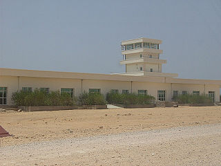
Bosaso Airport, also known as Bosaso International Airport, is an airport in Somalia. It sits at 11°16′32″N 49°9′0″E on the outer edge of the city of Bosaso, the commercial capital of the northeastern Puntland macro-region and adjacent to the Gulf of Aden. It is the second largest airport in the country after the Aden Adde International Airport in Mogadishu,

Bethel Airport is a state-owned public-use airport located three nautical miles (6 km) southwest of the central business district of Bethel, a city in the Bethel Census Area of the U.S. state of Alaska.

Herington Regional Airport is a public use airport in Morris County, Kansas, United States. The airport is owned by the City of Herington and is located seven nautical miles northeast of its central business district. Although the airport is in Morris County, most of Herington is located in Dickinson County. Previously known as Herington Municipal Airport, the airport is located on the site of the former Herington Army Airfield. This airport is included in the National Plan of Integrated Airport Systems for 2011–2015, which categorized it as a general aviation facility.

Ryan Airfield, also known as Ryan Field, is a city-owned, public-use airport located 12 miles southwest of the central business district of Tucson, a city in Pima County, Arizona, United States. It is included in the National Plan of Integrated Airport Systems for 2011–2015, which categorized it as a reliever airport. It is mostly used for general aviation but also serves a significant amount of law enforcement and military helicopter activity. Approximately 50% of Ryan's traffic is training-related.

Lake Elmo Airport is a public airport located just outside the city of Lake Elmo in Washington County, Minnesota, United States, about 12 miles east of the central business district of St. Paul. Although most airports in the United States use the same three-letter location identifier for the FAA and International Air Transport Association (IATA), this airport is assigned 21D by the FAA but has no designation from the IATA or ICAO. It is also home to a Civil Air Patrol squadron.

Ugolny Airport is a mixed-use military and civil airfield in the Russian Far East located 11 km east of Anadyr, separated from the town by the waters of Anadyrsky Liman. The airfield was originally constructed in the 1950s as a staging base for Long Range Aviation bombers such as the Tupolev Tu-95 and Tupolev Tu-22M. During the Cold War years it became the primary hub for civilian flights in the Chukotka region.

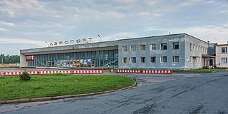
Princess Olga Pskov International Airport is an airfield in Pskov Oblast, Russia located 6 km (3.7 mi) southeast of Pskov.

Burevestnik is a military air base on Iturup Island, Russia, establishing the nation's presence on the disputed South Kuril Islands with the largest airfield in the region. It is also the former Soviet Union's most remote interceptor base. An Army helicopter combat support squadron was also stationed at the airfield in the early 1980s, providing limited fire support and transport capability. Burevestnik's communications and logistics were tied to Yuzhno-Sakhalinsk and supplies were flown in weekly on Antonov An-12 aircraft.

Demopolis Regional Airport is a city-owned, public-use airport located six nautical miles southwest of the central business district of Demopolis, a city in Marengo County, Alabama, United States. It is also known as Demopolis Municipal Airport and Julian D. "Buzz" Sawyer Airport.
Bardera Airport is an airport serving Bardera, a city in the southern Gedo region in Somalia.

Cleveland Municipal Airport is a public use airport in Bolivar County, Mississippi, United States. It is owned by the City of Cleveland and located two nautical miles (4 km) northwest of its central business district. This airport is included in the National Plan of Integrated Airport Systems for 2011–2015, which categorized it as a general aviation facility. There is no scheduled commercial airline service.

Jubaland, the Juba Valley or Azania, is a Federal Member State in southern Somalia. Its eastern border lies 40–60 km (25–35 mi) east of the Jubba River, stretching from Gedo to the Indian Ocean, while its western side flanks the North Eastern Province in Kenya, which was carved out of Jubaland during the colonial period.
Candala Airport is an airstrip serving Candala, a town in the northeastern Bari region in Puntland, Somalia.
Shatigadud International Airport Baidoa Somalia is an airport serving Baidoa, the capital city of the Bay region in Somalia.

The Port of Kismayo, also known as the Kismayo Port, is the official seaport of Kismayo, situated in southern Somalia. It is classified as a major class port. It has a harbour as well as a pier which juts into the Somali Sea.


