Cromstrijen was a municipality on the Hoeksche Waard Island in the western Netherlands, in the province of South Holland. The municipality covers an area of 70.33 km2 (27.15 sq mi) of which 15.96 km2 (6.16 sq mi) is water. It was formed on 1 January 1984, when the municipalities on the Hoeksche Waard were merged into larger municipalities. On 1 January 2019 it was merged with the municipalities of Binnenmaas, Korendijk, Oud-Beijerland, and Strijen to form the municipality of Hoeksche Waard.

's-Gravendeel is a town and former municipality in the western Netherlands, in the province of South Holland. 's-Gravendeel is on the eastern side of Hoeksche Waard Island on the river Dordtsche Kil. It is connected to Dordrecht by means of the Kil Tunnel.

Oud-Beijerland is a town and former municipality in the western Netherlands, in the province of South Holland, now a part of the Hoeksche Waard municipality. With a population of 24,575 in 2020, it is the most populous town of the Hoeksche Waard island. The town is located adjacent to the confluence of the Oude Maas and Spui River.

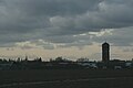
The Hoekse Waard is an island between the Oude Maas, Dordtsche Kil, Hollands Diep, Haringvliet and Spui rivers in the province of South Holland in the Netherlands. The island, part of the namesake municipality of Hoeksche Waard, is a mostly agricultural region, south of the outskirts of Rotterdam. The Hoeksche Waard consists of reclaimed land (polders): after the Saint Elisabeth flood of 1421 most of the area was flooded. The land has been reclaimed gradually in the following centuries.

Puttershoek is a village and former municipality in the western Netherlands. It is located on the banks of the Oude Maas, on the island Hoeksche Waard, in the province of South Holland. On 1 January 1984, the municipality of Puttershoek was merged with several others into Binnenmaas. With 6,293 inhabitants Puttershoek was the largest settlement in the municipality of Binnenmaas until 's-Gravendeel joined Binnenmaas in 2007. Since 1 January 2019, it is part of the new municipality Hoeksche Waard.

Numansdorp is a town and former municipality in the province South Holland in the Netherlands and is located on the island Hoeksche Waard near the Hollands Diep. On 1 January 1984, the municipalities Numansdorp and Klaaswaal were merged into one municipality called Cromstrijen. Cromstrijen was merged into the new municipality Hoeksche Waard in January 2019.

Nieuw-Beijerland is a village in the Dutch province of South Holland. It is a part of the municipality of Hoeksche Waard, and lies about 3 km south of Spijkenisse.

Piershil is a village in the Dutch province of South Holland. It is a part of the municipality of Hoeksche Waard, and lies about 5 km south of Spijkenisse.

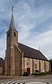
Goudswaard is a village in the Dutch province of South Holland, located on the westernmost tip of the Hoeksche Waard, approximately 6 km south-west of Spijkenisse. Goudswaard was a separate municipality from 1817 until 1984, when it was merged with Nieuw-Beijerland, Zuid-Beijerland and Piershil to form the municipality of Korendijk.

Zuid-Beijerland is a village in the Dutch province of South Holland. It is a part of the municipality of Hoeksche Waard, and lies about 10 km south of Spijkenisse.
Sint Pancras is a town in the northwestern Netherlands. It is located in the municipality of Dijk en Waard, North Holland, about 5 km northeast of Alkmaar.

Cillaarshoek is a hamlet in the western Netherlands. It is located in the municipality of Hoeksche Waard, South Holland, about 15 km south of Rotterdam.

Goidschalxoord is a hamlet in the Dutch province of South Holland. It is located about 5 km east of Oud-Beijerland, in the municipality of Hoeksche Waard.

Heinenoord is a village in the Dutch province of South Holland on the island Hoekse Waard. It is located about 10 km south of Rotterdam, in the municipality of Hoeksche Waard.

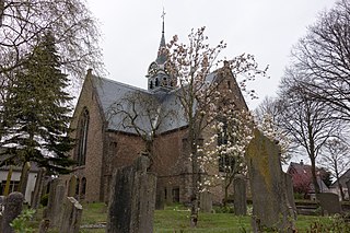
Maasdam is a village in the Dutch province of South Holland. It is located about 14 km south of the city of Rotterdam, in the municipality of Hoeksche Waard, on the rural Hoeksche Waard island. From the 14th Century until around 1800, Maasdam was also the name of the local administrative area, the fief and later the "ambacht".

Mijnsheerenland is a village and a former municipality on the Hoeksche Waard island in the Dutch province of South Holland with 4,435 inhabitants. It is located on the shores of the Binnenbedijkte Maas, about 14 km south of the city of Rotterdam, in the municipality of Hoeksche Waard. It was the only village in the former municipality Binnenmaas not built next to a dyke.

Sint Anthoniepolder is a hamlet in the Dutch province of South Holland. It is located about 14 km south of the city of Rotterdam, in the municipality of Hoeksche Waard.

Westmaas is a village in the Dutch province of South Holland. It is located about 14 km south of the city of Rotterdam, next to Mijnsheerenland in the municipality of Hoeksche Waard. In 2020, the population was 2065.

Mookhoek is a village in the Dutch province of South Holland and is part of the municipality of Hoeksche Waard. Mookhoek lies 2.5 km from the town Strijen. Until 1984 Mookhoek belonged to the former municipality Maasdam. Mookhoek had 479 inhabitants on 1 January 2007.

Hoeksche Waard is a municipality in the western Netherlands, in the province of South Holland, consisting of the eponymous Hoeksche Waard and Tiengemeten islands.