
Luzerne County is a county in the Commonwealth of Pennsylvania. According to the U.S. Census Bureau, the county has a total area of 906 square miles (2,350 km2), of which 890 square miles (2,300 km2) is land and 16 square miles (41 km2) is water. It is Northeastern Pennsylvania's second-largest county by total area. As of the 2020 census, the population was 325,594, making it the most populous county in the northeastern part of the state. The county seat and largest city is Wilkes-Barre. Other populous communities include Hazleton, Kingston, Nanticoke, and Pittston. Luzerne County is included in the Scranton–Wilkes-Barre–Hazleton Metropolitan Statistical Area, which has a total population of 555,426.

The Lackawanna River is a 42-mile-long (68 km) tributary of the Susquehanna River in northeastern Pennsylvania in the United States. It flows through a region of the northern Pocono Mountains that was once a center of anthracite coal mining in the United States. It starts in north Wayne County, Pennsylvania and ends in east Luzerne County, Pennsylvania in Duryea, Pennsylvania. The lower reaches of the river flow through the urban areas of Scranton, which grew around its banks in the 19th century as an industrial center. Its name comes from a Lenni Lenape word meaning "stream that forks".

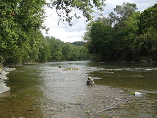
Bowman Creek is a tributary of the Susquehanna River in Luzerne County and Wyoming County, in Pennsylvania, in the United States. It is approximately 26 miles (42 km) long and flows through Ross Township and Lake Township in Luzerne County and Noxen Township, Monroe Township, and Eaton Township in Wyoming County. The watershed of the creek has an area of 120 square miles (310 km2). The creek is not designated as an impaired waterbody and its pH is close to neutral, although it has experienced some problems with acid rain. It has low concentrations of dissolved solids like calcium. The creek is relatively small in its upper reaches, but by Noxen, its width is 40 to 60 feet. It is also relatively shallow in many reaches. Rock formations in the watershed include the Catskill Formation, the Huntley Mountain Formation, Burgoon Sandstone, the Mauch Chunk Formation, the Pottsville Group, and the Pocono Formation. Soil associations in the creek's watershed include the Wellsboro-Morris-Oquaga association, the Oquaga-Lackawanna-Arnot association, the Mardin-Bath-Volusia association, and the Wyoming-Pope association.

Chillisquaque Creek is a tributary of the West Branch Susquehanna River in Montour County and Northumberland County, in Pennsylvania, in the United States. It is approximately 20.2 miles (32.5 km) long and flows through Derry Township, Washingtonville, and Liberty Township in Montour County and East Chillisquaque Township and West Chillisquaque Township in Northumberland County. The watershed of the creek has an area of 112 square miles (290 km2). Agricultural impacts have caused most of the streams in the watershed of the creek to be impaired. Causes of impairment include sedimentation/siltation and habitat alteration. The average annual discharge of the creek between 1980 and 2014 ranged from 48.2 to 146.0 cubic feet per second. Its watershed mainly consists of rolling agricultural land. The creek's channel flows through rock formations consisting of sandstone and shale. It is a warmwater stream.
Fishing Creek is a 29.98-mile (48.25 km) long tributary of the Susquehanna River in Columbia County, Pennsylvania, in the United States. It joins the Susquehanna River near the census-designated place of Rupert and the town of Bloomsburg. The watershed has an area of 385 square miles (1,000 km2).
Huntington Creek is a tributary of Fishing Creek in Luzerne and Columbia counties, Pennsylvania, in the United States. It is approximately 29.5 miles (47.5 km) long.

Little Fishing Creek is a tributary of Fishing Creek in Sullivan County, Lycoming County, and Columbia County, in Pennsylvania, in the United States. It is approximately 23.5 miles (37.8 km) long and flows through eight townships. The watershed of the creek has an area of 68.1 square miles (176 km2). The creek has six named tributaries, of which the largest are Spruce Run and West Branch Run.

North Mountain is a 2,584-foot (788 m) ridge primarily located in Davidson Township of Sullivan County in the U.S. state of Pennsylvania. Its summit is that county's highest point, the 10th highest among the state's 67 counties. Portions also extend into neighboring Lycoming, Luzerne, and Wyoming counties. The mountain has a topographic isolation of 57.99 miles (93.33 km). U.S. Route 220 passes near the mountain. The mountain once had a prolific population of animals, including grouse, deer, and bears.

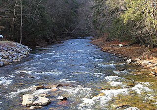
Shickshinny Creek is a tributary of the Susquehanna River in the Wyoming Valley in Luzerne County, Pennsylvania, in the United States. It is approximately 10.1 miles (16.3 km) long and flows through Ross Township, Union Township, and Shickshinny. Its watershed has an area of 35.0 square miles (91 km2) and its tributaries include Culver Creek, Reyburn Creek, and Little Shickshinny Creek. The creek is designated as a Coldwater Fishery and a Migratory Fishery. A sawmill and a gristmill were built on the creek in 1802 and 1804, respectively. Several bridges have also been constructed over it. The creek was historically polluted by culm near its mouth, but agriculture was the main industry in the watershed in the early 1900s. It was historically used as a water supply.
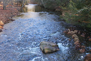
Little Wapwallopen Creek is a tributary of the Susquehanna River in Luzerne County, Pennsylvania, in the United States. It is approximately 17 miles (27 km) long and flows through Rice Township, Dorrance Township, Conyngham Township, and Hollenback Township. The watershed of the creek has an area of 39.5 square miles (102 km2). The creek is designated as a Coldwater Fishery and a Migratory Fishery and is not considered to be impaired. It has two named tributaries: Pond Creek and Nuangola Outlet. Wild trout naturally reproduce in the creek.
West Branch Fishing Creek is one of the northernmost major tributaries of Fishing Creek in Sullivan County, Pennsylvania and Columbia County, Pennsylvania, in the United States. It is 11.1 miles (17.9 km) long and flows through Davidson Township, Sullivan County and Sugarloaf Township, Columbia County. The creek's watershed has an area of 33.5 square miles, nearly all of which is forested land.

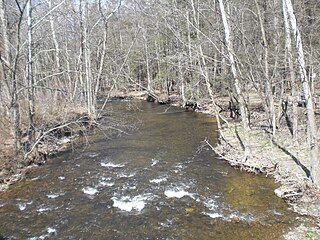
Pine Creek is a tributary of Huntington Creek in Luzerne County and Columbia County, in Pennsylvania, in the United States. It is approximately 12.4 miles (20.0 km) long and flows through Fairmont Township, Huntington Township, and New Columbus in Luzerne County; and Fishing Creek Township in Columbia County. The creek's watershed has an area of 30.7 square miles and is located in Columbia and Luzerne Counties. Its tributaries include Bell Branch and Little Pine Creek. The vicinity of the creek was settled in the late 1700s. The main industries in the watershed in the early 1900s were timber and agriculture. Pine Creek is designated as a coldwater fishery and a migratory fishery. Northern myotis bats also inhabit areas near the creek.

Catawissa Mountain is a mountain in Columbia County, Pennsylvania, in the United States. Its peak height is 1,873 feet (571 m) above sea level, making it the fifth-highest mountain in Columbia County. Streams that flow near the mountain include Roaring Creek, Catawissa Creek, and some of its tributaries. The mountain is near Nescopeck Mountain and Little Mountain. Sandstones and rock formations such as the Pocono Formation occur on Catawissa Mountain.

Little Pine Creek is a tributary of Pine Creek in Luzerne County and Columbia County, in Pennsylvania, in the United States. It is approximately 4.8 miles (7.7 km) long and flows through Huntington Township and New Columbus in Luzerne County and Fishing Creek Township in Columbia County. The watershed of the creek has an area of 7.15 square miles (18.5 km2). A number of bridges have been built over the creek and a fulling mill historically existed on it. The creek is inhabited by wild trout.

Nescopeck Mountain is a ridge in Columbia County and Luzerne County, in Pennsylvania, in the United States. Its elevation is 1,594 feet (486 m) above sea level. The ridge is a forested ridge, with at least two types of forest and two systems of vernal pools. It is a very long and unbroken ridge with two water gaps: one carved by Catawissa Creek and one carved by Nescopeck Creek. This later gap was exploited as a transportation corridor with the construction of the Lehigh & Susquehanna Turnpike between the respective frontier communities at Lausanne Landing and Nescopeck in 1805 connecting the newly developing Wyoming Valley with Philadelphia and the Delaware River valley; cutting off over 100 miles between Philadelphia and Wilkes-Barre. Today's Route PA 93 derives from this historic pack mule road.
McCauley Mountain is a mountain in Columbia County, Pennsylvania, in the United States. Its official elevation is 1,571 feet (479 m) above sea level. The mountain is a synclinal mountain. Main rock formations on and near it include the Mauch Chunk Formation and the Pottsville Formation. There are also coal deposits on it. The coal deposits were discovered in 1826 and mining of them began in the 1850s. However, coal mining on the east side of the mountain proved to be a commercial failure. There are a number of ponds on the mountain, some of which were created during the mining. However, others are natural vernal pools. Some of the ponds are surrounded by hemlocks and deciduous trees. Major streams near the mountain include Scotch Run, Beaver Run, and Catawissa Creek. The mountain is named after Alexander McCauley, who settled there in 1774.

Pennsylvania State Game Lands Number 55 are Pennsylvania State Game Lands in Columbia County, Pennsylvania, in the United States. They have an area of 2,474 acres (1,001 ha). A number of ridges, such as Knob Mountain, Huntington Mountain, and Lee Mountain, are within their boundaries, as are streams such as Briar Creek and Little Shickshinny Creek. The main game animals there include deer, grouse, squirrel, and turkey. Numerous bird species also inhabit these game lands.

Spring Brook is a tributary of the Lackawanna River in Lackawanna County and Luzerne County, in Pennsylvania, in the United States. It is approximately 17 miles (27 km) long and flows through Covington Township, Spring Brook Township, and Moosic in Lackawanna County and Pittston Township in Luzerne County. The watershed of the stream has an area of 57.2 square miles (148 km2). It is designated as a High-Quality Coldwater Fishery and a Migratory Fishery above Interstate 476 and as a Coldwater Fishery and a Migratory Fishery below it. A section is also designated as Class A Wild Trout Waters. The stream's tributaries include Panther Creek, Plank Bridge Creek, Rattlesnake Creek, Green Run, Monument Creek, and Covey Swamp Creek. It has a relatively high level of water quality and is very slightly acidic, with a pH of 6.4 to 6.9.

Oxbow Creek is a tributary of Tunkhannock Creek in Wyoming County, Pennsylvania, in the United States. It is approximately 2.5 miles (4.0 km) long and flows through Lemon Township. The watershed of the creek has an area of 8.56 square miles (22.2 km2). The creek has two named tributarie: Horton Creek and Oxbow Inlet. It is not designated as an impaired waterbody. The surficial geology in its vicinity mostly consists of Wisconsinan Till, alluvium, Wisconsinan Ice-Contact Stratified Drift, and bedrock.

Monroe Creek is a tributary of Tunkhannock Creek in Susquehanna County and Wyoming County, in Pennsylvania, in the United States. It is approximately 6.1 miles (9.8 km) long and flows through Springville Township in Susquehanna County and Nicholson Township in Wyoming County. The watershed of the creek has an area of 6.64 square miles (17.2 km2). The creek is not designated as an impaired waterbody. The surficial geology in its vicinity consists mostly of alluvium, Wisconsinan Till, and other things. Its watershed is designated as a Coldwater Fishery and a Migratory Fishery.

