Kortkerossky District

Last updated • 1 min readFrom Wikipedia, The Free Encyclopedia
Kortkerossky District
Корткеросский район
Other transcription(s)
  KomiКӧрткерӧс район
Lesovozy. Resp.Komi - panoramio.jpg
Logging trucks, Kortkerossky District
Kortkerossky rayon flag.jpg
Coat of Arms of Kortkerosskiy rayon (Komi).gif
Kortkerossky District
Location of Kortkerossky District in the Komi Republic
Coordinates: 61°48′N51°35′E / 61.800°N 51.583°E / 61.800; 51.583
CountryRussia
Federal subject Komi Republic [1]
Established14 July 1939 OOjs UI icon edit-ltr-progressive.svg
Administrative center Kortkeros [1]
Area
  Total19,760 km2 (7,630 sq mi)
Population
  Total19,658
  Density0.99/km2 (2.6/sq mi)
   Urban
0%
   Rural
100%
Administrative structure
   Administrative divisions 14 selo administrative territories, 4 settlement administrative territories
   Inhabited localities [1] 53 rural localities
Municipal structure
   Municipally incorporated asKortkerossky Municipal District [3]
   Municipal divisions [3] 0 urban settlements, 18 rural settlements
Time zone UTC+3 (MSK   OOjs UI icon edit-ltr-progressive.svg [4] )
OKTMO ID87616000
Website http://www.kortkeros.ru
Population of Kortkerossky District
2010 Census 19,658 [2]
2002 Census 23,642 [5]
1989 Census 27,555 [6]
1979 Census 28,176 [7]

Kortkerossky District (Russian : Корткеросский райо́н; Komi : Кӧрткерӧс район, Körtkerös rajon) is an administrative district (raion), one of the twelve in the Komi Republic, Russia. [1] It is located in the south of the republic. The area of the district is 19,760 square kilometers (7,630 sq mi).[ citation needed ] Its administrative center is the rural locality (a selo ) of Kortkeros. [1] As of the 2010 Census, the total population of the district was 19,658, with the population of Izhma accounting for 20.0% of that number. [2]

Contents

Etymology

Kortkeros' name was derived from two Komi words, кӧрт ("iron") and керӧс ("mountain"). Based on archaeological evidence and the names of locations (such as Körtyag, Lake Körtty, and the Körtvis River meaning "Iron Pine", "Iron Lake", and "Iron River" respectively), the village of Kortkeros was considered by archaeologists to be an ancient metallurgical centre. [8]

Administrative and municipal status

Within the framework of administrative divisions, Kortkerossky District is one of the twelve in the Komi Republic. [1] The district is divided into fourteen selo administrative territories and four settlement administrative territories, which comprise fifty-three rural localities. [1] As a municipal division, the district is incorporated as Kortkerossky Municipal District. [3] Its eighteen administrative territories are incorporated as eighteen rural settlements within the municipal district. [3] The selo of Kortkeros serves as the administrative center of both the administrative [1] and municipal [3] district.

See also

Related Research Articles

<span class="mw-page-title-main">Knyazhpogostsky District</span> District in Komi Republic, Russia

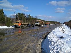
Knyazhpogostsky District is an administrative district (raion), one of the twelve in the Komi Republic, Russia. It is located in the west of the republic. The area of the district is 25,080 square kilometers (9,680 sq mi). Its administrative center is the town of Yemva. As of the 2010 Census, the total population of the district was 23,432, with the population of Yemva accounting for 62.2% of that number.

<span class="mw-page-title-main">Sysolsky District</span> District in Komi Republic, Russia

Sysolsky District is an administrative district (raion), one of the twelve in the Komi Republic, Russia. It is located in the south of the republic. The area of the district is 6,140 square kilometers (2,370 sq mi). Its administrative center is the rural locality of Vizinga. As of the 2010 Census, the total population of the district was 13,956, with the population of Vizinga accounting for 48.8% of that number.

<span class="mw-page-title-main">Ust-Kulomsky District</span> District in Komi Republic, Russia

Ust-Kulomsky District is an administrative district (raion), one of the twelve in the Komi Republic, Russia. It is located in the south of the republic. The area of the district is 26,400 square kilometers (10,200 sq mi). Its administrative center is the rural locality of Ust-Kulom. As of the 2010 Census, the total population of the district was 26,858, with the population of Ust-Kulom accounting for 19.1% of that number.

<span class="mw-page-title-main">Ust-Tsilemsky District</span> District in Komi Republic, Russia

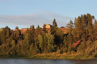
Ust-Tsilemsky District is an administrative district (raion), one of the twelve in the Komi Republic, Russia. It is located in the northwest of the republic. The area of the district is 42,500 square kilometers (16,400 sq mi). Its administrative center is the rural locality of Ust-Tsilma. As of the 2010 Census, the total population of the district was 13,036, with the population of Ust-Tsilma accounting for 37.4% of that number.

Usogorsk is an urban locality in Udorsky District of the Komi Republic, Russia, located at the confluence of the Us and Mezen Rivers. As of the 2010 Census, its population was 5,343.

Blagoyevo is an urban locality in Udorsky District of the Komi Republic, Russia. As of the 2010 Census, its population was 2,221.

Kozhym is an urban locality under the administrative jurisdiction of the town of republic significance of Inta in the Komi Republic, Russia. As of the 2010 Census, its population was 10.

Verkhnyaya Inta is an urban locality under the administrative jurisdiction of the town of republic significance of Inta in the Komi Republic, Russia. As of the 2010 Census, its population was 1,106.

Voyvozh is an urban locality under the administrative jurisdiction of the town of republic significance of Sosnogorsk in the Komi Republic, Russia. As of the 2010 Census, its population was 3,387.

Borovoy is an urban locality under the administrative jurisdiction of the town of republic significance of Ukhta in the Komi Republic, Russia. As of the 2010 Census, its population was 1,560.

<span class="mw-page-title-main">Yarega</span> Urban-type settlement in Komi Republic, Russia

Yarega is an urban locality under the administrative jurisdiction of the town of republic significance of Ukhta in the Komi Republic, Russia. As of the 2010 Census, its population was 7,806.

Parma is an urban locality under the administrative jurisdiction of the town of republic significance of Usinsk in the Komi Republic, Russia. As of the 2010 Census, its population was 1,248.

Komsomolsky is an urban locality under the administrative jurisdiction of the town of republic significance of Vorkuta in the Komi Republic, Russia. As of the 2010 Census, its population was 1,047.

Mulda is an urban locality under the administrative jurisdiction of the town of republic significance of Vorkuta in the Komi Republic, Russia. It had no recorded population as of the 2010 Census.

Promyshlenny is an abandoned urban locality under the administrative jurisdiction of the town of republic significance of Vorkuta in the Komi Republic, Russia. It had no recorded population as of the 2010 Census.

Yeletsky is an urban locality under the administrative jurisdiction of the town of republic significance of Vorkuta in the Komi Republic, Russia. As of the 2010 Census, its population was 631.

Zapolyarny is an urban locality under the administrative jurisdiction of the town of republic significance of Vorkuta in the Komi Republic, Russia. As of the 2010 Census, its population was 1,948.

<span class="mw-page-title-main">Izhma, Komi Republic</span> Selo in Izhemsky District, Komi Republic, Russia

Izhma is a rural locality and the administrative center of Izhemsky District of the Komi Republic, Russia.

<span class="mw-page-title-main">Kortkeros</span> Rural locality in the Komi Republic, Russia

Kortkeros is a rural locality and the administrative center of Kortkerossky District of the Komi Republic, Russia. Population: 4,624 (2010 Census); 4,659 (2002 Census); 4,373 (1989 Soviet census).

<span class="mw-page-title-main">Vylgort, Syktyvdinsky District, Komi Republic</span> Rural locality in the Komi Republic, Russia

Vylgort is a rural locality and the administrative center of Syktyvdinsky District of the Komi Republic, Russia. Population: 10,289 (2010 Census); 10,211 (2002 Census); 8,965 (1989 Soviet census).

References

Notes

  1. 1 2 3 4 5 6 7 8 Law #13-RZ
  2. 1 2 3 Russian Federal State Statistics Service (2011). Всероссийская перепись населения 2010 года. Том 1 [2010 All-Russian Population Census, vol. 1]. Всероссийская перепись населения 2010 года [2010 All-Russia Population Census] (in Russian). Federal State Statistics Service.
  3. 1 2 3 4 5 Law #11-RZ
  4. "Об исчислении времени". Официальный интернет-портал правовой информации (in Russian). June 3, 2011. Retrieved January 19, 2019.
  5. Federal State Statistics Service (May 21, 2004). Численность населения России, субъектов Российской Федерации в составе федеральных округов, районов, городских поселений, сельских населённых пунктов – районных центров и сельских населённых пунктов с населением 3 тысячи и более человек [Population of Russia, Its Federal Districts, Federal Subjects, Districts, Urban Localities, Rural Localities—Administrative Centers, and Rural Localities with Population of Over 3,000](XLS). Всероссийская перепись населения 2002 года [All-Russia Population Census of 2002] (in Russian).
  6. Всесоюзная перепись населения 1989 г. Численность наличного населения союзных и автономных республик, автономных областей и округов, краёв, областей, районов, городских поселений и сёл-райцентров [All Union Population Census of 1989: Present Population of Union and Autonomous Republics, Autonomous Oblasts and Okrugs, Krais, Oblasts, Districts, Urban Settlements, and Villages Serving as District Administrative Centers]. Всесоюзная перепись населения 1989 года [All-Union Population Census of 1989] (in Russian). Институт демографии Национального исследовательского университета: Высшая школа экономики [Institute of Demography at the National Research University: Higher School of Economics]. 1989 via Demoscope Weekly.
  7. Всесоюзная перепись населения 1979 г. Национальный состав населения по регионам России [All Union Population Census of 1979. Ethnic composition of the population by regions of Russia](XLS). Всесоюзная перепись населения 1979 года [All-Union Population Census of 1979] (in Russian). 1979 via Demoscope Weekly (website of the Institute of Demographics of the State University—Higher School of Economics.
  8. "Село Корткерос".

Sources