
The Godavari is India's second longest river after the Ganga river and drains into the third largest basin in India, covering about 10% of India's total geographical area. Its source is in Trimbakeshwar, Nashik, Maharashtra. It flows east for 1,465 kilometres (910 mi), draining the states of Maharashtra (48.6%), Telangana (18.8%), Andhra Pradesh (4.5%), Chhattisgarh (10.9%) and Odisha (5.7%). The river ultimately empties into the Bay of Bengal through an extensive network of distributaries. Measuring up to 312,812 km2 (120,777 sq mi), it forms one of the largest river basins in the Indian subcontinent, with only the Ganga and Indus rivers having a larger drainage basin. In terms of length, catchment area and discharge, the Godavari is the largest in peninsular India, and had been dubbed as the Dakshina Ganga.

East Godavari is a district in the Coastal Andhra region of Andhra Pradesh, India. Its district headquarters is at Rajamahendravaram.

Coastal Andhra or Kostandhra is a geographic region in the Indian state of Andhra Pradesh. Vijayawada is the largest city in this region. Region share borders with Uttarandhra, Rayalaseema and Telangana. It was part of Madras State before 1953 and Andhra State from 1953 to 1956. According to the 2011 census, it has an area of 91,915 square kilometres (35,489 sq mi) which is 57.99% of the total state area and a population of 34,193,868 which is 69.20% of Andhra Pradesh state population. This area includes the coastal districts of Andhra Pradesh on the Circar Coast between the Eastern Ghats and the Bay of Bengal, from the northern border with Odisha to Rayalaseema in the south.

Rajahmundry, officially known as Rajamahendravaram, is a city in the Indian state of Andhra Pradesh and district headquarters of East Godavari district. It is the fifth most populated city in the state. During British rule, the District of Rajahmundry was created in the Madras Presidency in 1823. It was reorganised in 1859 and bifurcated into the Godavari and Krishna districts. Rajahmundry was the headquarters of Godavari district, which was further bifurcated into East Godavari and West Godavari districts in 1925. When the Godavari district was bifurcated, Kakinada became the headquarters of East Godavari and Eluru became the headquarters of West Godavari. It is administered under Rajahmundry revenue division of the East Godavari district. The city is known for its floriculture, history, culture, agriculture, economy, tourism, and its heritage. It is known as the "Cultural Capital of Andhra Pradesh".

The West Godavari district is a coastal district in the Indian state of Andhra Pradesh with an administrative headquarters in Bhimavaram. As of the 2011 Census of India, the district has an area of 2,178 km2 (841 sq mi) and a population of 1,779,935. It is bounded by the Krishna district and Bay of Bengal to the south, East Godavari district to the east, and Eluru district, Kolleru Lake and Upputeru Drain to the northwest.
Kakinada is the sixth largest city of the Indian state of Andhra Pradesh and serves as the district headquarters of the Kakinada District. It lies on the coast of the Bay of Bengal. J.N.T.U. College of Engineering Kakinada, established in 1946, is the oldest and popular Government college in the state of Andhra Pradesh. The First Polytechnic college of Andhra Pradesh, Andhra Polytechnic was established here in 1946. It was also the origin point of Buckingham Canal where goods used to be transported by boats during the British rule. It was once home for Asia's largest sea port. Many people from the city migrated from this sea port to countries like Burma, Mauritius, Fiji and various southeast Asian countries to work there as workers where they were called as Coringas.

Mukteswaram is a village located in Ainavilli Mandal, Konaseema Delta, Amalapuram revenue division in Konaseema district of Andhra Pradesh, India. It is situated near the River Gautami-Godavari, a tributary to the Godavari. Mukteswaram is one of the three important Ferry points for Kotipalli-Mukteswaram and the other two being; Bodasakurru-Pasarlapudi and Sakhinetipalli-Narasapuram in the Konaseema region. Mukteswaram is 60 km from Kakinada.

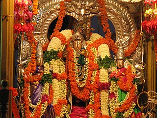
Draksharamam is one of the five Pancharama Kshetras that are sacred to the Hindu god Siva. The temple is located in Draksharamam town of Konaseema district in the Indian state of Andhra Pradesh. Bhimeswara Swamy refers to Lord Siva in this temple.
Narasapuram is a town in West Godavari district of the Indian state of Andhra Pradesh. It is a municipality and mandal headquarters of Narasapuram mandal in Narasapuram revenue division. The city is situated on the banks of the Vasista Godavari River. The lace industry is prevalent in the city and its surroundings.
Ramachandrapuram is a town in Dr. B.R. Ambedkar Konaseema district of the Indian state of Andhra Pradesh. The town is a Municipality which serves as the headquarters of Ramachandrapuram mandal and Ramachandrapuram revenue division.

Kotipalli also known as Koti Theertham is a village located in K. Gangavaram mandal of Ramachandrapuram revenue division in Konaseema district of Andhra Pradesh, India. The temple town is also known as Kumararama of the Pancharama Kshetras, and is located 15 km from Amalapuram. Every year festivals such as Maha Sivaratri, Vaisakha Suddha Ekadasi, Aswayuja Suddha Padyami to Dwadasi and Ksheerabdi Dwadasi Teppotsavam are celebrated in this village.
Mummidivaram is a town in Dr. B.R. Ambedkar Konaseema district of Andhra Pradesh, India. The Mummidivaram revenue block was formed out of the Amalapuram tehsil in July 1969. It is the second largest town in Konaseema district.

The Old Godavari Bridge is a decommissioned bridge that spans the Godavari River in Andhra Pradesh, India. Commissioned in 1900, the bridge served trains plying between Howrah and Madras. It is the earliest of three bridges that span the Godavari River at Rajahmundry. The Godavari Arch Bridge was later constructed as a replacement for the Havelock Bridge. The bridge along with the Godavari bridge and Godavari Arch Bridge is one of the most recognised symbols of Kovvur and Rajahmundry of the state of Andhra Pradesh.

The Polavaram Project is an under construction multi-purpose irrigation project on the Godavari River in the Eluru District and East Godavari District in Andhra Pradesh. The project has been accorded National project status by the Central Government of India. Its reservoir back water spreads up to the Dummugudem Anicut and approx 115 km on Sabari River side. Thus back water spreads into parts of Chhattisgarh and Odisha States. It gives major boost to tourism sector in Godavari Districts as the reservoir covers the famous Papikonda National Park, Polavaram hydro electric project (HEP) and National Waterway 4 are under construction on left side of the river. It is located 40 km to the upstream of Sir Arthur Cotton Barrage in Rajamahendravaram City and 25 km from Rajahmundry Airport.

Kakinada Port railway station is an Indian Railways station in Kakinada of East Godavari district in the Indian state of Andhra Pradesh. It lies on the Samalkot–Kakinada Port branch line, a branch line of Howrah–Chennai main line and is administered under Vijayawada railway division of South Coast Railway zone.
Vijayawada railway division is one of the three railway divisions under South Central Railways of the Indian Railways. The headquarters of the division are located at Vijayawada.
National Highway 216 is a National Highway in the Indian state of Andhra Pradesh. The former highways of NH 214 and 214A were merged and renumbered as NH 216. It starts from NH 16 junction at Kattipudi and passes through Kakinada, Amalapuram, Digamarru (Palakollu), Narasapuram, Machilipatnam, Repalle, Cherukupalle, Bapatla, Chirala before it junctions NH 16 again at Ongole. Visakhapatnam–Kakinada Petro Chemical Corridor, is a proposed project along the highway.
South Coast Railway Zone (SCoR) has been announced as the newest railway zone of the Indian Railways and is headquartered at Visakhapatnam, Andhra Pradesh. The formal notification for operationalization of this Zone is yet to be issued.

Dr.B.R. AMBEDKAR Konaseema district, officially designated as Dr. B. R. Ambedkar Konaseema district is one of the 26 districts in the Indian state of Andhra Pradesh. It is situated between the tributaries of the Godavari river in the Konaseema region of Coastal Andhra. It was carved out of East Godavari district on 4 April 2022 by the Government of Andhra Pradesh. Amalapuram is the district headquarters and the largest city in this district. Other significant towns in the district are Mandapeta, Ramachandrapuram, and Mummidivaram.
Amalapuram railway station is a railway station currently under construction located in Amalapuram, Dr. B.R. Ambedkar Konaseema district, Andhra Pradesh, India. It will serve as a vital link connecting the cities and villages between Narasapuram and Kakinada once completed and it is owned by Indian Railways.


