Koundianakoro

Last updated
Koundianakoro
Sub-prefecture and town
Guinea adm location map.svg
Red pog.svg
Koundianakoro
Location in Guinea
Coordinates: 11°14′N8°41′W / 11.233°N 8.683°W / 11.233; -8.683
CountryFlag of Guinea.svg  Guinea
Region Kankan Region
Prefecture Mandiana Prefecture
Population (2014)
  Total 31,489
Time zone GMT (UTC+0)

Koundianakoro is a town and sub-prefecture in the Mandiana Prefecture in the Kankan Region of eastern Guinea. [1] As of 2014 it had a population of 31,489 people. [2]

Town settlement that is bigger than a village but smaller than a city


A town is a human settlement. Towns are generally larger than villages but smaller than cities, though the criteria to distinguish them vary considerably between different parts of the world.

Sub-prefectures of Guinea

The sub-prefectures are the third-level administrative divisions in Guinea. As of 2009 there were 303 rural sub-prefectures of Guinea and 38 urban sub-prefectures, 5 of which compose the Conakry greater urban area; Kaloum, Dixinn, Matam, Ratoma and Matoto.

Mandiana Prefecture Prefecture in Kankan Region, Guinea

Mandiana is a prefecture located in the Kankan Region of Guinea. The capital is Mandiana. The prefecture covers an area of 12,825 km.² and has a population of 335,999.

Related Research Articles

Ridge, Hertfordshire human settlement in United Kingdom

Ridge is a village and civil parish in the Hertsmere borough of Hertfordshire, situated between Potters Bar and Shenley. At the 2011 Census the village was a civil parish in its own name. The population of the parish was 177. It has a church, St Margaret's; a children's playground; and the Old Guinea public house, which serves food on most days. The village holds an annual fete on the August bank holiday. Ridge is surrounded by countryside with numerous public footpaths. In 1926, the parish boundary between Ridge, Hertfordshire, and South Mimms, Middlesex, was subject to a minor adjustment.

Tougué Place in Labé Region, Guinea

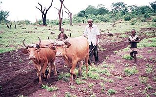
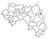
Tougué is a town located in central Guinea. It is the capital of Tougué Prefecture. In 2008, its population was estimated at 3,745.

Douprou Sub-prefecture and town in Boké Region, Guinea

Douprou is a town and sub-prefecture in the Boffa Prefecture in the Boké Region of western Guinea. As of 2014 it had a population of 21,045 people.

Banko, Guinea Sub-prefecture and town in Faranah Region, Guinea

Banko is a town and sub-prefecture in the Dabola Prefecture in the Faranah Region of Guinea. As of 2014 it had a population of 23,638 people.

Yalenzou Sub-prefecture and town in Nzérékoré Region, Guinea

Yalenzou is a town and sub-prefecture in the Nzérékoré Prefecture in the Nzérékoré Region of Guinea.It is located southeast of Nzérékoré along the N2 road. The town of Nzao lies between Yalenzou and Nzérékoré.

Diatiféré Sub-prefecture and town in Faranah Region, Guinea

Diatiféré is a town and sub-prefecture in the Dinguiraye Prefecture in the Faranah Region of western Guinea. As of 2014 it had a population of 33,729 people.

Benty Sub-prefecture and town in Kindia Region, Guinea

Benty is a town and sub-prefecture in the Forécariah Prefecture in the Kindia Region of western Guinea.

Koundou Sub-prefecture and town in Nzérékoré Region, Guinea

Koundou is a town and sub-prefecture in the Guéckédou Prefecture in the Nzérékoré Region of south-western Guinea.

Babila Sub-prefecture and town in Kankan Region, Guinea

Babila is a town and sub-prefecture in the Kouroussa Prefecture in the Kankan Region of eastern-central Guinea. As of 2014 it had a population of 16,290 people.

Koumana Sub-prefecture and town in Kankan Region, Guinea

Koumana is a town and sub-prefecture in the Kouroussa Prefecture in the Kankan Region of eastern-central Guinea. As of 2014 it had a population of 12,789 people.

Gama, Guinea Sub-prefecture and town in Nzérékoré Region, Guinea

Gama, Guinea is a town and sub-prefecture in the Lola Prefecture in the Nzérékoré Region of south-eastern Guinea.

Hérico Sub-prefecture and town in Labé Region, Guinea

Hérico is a town and sub-prefecture in the Lélouma Prefecture in the Labé Region of northern-central Guinea.

Linsan Sub-prefecture and town in Labé Region, Guinea

Linsan is a town and sub-prefecture in the Lélouma Prefecture in the Labé Region of northern-central Guinea.

Tyanguel-Bori Sub-prefecture and town in Labé Region, Guinea

Tyanguel-Bori is a town and sub-prefecture in the Lélouma Prefecture in the Labé Region of northern-central Guinea.

Dialakoro, Kankan Sub-prefecture and town in Kankan Region, Guinea

Dialakoro is a town and sub-prefecture in the Mandiana Prefecture in the Kankan Region of eastern Guinea. As of 2014 it had a population of 63,159 people.

Konkouré Sub-prefecture and town in Mamou Region, Guinea

For the river having its source near the town, see Konkouré River

Soyah Sub-prefecture and town in Mamou Region, Guinea

Soyah is a town and sub-prefecture in the Mamou Prefecture in the Mamou Region of Guinea.

Norassoba Sub-prefecture and town in Kankan Region, Guinea

Norassoba is a town and sub-prefecture in the Siguiri Prefecture in the Kankan Region of northern Guinea.

Koba, Kindia Sub-prefecture and town in Kindia Region, Guinea

Koba, Kindia is a town and sub-prefecture in the Télimélé Prefecture in the Kindia Region of western-central Guinea.

References

  1. "Subprefectures of Guinea". Statoids. Retrieved April 19, 2009.
  2. "Guinea". Institut National de la Statistique, Guinea, accessed via Geohive. Archived from the original on 24 November 2015. Retrieved 12 September 2014.

Coordinates: 11°14′N8°41′W / 11.233°N 8.683°W / 11.233; -8.683

Geographic coordinate system Coordinate system

A geographic coordinate system is a coordinate system that enables every location on Earth to be specified by a set of numbers, letters or symbols. The coordinates are often chosen such that one of the numbers represents a vertical position and two or three of the numbers represent a horizontal position; alternatively, a geographic position may be expressed in a combined three-dimensional Cartesian vector. A common choice of coordinates is latitude, longitude and elevation. To specify a location on a plane requires a map projection.