Kreis Samter (Polish : Powiat szamotulski ) was a district in Regierungsbezirk Posen, in the Prussian Province of Posen from 1818 to 1918. Its territory presently lies in the north-western part of Polish region of Greater Poland Voivodeship.

Kreis Samter (Polish : Powiat szamotulski ) was a district in Regierungsbezirk Posen, in the Prussian Province of Posen from 1818 to 1918. Its territory presently lies in the north-western part of Polish region of Greater Poland Voivodeship.
The Samter district was formed on 1 January 1818, with its capital at Samter. As part of the Province of Posen, the Samter district became part of the newly founded German Empire on 18 January 1871.
On 27 December 1918 the Greater Poland uprising began in the province of Posen, and on the same day the district town of Samter came under Polish control. On 16 February 1919 an armistice ended the Polish-German fighting, and on 28 June 1919 the German government officially ceded the Samter district to the newly founded Poland with the signing of the Treaty of Versailles.
In the German Empire, the district of Samter, together with the districts of Birnbaum, Obornik and Schwerin belonged to the Posen 2 Reichstag constituency. The constituency was won by the following candidates in the Reichstag elections:
The district had a majority Polish population, with a significant German minority.
| 1831 | 1860 | |||
|---|---|---|---|---|
| German | 10,823 | 32.2% | 16,695 | 37.1% |
| Polish | 22,760 | 67.8% | 28,312 | 62.9% |
| Total | 33,583 | 45,007 | ||
The five towns in the district were Obersitzko, Pinne, Samter, Scharfenort and Wronke. [2]

The Province of Silesia was a province of Prussia from 1815 to 1919. The Silesia region was part of the Prussian realm since 1742 and established as an official province in 1815, then became part of the German Empire in 1871. In 1919, as part of the Free State of Prussia within Weimar Germany, Silesia was divided into the provinces of Upper Silesia and Lower Silesia. Silesia was reunified briefly from 1 April 1938 to 27 January 1941 as a province of Nazi Germany before being divided back into Upper Silesia and Lower Silesia.

The Frontier March of Posen–West Prussia was a province of Prussia from 1920/1922 to 1938, covering most of lands of historical Greater Poland that were not included in the Second Polish Republic. Posen–West Prussia was established in 1922 as a province of the Free State of Prussia within Weimar Germany, formed from merging three remaining non-contiguous territories of Posen and West Prussia, which had lost the majority of their territory to the Second Polish Republic following the Greater Poland Uprising. From 1934, Posen–West Prussia was de facto ruled by Brandenburg until it was dissolved by Nazi Germany, effective 1 October 1938 and its territory divided between the provinces of Pomerania, Brandenburg and Silesia. Schneidemühl was the provincial capital. Today, lands of the province are entirely contained within Poland.

Kreis Birnbaum was a district in Prussia (Kreis) in the west of the Grand Duchy of Posen and the succeeding Province of Posen, as part of Regierungsbezirk Posen between 1815 and 1920. Today the area belongs to the Polish voivodeships of Greater Poland and Lubusz.

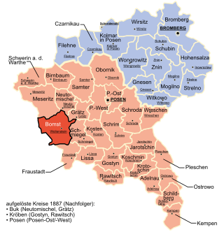
The district of Bomst was a Prussian district which existed from 1793 to 1807 in the province of South Prussia and from 1815 to 1938 successively in the Grand Duchy of Posen, the Province of Posen and the Frontier March of Posen-West Prussia. The district capital was Wollstein.

Kreis Schrimm was a district in the southern administrative region of Posen, in the Prussian province of Posen. The district capital was Schrimm. Its territory presently lies in the southern part of the Greater Poland Voivodeship in Poland.

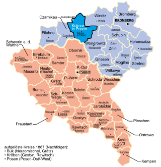
The Kreis Kolmar in Posen was a district in the northern government region of Bromberg, in the Prussian Province of Posen, from 1818 to 1920. The district capital was Kolmar in Posen.

Kreis Wirsitz was one of 14 or 15 Kreise in the northern administrative district of Bromberg, in the Prussian province of Posen. The county existed with essentially the same boundaries beginning in 1815 as a German Kreise then from 1919 as a Polish Powiat until 1975. Its administrative center was the town of Wyrzysk (Wirsitz). The county contained additional municipalities such as Bialosliwie, Lobzenica (Lobsens), Miasteczko Krajeńskie (Friedheim), Mrocza (Mrotschen), Nakło nad Notecią (Nakel), Sadki and Wysoka (Wissek) plus over 100 villages. Many villages that had Germanic names were changed to completely different Polish names following World War II, such as Radzicz. In 1954 the central government abolished the commune as the smallest unit of government, dividing the county into 28 clusters. In 1973 municipalities were restored. After the administrative reform of 1975, the territory of the county was divided between the new (lower) region of Bydgoszcz and the region Piła. The territory of the defunct county was annexed by Naklo County, Kujavian-Pomeranian Voivodeship and Pila County, Greater Poland Voivodeship. Wyrzysk was incorporated into Piła County.

The Province of Posen was a province of the Kingdom of Prussia from 1848 to 1920, occupying most of the historical Greater Poland. The province was established following the Poznań Uprising of 1848 as a successor to the Grand Duchy of Posen, which in turn was annexed by Prussia in 1815 from Duchy of Warsaw. It became part of the German Empire in 1871. After World War I, Posen was briefly part of the Free State of Prussia within Weimar Germany, but was dissolved in 1920 when the Greater Poland Uprising broke out and most of its territory was incorporated into the Second Polish Republic. The remaining German territory was re-organized into Posen-West Prussia in 1922.

Obrzycko is a town in Szamotuły County, Greater Poland Voivodeship, Poland, with 2,262 inhabitants (2010).

The Reichstag of the German Empire was Germany's lower House of Parliament from 1871 to 1918. Within the governmental structure of the Reich, it represented the national and democratic element alongside the federalism of the Bundesrat and the monarchic and bureaucratic element of the executive, embodied in the Reich chancellor. Together with the Bundesrat, the Reichstag had legislative power and shared in decision-making on the budget. It also had certain rights of control over the executive branch and could engage the public through its debates. The emperor had little political power, and over time the position of the Reichstag strengthened with respect to both the imperial government and the Bundesrat.
Moritz Baerwald was a German lawyer and politician of the German Democratic Party, a member of the Prussian House of Representatives and the Weimar National Assembly.

The Flatow district was a district that existed from 1818 to 1945 in the Kingdom of Prussia and Germany. It belonged to the province of West Prussia until 1920. After World War I, the eastern portion of the district was ceded to Poland. The western portion of the district remained in Germany and became part of the Frontier March of Posen-West Prussia until 1938. The district then became part of the Province of Pomerania from 1938 to 1945. Today the territory of the Flatow district lies in the Kuyavian-Pomeranian Voivodeship and the Greater Poland Voivodeship in Poland.

Kreis Schwetz was a Prussian district that existed from 1818 to 1920, with its capital at Schwetz. The district was located on the western bank of the Vistula river in the part of West Prussia that fell to Poland after the First World War through the Treaty of Versailles in 1920.

The district of Deutsch Krone was a district in Prussia from 1772 to 1945. It belonged to the part of West Prussia that remained in the German Reich after World War I and became part of the Province of Grenzmark Posen-West Prussia. From 1938 to 1945, it belonged to the Province of Pomerania. Today the territory of the district area lies in the Polish Voivodeships of West Pomerania and Greater Poland.

The district of Graudenz was a Prussian district in the administrative region of Marienwerder that existed from 1818 to 1920. It belonged to the province of West Prussia until 1829 and then again from 1878 to 1920. Between 1829 and 1878, it belonged to the Province of Prussia. It was located in the part of West Prussia that fell to Poland after the World War I in 1920 through the Treaty of Versailles. The city of Graudenz, was part of the district until 1900, after which it formed its own independent urban district.

The Berent district was a Prussian district that existed from 1818 to 1920. It was in the part of West Prussia that fell to Poland after World War I in 1920. Its capital was Berent. From 1939 to 1945, the district was re-established in German-occupied Poland as part of the newly established Reichsgau Danzig-West Prussia. Today the territory of the district is located in the Polish Pomeranian Voivodeship.

The Tuchel district was a Prussian district in Germany that existed from 1875 to 1920. It was in the part of West Prussia that fell to Poland after World War I through the Treaty of Versailles. Its capital was Tuchel.

The district of Thorn was a Prussian district in the Marienwerder administrative region that existed from 1818 to 1920. It belonged to the province of West Prussia, except for the period from 1829 to 1878 when it was part of the Province of Prussia. Its capital was Thorn. It was in the part of West Prussia that fell to Poland after World War I in 1920 through the Treaty of Versailles. From 1939 to 1945, the district of Thorn was re-established in Reichsgau Danzig-West Prussia in occupied Poland. Today, the area of the district is in the Kuyavian-Pomeranian Voivodeship in Poland.

The Preußisch Stargard district was a Prussian district that existed from 1772 to 1920 with varying borders. It was in the part of West Prussia that fell to Poland after World War I through the Treaty of Versailles in 1920. Its county seat was Preußisch Stargard. From 1939 to 1945 the district was re-established in German-occupied Poland as part of the newly established Reichsgau Danzig-West Prussia. Today the territory of the district is located in the Polish Pomeranian Voivodeship.

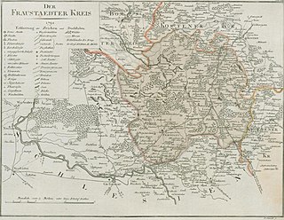
The Fraustadt district was Prussian district which existed in various borders from 1793 to 1945. From 1793 to 1807, it was located in the Province of South Prussia, from 1815 to 1848 in the Grand Duchy of Posen, from 1848 to 1920 in the Province of Posen, from 1922 to 1938, in the Province of Posen-West Prussia, from 1938 to 1941 in the Province of Silesia, and from 1941 to 1945 in the Province of Lower Silesia.
52°37′00″N16°35′00″E / 52.616667°N 16.583333°E