Mendez-Biscoe Islands is a series of islands, of which the principal ones are Renaud, Lavoisier, Watkins, Krogh, Pickwick and Rabot, lying parallel to the west coast of Graham Land and extending 150 km (81 nmi) between Southwind Passage on the northeast and Matha Strait on the southwest. Another group of islands are the Adolph Islands.

Renaud Island is an ice-covered island in the Biscoe Islands of Antarctica, 40 km (25 mi) long and from 6.4 to 16.1 km wide, lying between the Pitt Islands and Rabot Island. It is separated from the Pitt Islands to the northeast by Mraka Sound, and from Lavoisier Island to the southwest by Pendleton Strait.
Northeast Glacier is a steep, heavily crevassed glacier, 13 nautical miles long and 5 nautical miles wide at its mouth, which flows from McLeod Hill westward and then south-westwards into Marguerite Bay between the Debenham Islands and Roman Four Promontory, on the west coast of Graham Land, Antarctica.
Rymill Bay is a bay, 9 nautical miles wide at its mouth and indenting 5 nautical miles between Red Rock Ridge and Bertrand Ice Piedmont along the west coast of Graham Land, Antarctica.
Hanusse Bay is a broad, V-shaped bay, off the west coast of Graham Land, Antarctica. The bay is 37 kilometres (20 nmi) long and trends generally north–south. It is bordered by Cape Mascart on Anvers Island, and Shmidt Point on Arrowsmith Peninsula, Loubet Coast. At its north entrance, Isacke Passage separates it from Liard Island. It is bounded to the south by a line from Landauer Point, the north point of Hansen Island and Bagnold Point on Arrowsmith Peninsula.

The Willis Islands are a small archipelago to the west of South Georgia Island in the South Georgia Islands. They are 2 miles (3.2 km) west of Bird Island, separated by the Stewart Strait. They were discovered on 14 January 1775 by Captain James Cook and named for Cook's midshipman Thomas Willis, the crew member who first sighted them. The Willis Islands were charted in greater detail and individually named by Discovery Investigations (DI) personnel between 1926 and 1930.
Bazett Island is a small island close south of the west end of Krogh Island, in the Biscoe Islands. It was mapped from air photos by the Falkland Islands and Dependencies Aerial Survey Expedition (1956–57), and named by the UK Antarctic Place-Names Committee for Henry C. Bazett (1885–1950), American physiologist, pioneer of studies of temperature sensation and the physiology of temperature regulation of the human body.

Belding Island is an island 6 kilometres (3 nmi) long, lying west of the south end of Watkins Island, Biscoe Islands. It was mapped from air photos taken by the Falkland Islands and Dependencies Aerial Survey Expedition (1956–57), and named by the UK Antarctic Place-Names Committee for Harwood S. Belding, an American physiologist who was Director of the Quartermaster at the Climatic Research Laboratory, Department of the Army, Lawrence, Massachusetts, and initiated considerable research on cold climate clothing.
Buchanan Passage is a marine channel separating Liard Island from Adelaide Island at the north end of Hanusse Bay. It was discovered and first charted by the French Antarctic Expedition, 1908–10, under Jean-Baptiste Charcot, and named by the UK Antarctic Place-Names Committee for Captain Peter Buchanan, Royal Navy, commanding officer of HMS Endurance in the Antarctic Peninsula area, 1968–70, who proved that the passage can be used to approach Marguerite Bay from the North, through The Gullet.
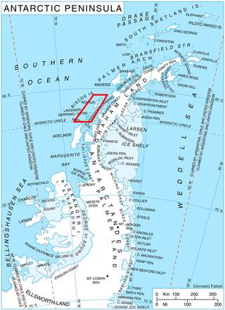
Pendleton Strait is a strait between Rabot and Lavoisier Islands, in the Biscoe Islands. The French Antarctic Expedition, in accordance with Charcot's conception of this water feature, applied the name Pendleton Bay in January 1909. The British Graham Land Expedition (BGLE) under Rymill, 1934–37, recognizing that it is really a strait, renamed it Pendleton Strait. Named by Charcot for Captain Benjamin Pendleton, Yankee sealer of Stonington, CT. Captain Pendleton was commodore of the little fleet which included the sloop Hero under Captain Nathaniel B. Palmer who, at Pendleton's direction, explored this area in January 1821.

DuBois Island is one of the Biscoe Islands lying near the south end of the chain, and separated from Krogh Island on the east by the 0.54 nautical miles (1 km) wide Papazov Passage. It was mapped from air photos by the Falkland Islands and Dependencies Aerial Survey Expedition (1956–57), and named by the UK Antarctic Place-Names Committee for Eugene F. DuBois, an American physiologist who has specialized in the measurement of basic metabolism and studies in the regulation of body temperature in man.
Edholm Point is the northwestern point of Krogh Island in the Biscoe Islands, Antarctica forming the west side of the entrance to Transmarisca Bay.
The Molnar Rocks are insular rocks lying 4 nautical miles (7 km) west of the middle of Lavoisier Island, in the Biscoe Islands of Antarctica. The rocks were mapped from air photos taken by the Falkland Islands and Dependencies Aerial Survey Expedition in 1956–57, and were named by the UK Antarctic Place-Names Committee for George W. Molnar, an American physiologist who has specialized in the reactions of the body to cold environments.
The Foote Islands are a small group of snow-capped islands and several rocks, lying 12 nautical miles (22 km) southeast of Cape Leblond, Lavoisier Island, in Crystal Sound. They were mapped from air photos obtained by the Ronne Antarctic Research Expedition (1947–48) and surveys by the Falkland Islands Dependencies Survey (FIDS) (1958–59). They were named by the UK Antarctic Place-Names Committee for Brian L.H. Foote, a FIDS radio mechanic at Arthur Harbour (1957) and a surveyor at Detaille Island (1958), who made surveys of the Crystal Sound area.
Fricker Glacier is a glacier, 10 nautical miles (19 km) long, which lies close north of Tindal Bluff and Monnier Point and flows in a northeasterly direction into the southwest side of Mill Inlet, on the east coast of Graham Land, Antarctica. It was charted by the Falkland Islands Dependencies Survey (FIDS) and photographed from the air by the Ronne Antarctic Research Expedition in 1947, and was named by the FIDS for Karl Fricker, a German Antarctic historian.
The Hardy Rocks are insular rocks lying 2 nautical miles (4 km) west of DuBois Island, in the Biscoe Islands of Antarctica. They were mapped from air photos taken by the Falkland Islands and Dependencies Aerial Survey Expedition (1956–57), and were named by the UK Antarctic Place-Names Committee for James D. Hardy, an American physiologist who has studied the reactions of the human body to cold environments.
Hariot Glacier is a glacier flowing northwest along the south side of Morgan Upland before turning west into the northern portion of the Wordie Ice Shelf, along the west coast of the Antarctic Peninsula. It was roughly surveyed by the British Graham Land Expedition, 1936–37, and the upper reaches were photographed from the air by the Ronne Antarctic Research Expedition, 1947. The glacier was surveyed from the ground by members of the Falkland Islands Dependencies Survey who traveled along it in December 1958, and it was named by the UK Antarctic Place-Names Committee after Thomas Hariot, an English mathematician who pioneered new methods of navigation under the patronage of Sir Walter Raleigh.
McClary Glacier is a glacier 10 nautical miles (19 km) long and 2 nautical miles (4 km) wide on the west coast of Graham Land, Antarctica. It flows southwest along the north side of Butson Ridge into Marguerite Bay between Cape Calmette and the Debenham Islands. The glacier was first roughly surveyed by the British Graham Land Expedition, 1936–37, and resurveyed by the Falkland Islands Dependencies Survey, 1946–50. It was named by the UK Antarctic Place-Names Committee for George B. McClary, father of Nelson McClary, mate on the Port of Beaumont during the Ronne Antarctic Research Expedition, 1947–48.
Lewis Sound is a body of water running northwest–southeast between Lavoisier Island and Krogh Island to the northeast and Watkins Island to the southwest, in the Biscoe Islands of Antarctica. It was mapped from aerial photographs taken by the Falkland Islands and Dependencies Aerial Survey Expedition, 1956–57. In association with the names of pioneers in cold climate physiology grouped in this area, it was named "Lewis Passage" by the UK Antarctic Place-Names Committee (1960) after Sir Thomas Lewis, an English physiologist who investigated the responses of the blood vessels of the skin to environmental temperature. The feature was later renamed as Lewis Sound as it does not provide safe passage for a ship.
Vladigerov Passage is a passage in the Biscoe Islands, Antarctica between Lavoisier Island on the east and Krogh Island on the west. It is 5.8 km long in the southwest-northeast direction and 1.05 km wide. The eponymous Vladigerov Island, 420 m long in southwest-northeast direction and 150 m wide, is lying in the narrowest part of the passage centred at 66°17′17″S66°54′35″W, formed as a result of the retreat of the ice cap of Lavoisier Island in the early 21st century.

