Kroonstad Airport | |||||||||||||||||||
|---|---|---|---|---|---|---|---|---|---|---|---|---|---|---|---|---|---|---|---|
| Summary | |||||||||||||||||||
| Airport type | Public | ||||||||||||||||||
| Serves | Kroonstad, Free State, South Africa | ||||||||||||||||||
| Elevation AMSL | 4,700 ft / 1,433 m | ||||||||||||||||||
| Coordinates | 27°39′38″S27°18′56″E / 27.66056°S 27.31556°E | ||||||||||||||||||
| Map | |||||||||||||||||||
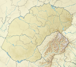 FAKS Location of airport in Free State province Location of Free State in South Africa 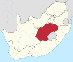 | |||||||||||||||||||
 | |||||||||||||||||||
| Runways | |||||||||||||||||||
| |||||||||||||||||||
Kroonstad Airport( ICAO : FAKS) is an airport serving Kroonstad in the Free State province of South Africa. [1] [2]