
Petrovce is a village and municipality in the Rimavská Sobota District of the Banská Bystrica Region of southern Slovakia.
Kelsey is a rural municipality in the province of Manitoba in Western Canada. It consists of several disjoint parts. The largest part is Carrot Valley, located around and southwest of The Pas along the Carrot River, but the communities of Wanless and Cranberry Portage, located further north, are also part of the municipality. It is 867.64 km² large. Also lying in the area around The Pas is the Opaskwayak Cree Nation Indian reserve.
Sevkar is a village in the Tavush Province of Armenia and the birthplace of the Armenian revolutionary leader Sevkaretsi Sako. The meaning of the name in Armenian is "Black Stone." The original name of the village was "Karadash", which also means "Black Stone" in Turkish.

Wrzosowisko is a village in the administrative district of Gmina Cekcyn, within Tuchola County, Kuyavian-Pomeranian Voivodeship, in north-central Poland. It lies approximately 7 kilometres (4 mi) east of Cekcyn, 18 km (11 mi) east of Tuchola, and 53 km (33 mi) north of Bydgoszcz.
Łyków is a village in the administrative district of Gmina Świnice Warckie, within Łęczyca County, Łódź Voivodeship, in central Poland. It lies approximately 8 kilometres (5 mi) east of Świnice Warckie, 13 km (8 mi) west of Łęczyca, and 42 km (26 mi) north-west of the regional capital Łódź.

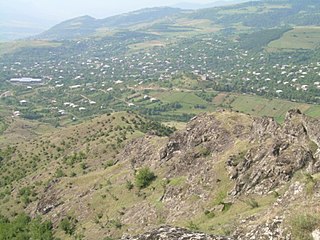
Çobankərəhməz is a village in the Kalbajar Rayon of Azerbaijan.
Şıxlar is a settlement in Baku, Azerbaijan. The settlement forms part of the municipality of Ələt in Qaradağ raion.
Rakowice is a village in the administrative district of Gmina Wróblew, within Sieradz County, Łódź Voivodeship, in central Poland. It lies approximately 3 kilometres (2 mi) south of Wróblew, 9 km (6 mi) west of Sieradz, and 62 km (39 mi) west of the regional capital Łódź.
Stare Kobiałki is a village in the administrative district of Gmina Stoczek Łukowski, within Łuków County, Lublin Voivodeship, in eastern Poland.
Psota is a settlement in the administrative district of Gmina Lutocin, within Żuromin County, Masovian Voivodeship, in east-central Poland.
Kamionka is a village in the administrative district of Gmina Chodzież, within Chodzież County, Greater Poland Voivodeship, in west-central Poland. It lies approximately 5 kilometres (3 mi) north-west of Chodzież and 69 km (43 mi) north of the regional capital Poznań.
Mielimąka is a settlement in the administrative district of Gmina Szamocin, within Chodzież County, Greater Poland Voivodeship, in west-central Poland. It lies approximately 5 kilometres (3 mi) west of Szamocin, 12 km (7 mi) east of Chodzież, and 70 km (43 mi) north of the regional capital Poznań.

Shui Pin Wai is an at-grade MTR Light Rail stop located at Castle Peak Road in Yuen Long District, near Shui Pin Wai Estate. It began service on 18 September 1988 and belongs to Zone 5. It serves Shui Pin Wai Estate ,Yuen Long Stadium and Yuen Long Park.
Nowe Czeskie is a village in the administrative district of Gmina Zbąszyń, within Nowy Tomyśl County, Greater Poland Voivodeship, in west-central Poland.
Stawki Żytniowskie is a village in the administrative district of Gmina Rudniki, within Olesno County, Opole Voivodeship, in south-western Poland.
Kołomąt is a village in the administrative district of Gmina Czaplinek, within Drawsko County, West Pomeranian Voivodeship, in north-western Poland. It lies approximately 5 kilometres (3 mi) north of Czaplinek, 29 km (18 mi) east of Drawsko Pomorskie, and 110 km (68 mi) east of the regional capital Szczecin.
Nowy Przylep is a village in the administrative district of Gmina Warnice, within Pyrzyce County, West Pomeranian Voivodeship, in north-western Poland.
Uniküla is a village in Lüganuse Parish, Ida-Viru County in northeastern Estonia.

Berkovići is a village in the Republika Srpska, Bosnia and Herzegovina. According to the 1991 census, the village is located in the municipality of Rogatica.

Agios Eleftherios is a metro station of the Athens Metro, Line 1, Patisia. It opened on 4 August 1961 and is 14.668 kilometres (9.114 mi) from Piraeus.


