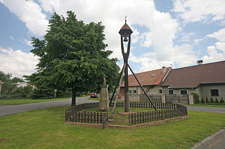
Svídnice is a village in Pardubice Region of the Czech Republic. It has around 420 inhabitants.
Eisstadion am Pulverturm is an arena in Straubing, Germany. It is primarily used for ice hockey and is the home arena of Straubing Tigers. It opened in 1967 and holds approximately 6,000 people. It is one of the smallest arenas in the DEL. Eisstadion am Pulverturm is on Kinseherberg 23 in the city center.

Dorimcheon Station is a station on the Sinjeong Branch of the Seoul Subway Line 2. It is the least-used station on Line 2. This station is located in Sindorim-dong, Guro-gu, Seoul.

Glinnik is a village in the administrative district of Gmina Zgierz, within Zgierz County, Łódź Voivodeship, in central Poland. It lies approximately 6 kilometres (4 mi) north-east of Zgierz and 12 km (7 mi) north of the regional capital Łódź.
Mazurki is a village in the administrative district of Gmina Augustów, within Augustów County, Podlaskie Voivodeship, in north-eastern Poland. It lies approximately 7 kilometres (4 mi) north-west of Augustów and 88 km (55 mi) north of the regional capital Białystok.
Suszczy Borek is a village in the administrative district of Gmina Narewka, within Hajnówka County, Podlaskie Voivodeship, in north-eastern Poland, close to the border with Belarus.
Dąbrówka is a village in the administrative district of Gmina Zadzim, within Poddębice County, Łódź Voivodeship, in central Poland. It lies approximately 7 kilometres (4 mi) north of Zadzim, 9 km (6 mi) south-west of Poddębice, and 41 km (25 mi) west of the regional capital Łódź.
Mariańskie Porzecze is a village in the administrative district of Gmina Wilga, within Garwolin County, Masovian Voivodeship, in east-central Poland.
Jeziórka is a village in the administrative district of Gmina Pniewy, within Grójec County, Masovian Voivodeship, in east-central Poland.
Stefanowo is a village in the administrative district of Gmina Lesznowola, within Piaseczno County, Masovian Voivodeship, in east-central Poland. It lies approximately 6 kilometres (4 mi) south-west of Lesznowola, 10 km (6 mi) west of Piaseczno, and 21 km (13 mi) south-west of Warsaw.
Stare Helenowo is a village in the administrative district of Gmina Przasnysz, within Przasnysz County, Masovian Voivodeship, in east-central Poland.
Kępa Karolińska is a village in the administrative district of Gmina Iłów, within Sochaczew County, Masovian Voivodeship, in east-central Poland.
Las Jaworski is a village in the administrative district of Gmina Wierzbno, within Węgrów County, Masovian Voivodeship, in east-central Poland.
Łączewna is a village in the administrative district of Gmina Przedecz, within Koło County, Greater Poland Voivodeship, in west-central Poland.
Benowo-Wrzosy is a settlement in the administrative district of Gmina Ryjewo, within Kwidzyn County, Pomeranian Voivodeship, in northern Poland. It lies approximately 5 kilometres (3 mi) north of Ryjewo, 17 km (11 mi) north of Kwidzyn, and 58 km (36 mi) south of the regional capital Gdańsk.
Piłąg is a settlement in the administrative district of Gmina Morąg, within Ostróda County, Warmian-Masurian Voivodeship, in northern Poland.
Kępinka is a settlement in the administrative district of Gmina Stargard, within Stargard County, West Pomeranian Voivodeship, in north-western Poland. It lies approximately 14 kilometres (9 mi) north-west of Stargard and 20 km (12 mi) east of the regional capital Szczecin.

Donje Trnjane is a village in the municipality of Leskovac, Serbia. According to the 2002 census, the village has a population of 289 people.

Nakrivanj is a village in the municipality of Leskovac, Serbia. According to the 2002 census, the village has a population of 1315 people.
Argun is the name of several inhabited localities in Russia.


