The autostrada A6 in Poland is a 25.7 km (16.0 mi) long motorway that starts at the Polish/German border at Kołbaskowo/Pomellen connecting to the German A11 autobahn. It forms a southern bypass of the Szczecin metropolitan area and terminates to the east of the city, where it becomes the S3 express road to Świnoujście. Another 4.9 km (3 mi) of the S3 road will be redesignated as A6, once improvement work is carried out. The motorway is part of the European route E28.
Orell is a neighborhood of Louisville, Kentucky centered along Dixie Highway and Orell Road.
Musiejówka is a village in the administrative district of Gmina Rossosz, within Biała Podlaska County, Lublin Voivodeship, in eastern Poland.

Zimnochy-Świechy is a village in the administrative district of Gmina Suraż, within Białystok County, Podlaskie Voivodeship, in north-eastern Poland. It lies approximately 9 kilometres (6 mi) east of Suraż and 21 km (13 mi) south of the regional capital Białystok.

Kociołki is a village in the administrative district of Gmina Szypliszki, within Suwałki County, Podlaskie Voivodeship, in north-eastern Poland, close to the border with Lithuania. It lies approximately 4 kilometres (2 mi) north of Szypliszki, 24 km (15 mi) north-east of Suwałki, and 129 km (80 mi) north of the regional capital Białystok.
Chorzepinek is a village in the administrative district of Gmina Świnice Warckie, within Łęczyca County, Łódź Voivodeship, in central Poland.
Dębina is a village in the administrative district of Gmina Tyszowce, within Tomaszów Lubelski County, Lublin Voivodeship, in eastern Poland.
Grudusk-Brzozowo is a village in the administrative district of Gmina Grudusk, within Ciechanów County, Masovian Voivodeship, in east-central Poland.

Szydłowo is a village in Piła County, Greater Poland Voivodeship, in west-central Poland. It is the seat of the gmina called Gmina Szydłowo. It lies approximately 8 kilometres (5 mi) west of Piła and 87 km (54 mi) north of the regional capital Poznań.

Strużka is a settlement in the administrative district of Gmina Koczała, within Człuchów County, Pomeranian Voivodeship, in northern Poland. It lies approximately 6 kilometres (4 mi) south of Koczała, 30 km (19 mi) north-west of Człuchów, and 117 km (73 mi) south-west of the regional capital Gdańsk.

Chorążówka is a village in the administrative district of Gmina Stegna, within Nowy Dwór Gdański County, Pomeranian Voivodeship, in northern Poland. It lies approximately 9 kilometres (6 mi) north of Nowy Dwór Gdański and 30 km (19 mi) east of the regional capital Gdańsk.

Walana is a village in the Punjab province of Pakistan. It is located at 32°53'0N 72°37'0E with an altitude of 511 metres.
Łowizowo is a settlement in the administrative district of Gmina Iława, within Iława County, Warmian-Masurian Voivodeship, in northern Poland.

Wojny is a village in the administrative district of Gmina Biała Piska, within Pisz County, Warmian-Masurian Voivodeship, in northern Poland. It lies approximately 8 kilometres (5 mi) east of Biała Piska, 26 km (16 mi) east of Pisz, and 113 km (70 mi) east of the regional capital Olsztyn.
Nannilam taluk is a taluk in Thiruvarur district of the Indian state of Tamil Nadu. The headquarters of the taluk is the town of Nannilam.
Quanjiao County is a county in the east of Anhui Province, China, bordering Jiangsu province to the east. It is under the administration of Chuzhou city.

Ćićevci is a village in the municipality of Srebrenica, Bosnia and Herzegovina.

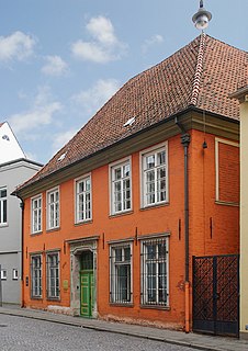
The Heineken House is a historic building in Bremen, Germany. The house has Bremen's oldest painted wooden ceiling. The building's exterior dates from the 18th century but its core is medieval.

The House of the Seven Lazy Brothers is a historic building in Bremen, Germany, completed in 1927. With a name based on a local legend, the building located in Böttcherstraße in the old town was built by the prosperous coffee merchant Ludwig Roselius to a design by Bremen architects Eduard Scotland and Alfred Runge. The first version of the house was home to the advertising department of Roselius's coffee company and the Deutscher Werkbund association of craftsmen. When it was rebuilt in 1954 the new design was based on a traditional local story.

Division No. 1, Subdivision E is an unorganized subdivision on the Avalon Peninsula in Newfoundland and Labrador, Canada. It is in Division 1 and contains the unincorporated communities of Broad Cove, Dildo, Green's Harbour, Harnum Point, Hopeall, New Harbour and Reids Room.


