National Route 12 is a Japanese national highway connecting the two largest cities of Hokkaido, Sapporo and Asahikawa. The 135.7-kilometer-long (84.3 mi) highway begins at an intersection with National Routes 36 and 230 in Sapporo. It travels northeast across the western side of Hokkaido to Asahikawa where it ends at an intersection with National Routes 39 and 40.
National Route 44 is the easternmost of the national highways of Japan. It connects the cities of Kushiro and Nemuro in eastern part of the island and prefecture of Hokkaido in northern Japan.

The Akita Expressway is a national expressway in the Tōhoku region of Japan. The 229.2-kilometer-long (142.4 mi) expressway begins at an interchange with the Tōhoku Expressway in Kitakami, Iwate from where it proceeds northwest towards the capital of Akita Prefecture, Akita. From there, it travels northeast back to another interchange along the Tōhoku Expressway in the town of Kosaka. It is jointly owned and operated by East Nippon Expressway Company and the Ministry of Land, Infrastructure, Transport and Tourism (MLIT). The Akita Expressway is numbered E7 between Kosaka and Kitakami Junctions and E46 between Kitakami and Kawabe Junctions under the MLIT's "2016 Proposal for Realization of Expressway Numbering."
National Route 42, also called Kumano Kaidō or Tropical Route is a national highway connecting Hamamatsu, Shizuoka and Wakayama, Wakayama in Japan. Part of the route requires crossing Ise Bay on the Ise-wan Ferry. It is the 8th longest national highway in Japan.

National Route 336 is a national highway connecting Urakawa, Hokkaido and Kushiro, Hokkaido in Japan.

National Route 235 is a national highway connecting Muroran, Hokkaido and Urakawa, Hokkaido in Japan.
National Route 48 is a national highway of Japan that connects the capital cities of Miyagi Prefecture and Yamagata Prefecture, Sendai and Yamagata. It has a total length of 75.0 kilometers (46.6 mi).
National Route 101 is a national highway of Japan connecting the capitals of Aomori and Akita prefectures, Aomori and Akita in northern Japan, with a total length of 241.6 kilometers (150.1 mi). The majority of the highway travels along the coast of the Sea of Japan, paralleling the more inland National Route 7. The present-day highway largely follows the path of the Ōmagoe-kaidō, an Edo period road that linked the Kubota and Hirosaki feudal domains.
National Route 114 is a national highway of Japan that traverses the prefecture of Fukushima in a northwest–southeast routing. It connects the prefecture's capital city, Fukushima in north-central Fukushima Prefecture to the town of Namie on the prefecture's eastern coast. It has a total length of 69.0 kilometers (42.9 mi). A section of the highway was closed following the Fukushima Daiichi nuclear disaster, but it has since been reopened.
National Route 119 is a national highway located entirely within Tochigi Prefecture, Japan. It connects the city of Nikkō to Utsunomiya, the prefecture's capital, and has a total length of 63.9 kilometers (39.7 mi). The present-day highway largely follows the path of the Nikkō Kaidō, an Edo period road that linked Edo and the Shrines and Temples of Nikkō.

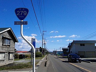
National Route 279 is a national highway of Japan that traverses the prefectures of Aomori and Hokkaido, as well as the Tsugaru Strait that separates them. The 134.0-kilometer (83.3 mi) highway begins at an intersection with National Route 5 in Hakodate, then crosses the Tsugaru Strait on a ferry from Hakodate to Ōma, Aomori, that it shares with National Route 279, where it then travels south through eastern Aomori Prefecture, passing through the city of Mutsu before ending at an intersection with National Route 4 in Noheji.

National Route 282 is a national highway of Japan connecting the cities of Morioka, the capital city of Iwate Prefecture, and Hirakawa in southern Aomori Prefecture. It travels south to north and has a total length of 124.4 kilometers (77.3 mi).
National Route 423 is a national highway of Japan connecting Kita-ku, Osaka and Kameoka, Kyoto in the Kansai region of Japan.
National Route 466 is a national highway in Japan connecting Setagaya and Hodogaya-ku, Yokohama, with a total length of 18.4 kilometers (11.4 mi).

The Kamikita Expressway is a free two-lane expressway in Aomori Prefecture connecting the towns of Shichinohe and Rokunohe. Alongside other tolled roads, the expressway is part of a series of highways that will link the Hachinohe Expressway to the Aomori Expressway. The road is managed by the Ministry of Land, Infrastructure and Transport and is numbered E4A as an extension of the Tōhoku Expressway. It is routed concurrently with an alternate route of Japan National Route 45.

The Tsugaru Expressway is a two-lane national expressway in Aomori Prefecture, Japan. The expressway connects the prefecture's capital, Aomori, and the Tōhoku Expressway to the municipalities of Goshogawara, Tsugaru and, Ajigasawa. It is owned and operated by Ministry of Land, Infrastructure, Transport and Tourism and is signed as an auxiliary route of National Route 101 as well as E64 under their "2016 Proposal for Realization of Expressway Numbering."

The Tokachi-Okhotsk Expressway is a two-lane national expressway in Tokachi Subprefecture and Okhotsk Subprefecture, Hokkaido, Japan. As of December 2018, the expressway is under construction to connect to link to the Kitami Route of the Dōtō Expressway in Ashoro. As of December 2018, it connects Rikubetsu to Kitami, the most populous city in Okhotsk Subprefecture, on the Sea of Okhotsk coast. It is owned and operated by Ministry of Land, Infrastructure, Transport and Tourism and is signed as E61 under their "2016 Proposal for Realization of Expressway Numbering."

The Hachinohe-Kuji Expressway is an incompleted expressway in the southeastern part of Aomori Prefecture and the coastal area of Iwate Prefecture in northern Japan. It is owned and operated primarily by the Ministry of Land, Infrastructure, Transport and Tourism (MLIT), but has a section maintained by the East Nippon Expressway Company. The route is signed as an auxiliary route of National Route 45 as well E45 under MLIT's "2016 Proposal for Realization of Expressway Numbering."

The Obihiro-Hiroo Expressway is an incomplete two-lane national expressway in Tokachi Subprefecture, Hokkaido. It is owned and operated primarily by the Ministry of Land, Infrastructure, Transport and Tourism (MLIT), but has a short section maintained and tolled by the East Nippon Expressway Company at its northern terminus with the Dōtō Expressway. The route is signed as an auxiliary route of National Route 236 as well E60 under MLIT's "2016 Proposal for Realization of Expressway Numbering."

The Naha Airport Expressway is an expressway on Okinawa Island in Okinawa Prefecture, Japan. The expressway has a length of 11.7 kilometres (7.3 mi). The Ministry of Land, Infrastructure, Transport and Tourism maintains most of the expressway, but the West Nippon Expressway Company is the owner and operator of a short section of the expressway at its eastern end. It is signed E58 as a spur route of the Okinawa Expressway under the "2016 Proposal for Realization of Expressway Numbering". It also carries the entire length of National Route 506.


