Kusowo, West Pomeranian Voivodeship

Last updated
Kusowo
Village
Poland adm location map.svg
Red pog.svg
Kusowo
Coordinates: 53°48′N16°33′E / 53.800°N 16.550°E / 53.800; 16.550
Country Flag of Poland.svg Poland
Voivodeship West Pomeranian
County Szczecinek
Gmina Gmina Szczecinek

Kusowo [kuˈsɔvɔ] is a village in the administrative district of Gmina Szczecinek, within Szczecinek County, West Pomeranian Voivodeship, in north-western Poland. [1] It lies approximately 13 kilometres (8 mi) north-west of Szczecinek and 137 km (85 mi) east of the regional capital Szczecin.

Village Small clustered human settlement smaller than a town

A village is a clustered human settlement or community, larger than a hamlet but smaller than a town, with a population ranging from a few hundred to a few thousand. Though villages are often located in rural areas, the term urban village is also applied to certain urban neighborhoods. Villages are normally permanent, with fixed dwellings; however, transient villages can occur. Further, the dwellings of a village are fairly close to one another, not scattered broadly over the landscape, as a dispersed settlement.

Gmina Szczecinek is a rural gmina in Szczecinek County, West Pomeranian Voivodeship, in north-western Poland. Its seat is the town of Szczecinek, although the town is not part of the territory of the gmina.

Szczecinek County County in West Pomeranian, Poland

Szczecinek County is a unit of territorial administration and local government (powiat) in West Pomeranian Voivodeship, north-western Poland. It came into being on January 1, 1999, as a result of the Polish local government reforms passed in 1998. Its administrative seat and largest town is Szczecinek, which lies 143 kilometres (89 mi) east of the regional capital Szczecin. The county contains three other towns: Borne Sulinowo, 19 km (12 mi) south-west of Szczecinek, Barwice, 23 km (14 mi) west of Szczecinek, and Biały Bór, 23 km (14 mi) north-east of Szczecinek.

History

At the time of the foundation of the German Empire in 1871, the Kingdom of Prussia was the largest and dominant part of the empire. Pomerania was taken by the kingdom, and along with a few other places, and would later be called in Germany "Ostgebiete des deutschen Reiches" (Eastern territories of the German Empire).

German Empire empire in Central Europe between 1871–1918

The German Empire, also known as Imperial Germany, was the German nation state that existed from the unification of Germany in 1871 until the abdication of Kaiser Wilhelm II in 1918.

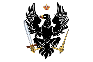
Kingdom of Prussia Former German state (1701–1918)

The Kingdom of Prussia was a German kingdom that constituted the state of Prussia between 1701 and 1918. It was the driving force behind the unification of Germany in 1871 and was the leading state of the German Empire until its dissolution in 1918. Although it took its name from the region called Prussia, it was based in the Margraviate of Brandenburg, where its capital was Berlin.

Pomerania Place

Pomerania is a historical region on the southern shore of the Baltic Sea in Central Europe, split between Germany and Poland.

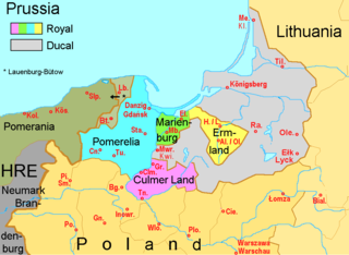
Pomerelia (now Pomeranian Voivodeship) was handed over to Poland after the Greater Poland Uprising. It was, however, annexed by Nazi Germany during the Second World War. After the war, it was decided in the Potsdam Agreement that the Pomeranian Voivodeship would be returned to Poland.

Pomerelia

Pomerelia, also referred to as Eastern Pomerania or as Danzig Pomerania, is a historical region in northern Poland. Pomerelia lay on the southern shore of the Baltic Sea, west of the Vistula river and east of the Łeba river. Its biggest city was Gdańsk. Since 1999 the region has formed the core of the Pomeranian Voivodeship. Gdańsk Pomerania is traditionally divided into Kashubia and Kociewie.

Pomeranian Voivodeship Voivodeship in Poland

Pomeranian Voivodeship, Pomorskie Region, or Pomerania Province, is a voivodeship, or province, in north-western Poland. The provincial capital is Gdańsk.

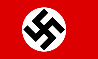
Nazi Germany The German state from 1933 to 1945, under the dictatorship of Adolf Hitler

Nazi Germany is the common English name for Germany between 1933 and 1945, when Adolf Hitler and his Nazi Party (NSDAP) controlled the country through a dictatorship. Under Hitler's rule, Germany was transformed into a totalitarian state that controlled nearly all aspects of life via the Gleichschaltung legal process. The official name of the state was Deutsches Reich until 1943 and Großdeutsches Reich from 1943 to 1945. Nazi Germany is also known as the Third Reich, meaning "Third Realm" or "Third Empire", the first two being the Holy Roman Empire (800–1806) and the German Empire (1871–1918). The Nazi regime ended after the Allies defeated Germany in May 1945, ending World War II in Europe.

Related Research Articles

Czarne Małe, West Pomeranian Voivodeship Village in West Pomeranian, Poland

Czarne Małe is a village in the administrative district of Gmina Czaplinek, within Drawsko County, West Pomeranian Voivodeship, in north-western Poland. It lies approximately 7 kilometres (4 mi) east of Czaplinek, 36 km (22 mi) east of Drawsko Pomorskie, and 117 km (73 mi) east of the regional capital Szczecin.

Ostroróg, West Pomeranian Voivodeship Village in West Pomeranian, Poland

Ostroróg is a village in the administrative district of Gmina Czaplinek, within Drawsko County, West Pomeranian Voivodeship, in north-western Poland. It lies approximately 12 kilometres (7 mi) east of Czaplinek, 40 km (25 mi) east of Drawsko Pomorskie, and 122 km (76 mi) east of the regional capital Szczecin.

Chwalimki Village in West Pomeranian, Poland

Chwalimki is a village in the administrative district of Gmina Barwice, within Szczecinek County, West Pomeranian Voivodeship, in north-western Poland. It lies approximately 8 kilometres (5 mi) east of Barwice, 15 km (9 mi) west of Szczecinek, and 130 km (81 mi) east of the regional capital Szczecin.

Jeziorki, Szczecinek County Village in West Pomeranian, Poland

Jeziorki is a village in the administrative district of Gmina Barwice, within Szczecinek County, West Pomeranian Voivodeship, in north-western Poland. It lies approximately 9 kilometres (6 mi) south-east of Barwice, 15 km (9 mi) west of Szczecinek, and 129 km (80 mi) east of the regional capital Szczecin.

Nowy Chwalim Village in West Pomeranian, Poland

Nowy Chwalim is a village in the administrative district of Gmina Barwice, within Szczecinek County, West Pomeranian Voivodeship, in north-western Poland.

Polne, West Pomeranian Voivodeship Village in West Pomeranian, Poland

Polne is a village in the administrative district of Gmina Barwice, within Szczecinek County, West Pomeranian Voivodeship, in north-western Poland. It lies approximately 10 kilometres (6 mi) south of Barwice, 26 km (16 mi) west of Szczecinek, and 118 km (73 mi) east of the regional capital Szczecin.

Sulikowo, Szczecinek County Village in West Pomeranian, Poland

Sulikowo is a village in the administrative district of Gmina Barwice, within Szczecinek County, West Pomeranian Voivodeship, in north-western Poland. It lies approximately 8 kilometres (5 mi) north of Barwice, 25 km (16 mi) west of Szczecinek, and 124 km (77 mi) east of the regional capital Szczecin.

Jeleń, West Pomeranian Voivodeship Village in West Pomeranian, Poland

Jeleń is a village in the administrative district of Gmina Borne Sulinowo, within Szczecinek County, West Pomeranian Voivodeship, in north-western Poland. It lies approximately 6 kilometres (4 mi) north-east of Borne Sulinowo, 13 km (8 mi) south-west of Szczecinek, and 136 km (85 mi) east of the regional capital Szczecin.

Jeziorna, West Pomeranian Voivodeship Village in West Pomeranian, Poland

Jeziorna is a village in the administrative district of Gmina Borne Sulinowo, within Szczecinek County, West Pomeranian Voivodeship, in north-western Poland. It lies approximately 8 kilometres (5 mi) south-west of Borne Sulinowo, 26 km (16 mi) south-west of Szczecinek, and 125 km (78 mi) east of the regional capital Szczecin.

Komorze, West Pomeranian Voivodeship Village in West Pomeranian, Poland

Komorze is a village in the administrative district of Gmina Borne Sulinowo, within Szczecinek County, West Pomeranian Voivodeship, in north-western Poland. It lies approximately 14 kilometres (9 mi) north-west of Borne Sulinowo, 24 km (15 mi) south-west of Szczecinek, and 120 km (75 mi) east of the regional capital Szczecin.

Łubowo, West Pomeranian Voivodeship Village in West Pomeranian, Poland

Łubowo is a village in the administrative district of Gmina Borne Sulinowo, within Szczecinek County, West Pomeranian Voivodeship, in north-western Poland. It lies approximately 10 kilometres (6 mi) west of Borne Sulinowo, 25 km (16 mi) south-west of Szczecinek, and 121 km (75 mi) east of the regional capital Szczecin.

Nobliny Village in West Pomeranian, Poland

Nobliny is a village in the administrative district of Gmina Borne Sulinowo, within Szczecinek County, West Pomeranian Voivodeship, in north-western Poland. It lies approximately 9 kilometres (6 mi) west of Borne Sulinowo, 26 km (16 mi) south-west of Szczecinek, and 122 km (76 mi) east of the regional capital Szczecin.

Przeradz, West Pomeranian Voivodeship Village in West Pomeranian, Poland

Przeradz is a village in the administrative district of Gmina Grzmiąca, within Szczecinek County, West Pomeranian Voivodeship, in north-western Poland. It lies approximately 13 kilometres (8 mi) south-east of Grzmiąca, 11 km (7 mi) north-west of Szczecinek, and 136 km (85 mi) east of the regional capital Szczecin.

Storkowo, Szczecinek County Village in West Pomeranian, Poland

Storkowo is a village in the administrative district of Gmina Grzmiąca, within Szczecinek County, West Pomeranian Voivodeship, in north-western Poland. It lies approximately 6 kilometres (4 mi) south-east of Grzmiąca, 17 km (11 mi) north-west of Szczecinek, and 132 km (82 mi) east of the regional capital Szczecin.

Dziki, West Pomeranian Voivodeship Village in West Pomeranian, Poland

Dziki is a village in the administrative district of Gmina Szczecinek, within Szczecinek County, West Pomeranian Voivodeship, in north-western Poland. It lies approximately 10 kilometres (6 mi) south of Szczecinek and 142 km (88 mi) east of the regional capital Szczecin.

Gałowo, West Pomeranian Voivodeship Village in West Pomeranian, Poland

Gałowo is a village in the administrative district of Gmina Szczecinek, within Szczecinek County, West Pomeranian Voivodeship, in north-western Poland. It lies approximately 2 kilometres (1 mi) north of Szczecinek and 144 km (89 mi) east of the regional capital Szczecin.

Grąbczyn Village in West Pomeranian, Poland

Grąbczyn is a village in the administrative district of Gmina Szczecinek, within Szczecinek County, West Pomeranian Voivodeship, in north-western Poland. It lies approximately 17 kilometres (11 mi) north of Szczecinek and 145 km (90 mi) east of the regional capital Szczecin.

Gwda Mała Village in West Pomeranian, Poland

Gwda Mała is a village in the administrative district of Gmina Szczecinek, within Szczecinek County, West Pomeranian Voivodeship, in north-western Poland. It lies approximately 9 kilometres (6 mi) east of Szczecinek and 152 km (94 mi) east of the regional capital Szczecin.

Gwda Wielka Village in West Pomeranian, Poland

Gwda Wielka is a village in the administrative district of Gmina Szczecinek, within Szczecinek County, West Pomeranian Voivodeship, in north-western Poland. It lies approximately 8 kilometres (5 mi) east of Szczecinek and 151 km (94 mi) east of the regional capital Szczecin.

Jelenino, Szczecinek County Village in West Pomeranian, Poland

Jelenino is a village in the administrative district of Gmina Szczecinek, within Szczecinek County, West Pomeranian Voivodeship, in north-western Poland. It lies approximately 9 kilometres (6 mi) south-west of Szczecinek and 137 km (85 mi) east of the regional capital Szczecin.

References


Coordinates: 53°48′00″N16°33′00″E / 53.8000°N 16.5500°E / 53.8000; 16.5500

Geographic coordinate system Coordinate system

A geographic coordinate system is a coordinate system that enables every location on Earth to be specified by a set of numbers, letters or symbols. The coordinates are often chosen such that one of the numbers represents a vertical position and two or three of the numbers represent a horizontal position; alternatively, a geographic position may be expressed in a combined three-dimensional Cartesian vector. A common choice of coordinates is latitude, longitude and elevation. To specify a location on a plane requires a map projection.