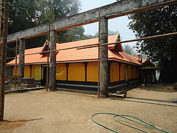
Thrissur, formerly Trichur, also known by its historical name Thrissivaperur, is a city and the headquarters of the Thrissur district in Kerala, India. It is the third largest urban agglomeration in Kerala after Kochi and Kozhikode, and the 21st largest in India. The city is built around a 65-acre (26 ha) hillock called the Thekkinkaadu Maidaanam which seats a large Hindu Shiva Temple. It is located central of the state, and 304 kilometres (189 mi) north-west of the state's capital city, Thiruvananthapuram. Thrissur was once the capital of the Kingdom of Cochin, and was a point of contact for the Assyrians, Greeks, Persians, Arabs, Romans, Portuguese, Dutch and English.

Guruvayur is a municipal temple town in Thrissur District, of Kerala State in India. It is a suburban town of Thrissur city, located 27 kilometres (17 mi) from Thrissur towards the north-west. It houses the Guruvayur Shri Krishna Temple. It is located at a distance of 292 km (181 mi) from the state capital Trivandrum towards the north-west, 80 km (50 mi) from Kochi towards the north, 90 km (56 mi) from Calicut towards south.

Shornur is a town and a municipality located in the Palakkad district, in the Indian state of Kerala, located on the banks of the Bharathapuzha River. The town covers an area of 32.28 km2.

Ottapalam, is a town, taluk and municipality in the Palakkad District, Kerala, India. It is the administrative headquarters of the Ottapalam taluk. Ottapalam is located about 36 km from district headquarters Palakkad. Ottapalam is located along the banks of Bharathapuzha, second longest river of the state.

Walayar is a border town, located in the eastern corner of Palakkad district in Kerala, India.

Pattambi is a town taluk and municipality in the Palakkad district of the state of Kerala, India. It is also the administrative headquarters of the Pattambi Taluk. Pattambi is located along the banks of Bharathappuzha river. A Mini Civil Station also functions here to provide government related services.

Palakkad, formerly known as Palghat, historically known as Palakkattussery is a city and municipality in the Indian state of Kerala. It is the administrative headquarters of the Palakkad District. Palakkad is most densely populated municipality and fourth-most densely populated city in Kerala. It was established before Indian independence under British rule and known by the name Palghat. Palakkad is famous for the ancient Palakkad Fort, which is in the heart of the city and was captured and rebuilt by Hyder Ali in 1766. The city is about 347 kilometres (216 mi) northeast of the state capital, Thiruvananthapuram.

Thrissur, is one of the 14 districts in the Indian state of Kerala. It is situated in the central part the state. Spanning an area of about 3,032 km2 (1,171 sq mi), Thrissur district is home to over 9% of Kerala's population.
Pollachi is a town and a taluk headquarters in Coimbatore district, Tamil Nadu state, India. Located about 40 km (25 mi) to the south of Coimbatore, it is the second largest town in the district after Coimbatore. Pollachi is a popular Marketplace for jaggery, vegetables and cattle. As of 2011, the town had a population of 90,180.

Bhagavatī, is a Hindu epithet of Sanskrit origin, used as an honorific title for female deities in Hinduism. It is primarily used to address one of the Tridevi: Saraswati, Lakshmi, and Parvati.

The Syro-Malabar Catholic Archeparchy of Trichur-Palayoor, in Thrissur District of Central Kerala, India, with nearly half a million Syro-Malabar Catholics now, used to be the largest Catholic diocese in India when it included the Syro-Malabar Catholic Diocese of Irinjalakuda until 1978 and Syro-Malabar Catholic Eparchy of Palghat until 1973. Syro-Malabar Catholic Diocese of Irinjalakuda, also located in Thrissur District, has over a quarter million Syro-Malabar Catholics now. Syro-Malabar Catholic Diocese of Palghat in Central Kerala extends to some regions in the neighbouring state of Tamil Nadu. In 2010, the parts of Tamil Nadu under the Syro-Malabar Catholic Diocese of Palghat were separated to form another Syro-Malabar Catholic Diocese of Ramanathapuram.

Kerala, a state in Southern India, has a network of 11 National Highways, 72 State Highways and many district roads.

Wadakkancherry is a major town in Thrissur, Kerala. Up until 1860, this area was part of Chelakkara Taluk. Now, it is the headquarters of Talappilly Taluk.
Pathirippala is a town in Palakkad district, Kerala, India, between Ottappalam and Palakkad on the Palakkad–Ponnani state highway SH 23.
Ramavarmapuram is the northern suburb of Thrissur City in Kerala. This suburban area is home to several governmental and other institutions of national importance. The largest menhir type megalithic monument in granite in Kerala is found here. A local catholic church has recently been adorned with mural paintings in the traditional Kerala style. This is the first instance of such a church decoration in Kerala in modern times.

Shoranur Junction is the railway station located at Shoranur, Palakkad District, Kerala. It comes under the Palakkad Railway Division of the Southern Railway. It is the largest railway station in the state of Kerala in terms of area. It is an important junction because it is the point at which the line from Chennai via Jolarpettai, Erode and Palakkad meets the coastal line from Mangalore to Kanyakumari. Further, Shoranur junction is the node from which a separate Branch line goes to the town of Nilambur, about 66 km to the north. The Nilambur–Shoranur line, which connects two tiny hill-towns, is one of the most picturesque in India.

.
State Highway 22 is a State Highway in Kerala, India that starts in Kodungallur and ends at State Highway 23. The highway is 70.5 km long.

National Highway 544, commonly referred to as NH 544, is a 340-kilometre-long (210 mi) National Highway in South India connecting Salem city in Tamil Nadu to the city of Kochi in Kerala. It is also called the Salem-Kochi Highway. The highway runs through the states of Kerala and Tamil Nadu, connecting various important cities and towns such as Salem, Erode, Coimbatore, Palakkad, Thrissur and Kochi. It is a spur of National Highway 44, which forms the North South Corridor of the National Highway network of India.It passes south of Coimbatore. NH544 is the only highway in kerala which is fully 4lane including kuthiran Road Tunnel. It was formerly designated National Highway 47.

Kuthiran Tunnel is a twin-tube six-lane highway tunnel in the South Indian state of Kerala. The tunnel is located on the National Highway 544 and it is owned and operated by the National Highways Authority of India. This is Kerala's first-ever tunnel for road transport and South India's longest six-lane road tunnel. Construction of the tunnel started in 2016 and completed by December 2021.