
The Chindwin River, also known as the Ningthi River, is a river flowing entirely in Myanmar, and the largest tributary of the country's main river, the Ayeyarwady. Its official name is also spelled Chindwinn.

Kalewa is a town at the confluence of the Chindwin River and the Myittha River in Kale District, Sagaing Region of north-western Myanmar. It is the administrative seat of Kalewa Township.

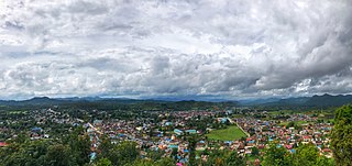
Falam Township is a township of Falam District in the Chin State of Burma (Myanmar). Its administrative seat is the town of Falam. The population, as of 2014, is 41,457. Out of this population, 9,092 live in Falam town and 32,365 live in rural areas.

Kyainseikgyi Township is a township of Kawkareik District in the Kayin State of Myanmar. It is the fourth-biggest township in Kayin State. The two main sub-towns are Kyeikdon and Payathonsu. It is drained by the Zami, Winyaw and the Haungtharaw rivers.

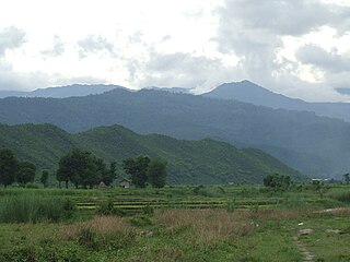
Kalay, also known as Kale, is a town in the Sagaing Region of Myanmar. It is located upstream from Mandalay and Monywa on the Myittha River, a tributary of the Chindwin River. The town is the district headquarters of the Kalay District. It has gained importance with trans border movement enabled between Myanmar and India following the 165 kilometres (103 mi) Tamu–Kalay section of India–Myanmar–Thailand Trilateral Highway built by the Border Roads Organization of India under the Look-East Connectivity policy. Consequently, Kalay is now one of the fastest developing towns in Myanmar.

Myitnge River (Burmese: မြစ်ငယ် or Nam Tu, also known as Dokhtawaddy River, is a major tributary of Ayeyarwady River in Myanmar. The name Myitnge in Burmese and Dokhtawaddy in Pali both mean "little river", by contrast with the Ayeyarwady or "big river".

Mingin Township is a township of Kale District in Sagaing Division of Burma (Myanmar). The principal town and administrative seat is Mingin (Minking).
Mawlaik District is a district in central Sagaing Division of Burma (Myanmar). Its administrative center is the town of Mawlaik.
Kale District is the westernmost district in Sagaing Division of Myanmar (Burma).

Kalewa Township is a township of Kale District in Sagaing Division of Burma (Myanmar). The principal town and administrative seat is Kalewa. The Paluzawa coal mines are located in Kalewa township.
Kale Township is a township in Kale District in the Sagaing Division of Burma (Myanmar). The principal town is Kalay.
Myittha is a village in Kalewa Township, Kale District, in the Sagaing Region of western Burma.
Kutkai is a town and seat of Kutkai Township, in the Shan State of eastern-central Burma. It lies along National Highway 3, approximately 24 kilometres to the north of Lashio.
Yazagyo is the northernmost village in Kale Township, Kale District, of western Burma (Myanmar).
Neyinzaya River is a river in Chin State and Sagaing Region of Burma (Myanmar). It is a tributary of the Myittha River, enterring it from the left (west) just south of Kalemyo.
Siyin is a village in Kale Township, Kale District, in the Sagaing Region of western Burma. It is located about 10 kilometres (6.2 mi) west of Kalemyo on the Kalemyo – Theizang road. It lies at the mouth of the Siyin Valley where it debouches into the Kale Valley.
The Imphal River, also known as the Turel Achouba, is a major river in Manipur state, northeastern India which originates from the northern side of Kangpokpi district. It is a tributary of the Manipur River, joining it in Thoubal district. It flows past Loktak Lake and the city of Imphal and joins the Lilong River, some 10 kilometres (6.2 mi) to the south. It flows towards Myanmar (Burma), marking the end point at 23°59'49.2"N 93°44'29.7"E. It then goes south meeting Myittha River at 22°53'24.19"N, 94° 5'1.79"E. Myittha river flows towards north and meets Chindwin River at 23°11'36.82"N, 94°18'38.28"E. Chindwin river then meets Irrawaddy River at 21°25'23.85"N, 95°16'47.56"E. Irrawaddy river then flows south till it ends at Andaman Sea, adjoining the Bay of Bengal and thereby connecting Imphal city to the sea. Imphal River was used by Japanese soldiers in boats to reach Imphal in World War II.

The Kaladan Road Project is a US$484 million project connecting the eastern Indian seaport of Kolkata with Sittwe seaport in Rakhine State, Myanmar by sea. In Myanmar, it will then link Sittwe seaport to Paletwa in Chin State via the Kaladan river boat route, and then from Paletwa by road to Mizoram state in Northeast India. All components of the project, including Sittwe port and power, river dredging, Paletwa jetty, have been completed, except the under construction Zorinpui-Paletwa road. Originally, the project was scheduled to be completed by 2014, but end-to-end project is expected to be fully operational only by March 2023 as per March 2021 update.
The Bairabi–Sairang line is a 51 kilometres (32 mi) long railway line from Bairabi to Sairang under the Northeast Frontier Railway zone of Indian Railways.

Tagundaing or Ta Khun Taing is a large village in the Kayin State of south-eastern Myanmar, located near the west bank of the Winyaw River and the west of the Kyain Seikgyi Township, Kawkareik District. The population as of the 2014 census was 4,994. Most of the residents are of the Karen (Kayin) ethnic group.

