La Chimba Airport

Last updated
La Chimba Airport
Summary
Airport typeClosed
Serves Antofagasta, Chile
Elevation  AMSL 120 ft / 37 m
Coordinates 23°33′13″S70°23′46″W / 23.55361°S 70.39611°W / -23.55361; -70.39611 (La Chimba Airport (Antofagasta)) Coordinates: 23°33′13″S70°23′46″W / 23.55361°S 70.39611°W / -23.55361; -70.39611 (La Chimba Airport (Antofagasta))
Map
Chile location map.svg
Airplane silhouette.svg
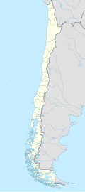
SCMB
Location of La Chimba Airport in Chile
Runways
Direction LengthSurface
ftm
Closed
Source: Google Maps [1] OurAirports [2]

La Chimba Airport (Spanish : Aeropuerto La Chimba, ( ICAO : SCMB)) was an airport serving Antofagasta, capital of the Antofagasta Region of Chile.

Contents

Google Earth Historical Imagery (10/19/2002) shows the runway marked closed and criss-crossed by new streets. Subsequent imagery show the land filled by a housing project.

See also

Related Research Articles

<span class="mw-page-title-main">Andrés Sabella Gálvez International Airport</span> Airport

Andrés Sabella Gálvez International Airport is an airport serving Antofagasta, capital of the Antofagasta Region of Chile. It is 10 kilometres (6.2 mi) north of Antofagasta and 3 kilometres (1.9 mi) inland from the Pacific coastline.

San Alfonso Airport was a rural airstrip 14 kilometres (8.7 mi) west of Alhué, a town in the Santiago Metropolitan Region of Chile.

Rucamelen Airport Spanish: Aeropuerto de Rucamelen, was a rural airstrip 14 kilometres (8.7 mi) east of Bulnes, a town in the Bío Bío Region of Chile.

Chépica Airport was an airstrip 4 kilometres (2.5 mi) west of Chépica, a town in the O'Higgins Region of Chile.

La Vertiente Airport Spanish: Aeropuerto de La Vertiente, was a public use airport located near Chillán, Bío Bío, Chile.

Aguas Blancas Airport (Spanish: Aeropuerto Aguas Blancas, is an airport serving the Aguas Blancas iodine mine in the Antofagasta Region of Chile.

María Elena Airport was an airstrip 7 kilometres (4 mi) northwest of María Elena, a mining town in the Antofagasta Region of Chile.

Carolina Airport, is an airport located 2 kilometres (1.2 mi) north of Michilla (es), a town in the Antofagasta Region of Chile. The airport is on the Pacific coast and serves the ore processing facility of the Michilla copper mine.

Alempue Airport was an airport serving Teno, a city in the Maule Region of Chile.

Mulchén Poco A Poco Airport, was an airstrip serving Mulchén, in the Bío Bío Region of Chile.

Ollagüe Airport is an extremely high elevation airport in the Chilean altiplano. It is 1 kilometre (0.6 mi) east of Ollagüe, a railroad and industrial town in the Antofagasta Region of Chile. Ollagüe is 2.5 kilometres (1.6 mi) southwest of Chile's border with Bolivia.

Papageno Airport, was an airstrip 1 kilometre (0.6 mi) west of Calafquén Lake. Panguipulli, a city in the Los Ríos Region of Chile, is 11 kilometres (6.8 mi) to the south.

Panimávida Airport was an airstrip 1 kilometre (0.6 mi) east of Panimávida, a town in the Maule Region of Chile.

Pedro de Valdivia Airport, is an airport serving María Elena, a saltpeter mining facility in the Antofagasta Region of Chile.

El Salar Airport is a high elevation airport serving the mineral salt mining operations on the Salar de Atacama salt flat, in the Antofagasta Region of Chile.

Minsal Airport is a high elevation airport serving the mineral salt mining operations on the Salar de Atacama salt flat, in the Antofagasta Region of Chile.

<span class="mw-page-title-main">San Pedro de Atacama Airport</span> Airport

San Pedro de Atacama Airport is a high elevation airport serving San Pedro de Atacama, a town in the Antofagasta Region of Chile. The airport is 3 kilometres (1.9 mi) east of the town.

Las Breas Airport is an airport 20 kilometres (12 mi) south-southeast of Taltal, a Pacific coastal town in the Antofagasta Region of Chile.

Uni Frutti Airport is an airstrip 12 kilometres (7.5 mi) northeast of Teno, a town in the Maule Region of Chile.

Barriles Airport Spanish: Aeropuerto Barriles is an airport 15 kilometres (9.3 mi) east-southeast of Tocopilla, a Pacific coastal town in the Antofagasta Region of Chile.

References

  1. Google (2013-09-03). "location of La Chimba Airport" (Map). Google Maps . Google. Retrieved 2013-09-03.
  2. OurAirports - La Chimba