Chacalluta International Airport is an airport serving the city of Arica, capital of the Arica Province in the northern Arica y Parinacota Region of Chile. It is 18.5 kilometres (11.5 mi) northwest of the city and 1 kilometre (0.62 mi) south of the border with Peru, adjacent to the village of Villa Frontera.
Balmaceda Airport is an airport next to the village of Balmaceda, serving the Aysén Region of Chile. The airport is 4 kilometres (2.5 mi) west of the Argentina border, it is located 55 km south-east of Coyhaique, the regional capital.
Ricardo García Posada Airport, formerly El Salvador Bajo Airport, is an airport serving the copper mining community of El Salvador, in the Atacama Region of Chile.
Gamboa Airport is an airport serving Castro, a city on Chiloé Island in the Los Lagos Region of Chile.
Las Heras Airport is a public use airport serving Las Heras, a town in the oil and gas production region of Santa Cruz Province in Argentina. The airport is at the west edge of the town.
Alto Palena Airport is an airport serving Palena, a small town in the mountains of the Los Lagos Region of Chile. Palena is 5 kilometres (3.1 mi) from the Argentina border. The airport is just north of the town, and south of a bend in the Palena River.
La Chimba Airport was an airport serving Antofagasta, capital of the Antofagasta Region of Chile.
Franco Bianco Airport is an airport 5 kilometres (3.1 mi) northwest of Cerro Sombrero, a petroleum production town in the Magallanes Region of Chile. Cerro Sombrero is near the eastern entrance to the Strait of Magellan.
La Vertiente Airport Spanish: Aeropuerto de La Vertiente, was a public use airport located near Chillán, Bío Bío, Chile.

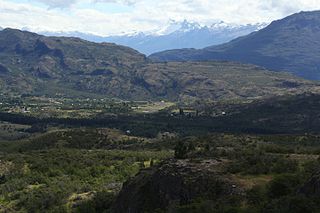
Cochrane Airport Spanish: Aeródromo Cochrane, is an airport serving Cochrane, a town in the Aysén Region of Chile. The airport is just northwest of the town, at the foot of Cerro Tamanguito (sv).
Teniente Vidal Airport is an airport serving Coyhaique, capital of the Aysén Region of Chile. The airport is 3 kilometres (1.9 mi) southwest of Coyhaique.
General Freire Airport is an airport serving Curicó, a city in the Maule Region of Chile. The airport is within the northeast part of the city.
Frutillar Airport is an airport serving Frutillar, a town at the western end of Llanquihue Lake in the Los Lagos Region of Chile.
Futaleufú Airfield is an airport serving Futaleufú, a town in the Los Lagos Region of Chile.
La Laguna Airport, is an airstrip 6 kilometres (3.7 mi) northwest of Marchigüe, a town in the O'Higgins Region of Chile.
El Tuqui Airport, is an airport serving Ovalle, a city in the Coquimbo Region of Chile.
Cabo Juan Román Airport is an airport serving Puerto Aysén, a city at the head of the Aysén Fjord in the Aysén Region of Chile.

Teniente Julio Gallardo Airport, is an airport serving Puerto Natales, a city in the Magallanes Region of Chile. The airport is 7 kilometres (4.3 mi) north-northwest of Puerto Natales, which is on the Admiral Montt Gulf (es), a long fjord that reaches inland close to the border with Argentina. The airport is 12 kilometres (7.5 mi) from the border.
De la Independencia Aerodrome is an airport serving Rancagua, a city in the O'Higgins Region of Chile.
Las Breas Airport is an airport 20 kilometres (12 mi) south-southeast of Taltal, a Pacific coastal town in the Antofagasta Region of Chile.


