Formentera is the smallest and more southerly island of the Pityusic Islands group, which belongs to the Balearic Islands autonomous community (Spain). It covers an area of 83.22 square kilometres (32.13 sq mi) and had a population of 10,582 at the Census of 1 November 2011; the latest official estimate was 12,111.

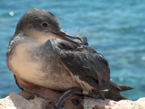
The Balearic shearwater is a medium-sized shearwater in the seabird family Procellariidae. Puffinus is a New Latin loanword based on the English "puffin" and its variants, that referred to the cured carcass of the fat nestling of the Manx shearwater, a former delicacy. The specific mauretanicus refers to Mauretania, an old name for an area of North Africa roughly corresponding to Morocco and Algeria.

The yelkouan shearwater, Levantine shearwater or Mediterranean shearwater is a medium-sized shearwater in the seabird family Procellariidae.

The Snares Islands/Tini Heke, also known as The Snares, is a small group of uninhabited islands lying about 200 km south of New Zealand's South Island and to the south-southwest of Stewart Island. The Snares consist of the main North East Island and the smaller Broughton Island as well as the Western Chain Islands some 5 km (3.1 mi) to the west-southwest. Collectively, the Snares have a total land area of 3.5 km2 (1.4 sq mi).

Rapa, sometimes called Rapa Iti, or "Little Rapa," to distinguish it from Rapa Nui, or Big Rapa, is the largest and only inhabited island of the Bass Islands in French Polynesia. An older name for the island is Oparo. The total land area including offshore islets is 40.5 km2 (15.6 sq mi). As of the 2017 census, Rapa had a population of 507. The island's highest point is at 650 metres (2,130 ft) elevation at Mont Perahu. Its main town is Ahuréi. The inhabitants of Rapa Iti speak their own Polynesian language called the Rapa language.

The Balearic Sea is a body of water in the Mediterranean Sea near the Balearic Islands. The Ebro River flows into this small sea.

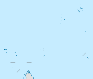
Cousin Island is a small granitic island of the Seychelles, lying 2 km (1.2 mi) west of Praslin. It is a nature reserve protected under Seychelles law as a Special Reserve. It is managed by Nature Seychelles, a national nonprofit organization and Partner of BirdLife International, by which it has been identified as an Important Bird Area.

Zembra is a Tunisian island. The island is a 432 metres tall rock formation, and as such contains many 400 metre-high cliffs. It has an area of 369 hectares. Located 15 kilometres from El Haouaria and 50 kilometres from the port of La Goulette, it is a natural extension of the peninsula of Cap Bon. Zembra is a natural fortress that housed a resort until 1976 and then passed into the hands of the Tunisian army. On the southern coast there are remains of an ancient harbour.

Gwennap Head is a headland on the south coast of the Penwith peninsula, Cornwall, United Kingdom. It is within the parish of St Levan and approximately 4 miles (6.4 km) south of Land's End, and less than 1 mile (1.6 km) north-west of Porthgwarra, the nearest village. The area of Gwennap Head is designated as part of the Penwith Heritage Coast and also designated as part of the Cornwall Area of Outstanding Natural Beauty. The South West Coast Path closely follows the coastline around the headland.

The Investigator Group is an archipelago in South Australia that consists of Flinders Island and five island groups located off the western coast of the Eyre Peninsula. It is named after HMS Investigator by her commander, Matthew Flinders when he explored the area in 1802. The Group lies within the Great Australian Bight. All the islands except Flinders Island, and a part of Pearson Island, are within the Investigator Group Wilderness Protection Area and the Waldegrave Islands Conservation Park.

The Tasman Island, part of the Tasman Island Group, is an oval island with an area of 1.2 square kilometres (0.46 sq mi), lying close to the south-eastern coast of Tasmania, Australia. The island is located in the Tasman Sea, situated off the Tasman Peninsula and is contained within the Tasman National Park.

The Balearic Islands are a Spanish archipelago in the Balearic Sea, near the eastern coast of the Iberian Peninsula.

The Cierva Point and offshore islands Important Bird Area is a 6540 ha tract of land and sea on the Danco Coast of the Antarctic Peninsula.

The il-Kullana to tal-Ġifen Cliffs Important Bird Area comprises a 47 ha linear strip of cliffed coastline on the southern coast of the main island of Malta, in the Mediterranean Sea. The cliffs lie within the limits of Rabat, Dingli and Siġġiewi, and include the Dingli Cliffs. The steep and rugged cliffs rise from sea level to a height of over 100 m. It was identified as an Important Bird Area (IBA) by BirdLife International because it supports 500–1000 breeding pairs of Cory's shearwaters and 100–200 pairs of yelkouan shearwaters.

Rivière des Remparts – Rivière Langevin Important Bird Area (IBA) is a 7000 ha tract of land on the island of Réunion, a French territory in the western Indian Ocean.

The Persian shearwater is a seabird in the family Procellariidae formerly lumped in with Audubon's shearwater.

Scopoli's shearwater is a bird in the family Procellariidae. It has no subspecies. The genus name Calonectris comes from Ancient Greek kalos, "good" and nectris, "swimmer". The specific diomedea refers to Diomedes, the mythical king. His wife was serially unfaithful while he fought at Troy, so he left to found a city in Italy. After his death, his distraught friends were turned into white seabirds. The English name is for Italian naturalist Giovanni Antonio Scopoli who first described the species.

The Summerland Peninsula is located at the western end of Phillip Island in Victoria, Australia. The peninsula lies within the Gippsland Plain Bioregion and is a site of high conservation significance.

Formentera is one of the four constituencies represented in the Parliament of the Balearic Islands, the regional legislature of the Autonomous Community of the Balearic Islands. The constituency currently elects one deputy using plurality voting. Its boundaries correspond to those of the island of Formentera.

Cape Barbaria, or Cap de Barbaria, is a cape that marks the south-western end of the island of Formentera in the Balearic Islands of Spain in the western Mediterranean Sea. The natural vegetation of the cape includes shrubland and small patches of Pinus halepensis and Juniperus phoenicea forest. Human uses of the cape include hunting and agriculture.


