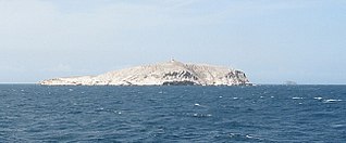
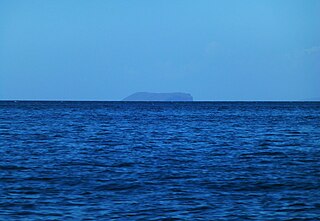
La Orchila

Last updated

La Orchila
La orchila.JPG
La Orchila
Venezuela location map (+claimed).svg
Red pog.svg
La Orchila
Geography
Location Caribbean Sea
Coordinates 11°48′N66°10′W / 11.800°N 66.167°W / 11.800; -66.167
Area43 km2 (17 sq mi)
Highest elevation139 m (456 ft)
Highest pointCerro Walker
Administration
Federal dependencies of Venezuela
Miranda Insular Territory

La Orchila is an island and a military base off the coast of Venezuela, north of Caracas. It has numerous beaches, including one where the sand is markedly pink (Arena Rosada). [1] [2] [3]

Contents

There is a presidential retreat on this island, and the residential complex reserved for the military houses consists mainly of elevated houses made of wooden logs. There is also a court for bolas criollas. All the facilities are connected by pathways, mostly unpaved but smooth and clean.[ citation needed ]

History

The Spanish explorer Alonso de Santa Cruz described the island, calling it Orchilla, in the first half of the 16th century:

...to the east of this island [Tortuga] for eight leagues is another joy, Orchilla, eight leagues long and seven wide, with two islands to the south of it; this name was given because there is a lot of Orchilla, of which we speak long in the islands of Canaria General Islario...

In 1589 by order of the Spanish governor Diego de Osorio [4] La Orchila and other islands like Los Roques were formally taken over by the Spanish Crown. At the end of the 16th century the islands were considered part of the Province of Venezuela.

The author M.D. Teenstra wrote in 1836 (in his book The Dutch West Indies):

The government of Curaçao also includes the uninhabited islets and rocks Little Curaçao, Aves, Roques and Orchilla." He goes on to say that "Orchilla, although we consider it to belong to Curaçao, is of too little importance to justify any dispute with Spain which claims this island as well. The Republic of Venezuela also considers it theirs and their coastal guard often chases away the fishermen from Curaçao who go there to collect shell fish, fire wood, grass and hay, turtles, and birds' eggs or burn lime.

Around the year 1870 the American company Philadelphia Guano Company was established in this group of islands, dedicated to the exploitation and exportation of guano, arriving to install a factory that would be abandoned over the years.

On August 22, 1871, it became part of the Colon Territory, an administrative division created under the government of General Antonio Guzmán Blanco, which was later dissolved. [5]

In 1938, along with other islands, it became part of the Federal Dependencies created by law that same year. Until the 1950s it was populated by some 121 inhabitants, who were evicted during the government of General Marcos Pérez Jiménez [6] (1952–58). Under his regime, some military installations and about thirty small houses were built, among them a presidential residence, designed by Julio Barreiro Rivas and which would be frequented by the governor and his close associates. Many of the successive Venezuelan presidents also used it as a summer residence, among them the former social democrat president Carlos Andrés Pérez (1974–79 and 1989–93).

In 1978 [7] Venezuela and the Kingdom of the Netherlands established the marine limits between the Federal Dependencies and the Dutch Antilles in the Caribbean Sea. Venezuelan President Hugo Chávez was imprisoned on the island during the April 2002 coup.

On March 14, 2009, Russian Air Force Major General Anatolii Zhikharev, head of the Russian Air Force's Long-Range Aviation, reported that Venezuela has offered Russia the use of the Antonio Diaz Naval Air Station on the island to base its strategic bombers. [8] Chavez however denied this, which Kremlin official Alexei Pavlov prompted to say that the military just spoke about 'technical possibilities'. [9]

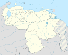
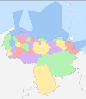
In October 2011 the Orchila and its adjacent islands are integrated to the Francisco de Miranda Island Territory, a subdivision of the Federal Dependencies with capital in Los Roques. [10]

In 2018, the Russian military released a plan to deploy supersonic Tupolev Tu-160 strategic bombers to the island. According to Colonel Eduard Rodyukov, a Corresponding Member of the Academy of Military Sciences, in turn, told Nezavisimaya Gazeta that "the arrival of Russia’s Tu-160 strategic bombers to Central America is kind of a signal to Trump to make him realize that abandoning nuclear disarmament treaties will have a boomerang effect." [11]

See also

Related Research Articles

Isla de Aves Venezuelan uninhabited islet in the eastern Caribbean Sea

Isla de Aves, or Aves Island, is a Federal Dependency of Venezuela. It has been the subject of numerous territorial disputes between the neighboring independent islands, such as Dominica, and European mother countries of surrounding dependent islands, such as the Netherlands.

States of Venezuela Federated states of the Bolivarian Republic of Venezuela

The Bolivarian Republic of Venezuela is a federation made up of twenty-three states, a Capital District and the Federal Dependencies, which consist of many islands and islets on the Caribbean Sea. Venezuela also claims the Guayana Esequiba territory which comprises six districts in the independent nation of Guyana.

Federal Dependencies of Venezuela Dependencies

The Federal Dependencies of Venezuela encompass most of Venezuela's offshore islands in the Caribbean Sea and the Gulf of Venezuela, excluding those islands that form the State of Nueva Esparta and some Caribbean coastal islands that are integrated with nearby states. These islands, with a total area of 342 square kilometres, are sparsely populated – according to the preliminary results of the 2011 Census only 2,155 people live there permanently, with another hundred from Margarita Island who live there seasonally to engage in fishing. Local government is officially under the authority of Central government in Caracas, although de facto power is often held in the heads of the sparse and somewhat isolated communities that decorate the territories.

Index of Venezuela-related articles Wikipedia index

The following is an alphabetical list of topics related to the Bolivarian Republic of Venezuela.

Los Frailes Archipelago

The Islas Los Frailes are an archipelago of rock islets with sparse scrub vegetation belonging to the Federal dependencies of Venezuela, part of Venezuela.

William H. Phelps Jr.

William Henry Phelps Jr. was a Venezuelan ornithologist and businessman.

Los Roques Archipelago Federal dependency of Venezuela

The Los Roques Archipelago is a federal dependency of Venezuela consisting of approximately 350 islands, cays, and islets in a total area of 40.61 square kilometers. The archipelago is located 128 kilometers (80 mi) directly north of the port of La Guaira, in the Caribbean Sea.

La Tortuga Island

La Tortuga Island is an uninhabited island of Venezuela, the largest in the Federal Dependencies of Venezuela. It is part of a group of islands that include the Tortuguillos and Cayo Herradura. Isla La Tortuga has an area of 156 km2 (60 sq mi).

Leeward Antilles Island group in the Caribbean

The Leeward Antilles are a chain of islands in the Caribbean – specifically, the southerly islands of the Lesser Antilles along the southeastern fringe of the Caribbean Sea, just north of the Venezuelan coast of the South American mainland. The Leeward Antilles, while among the Lesser Antilles, are not to be confused with the Leeward Islands to the northeast.

Las Aves Archipelago

The Las Aves Archipelago is a pristine archipelago in the Caribbean Sea, and is part of the Federal Dependencies of Venezuela. It is located north of the Venezuelan states of Aragua and Carabobo, between the Dutch island Bonaire in the west, and the Los Roques Archipelago in the east, at 12°00′N67°40′W. The prime economic importance of the islands lies in fishing. "Las Aves" translates to "The Birds" in English.

The Los Hermanos Archipelago is a chain of seven rocky barren islets that is part of the Federal Dependencies of Venezuela, at 11°45′N64°25′W.

La Blanquilla Island

Blanquilla is an island, one of the Federal Dependencies of Venezuela, located in the southeastern Caribbean Sea about 293 km northeast of Caracas. It is a popular location for divers, as well as famous for its white sand beaches, for which it is named. The island's wildlife include local cacti and iguana. The island is also home to feral donkeys and goats. Its reefs are notable for their black coral, which is used for jewelry and other crafts. The island is formed by the Aves Ridge, a seafloor feature which protrudes above water to the north, forming several other islands. Has an area of 64.53 km2

Insular Region, Venezuela Geographic/Natural and Administrative Region in Nueva Esparta, Venezuela

The Insular Region is one of the eight natural regions of Venezuela and one of the 10 administrative regions in which Venezuela was divided for its development plans; it comprises all of the nation's islands, and is formed by the state of Nueva Esparta and the Federal Dependencies.

Los Monjes Archipelago

The Los Monjes islands is a federal dependency of Venezuela are located to the northwest 80 kilometres of the Gulf of Venezuela, 34.8 kilometres off the coast of Guajira Peninsula at the border between Colombia and the Venezuelan state of Zulia.

Los Testigos Islands

Los Testigos Islands are a group of islands in the southeastern Caribbean Sea. They are a part of the Dependencias Federales of Venezuela.

La Sola Island is a small island in the southeastern Caribbean Sea. The island is a part of the Dependencias Federales of Venezuela.

Patos Island (Venezuela)

Patos Island is a small uninhabited island in the northwestern Gulf of Paria. The island is a part of the Dependencias Federales of Venezuela.

Luis Britto García Venezuelan writer

Luis Britto García is a Venezuelan writer, playwright and essayist. His fiction has been recognised twice with the Casa de Las Américas Prize, for his works Rajatabla (1970) and Abrapalabra (1979). In 2002 he was the winner of Venezuela's National Prize for Literature, given as a lifetime achievement award. In 2005 he was recognized with the Ezequiel Martínez Estrada honorary award of Casa de Las Américas. In April 2012 he received Venezuela's Order of Juan Francisco de León. In May 2012 he was appointed by President Hugo Chávez to the Venezuelan Council of State, "the highest circle of advisers to the president" provided for in the Venezuelan Constitution.

Federal Territories is a special political division in the territory of Venezuela. Their existence is provided for in Article 16 of the National Constitution of 1999, with the national government in charge of administration according to law. Currently, there are no Federal Territories in the country because they were elevated to the category of State within the Venezuelan Federation.

Cayo de Agua

Cayo de Agua is the name of an island in the eastern Caribbean Sea that geographically belongs to the Los Roques Archipelago and is administratively organized as part of the Federal Dependencies, Venezuela, in addition to being part of the National Park of the same name and the Miranda Island Territory, the name of this key has its origin in the fact that it has freshwater wells within it.

References

  1. Vila, Marco Aurelio. 1967: Aspectos geográficos de las Dependencias Federales. Corporación Venezolana de Fomento. Caracas. 115p.
  2. Cervigon, Fernando. 1995: Las Dependencias Federales. Academia Nacional de la Historia. Caracas. 193p.
  3. Hernández Caballero, Serafín (Editor). 1998: Gran Enciclopedia de Venezuela. Editorial Globe, C.A. Caracas. 10 volúmenes. ISBN   980-6427-00-9 ISBN   980-6427-10-6
  4. Antczak, María Magdalena; Antczak, Andrzej T. (2006). Los ídolos de las islas prometidas: arqueología prehispánica del archipiélago de los Roques (in Spanish). Equinoccio. ISBN   978-980-237-236-2.
  5. Sic (in Spanish). Seminario Interdiocesano de Caracas. 2000.
  6. "La Orchila, por Laureano Márquez". TalCual (in Spanish). December 18, 2018. Retrieved August 27, 2020.
  7. "Boundary delimitation Treaty between the Republic of Venezuela and the Kingdom of the Netherlands (with map), 31 March 1978 (entry into force: 15 December 1978; registration #: 17901; registration date: 17 July 1979; link to UNTS)".
  8. Carl Rosenberg and Phil Gunson, "Report: Russians to land long-range bomber aircraft in Venezuela," Miami Herald, March 15, 2009.
  9. "Chavez: Russia jets welcome, but no Venezuela base". Washington Times. AP. March 15, 2009. Retrieved July 14, 2014.
  10. "Ley de Creación del Territorio Insular Francisco de Miranda – Pandectas Digital". pandectasdigital.blogspot.com. Retrieved August 27, 2020.
  11. "Press review: Russia to set up Caribbean base and meet Israeli brass to discuss Iran".

Coordinates: 11°48′N66°10′W / 11.800°N 66.167°W / 11.800; -66.167