La Rosette | |
|---|---|
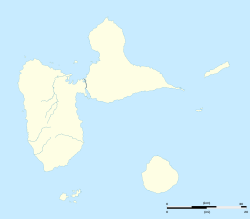 La Rosette Location of La Rosette | |
| Coordinates: 16°20′19″N61°22′42″W / 16.33861°N 61.37833°W | |
| Country | France |
| Department | Guadeloupe |
| Arrondissement | Grande-Terre |
| Commune | Le Moule |
La Rosette is a settlement in the commune of Le Moule in the French overseas department of Guadeloupe. It is located on the island of Grande-Terre in the Lesser Antilles in the Caribbean. It is the site of the Edgar Clerc Archeological Museum, which exhibits Amerindian artifacts from the pre-Columbian era collected from the region.