
The Gletscherhorn is a mountain of the Bernese Alps, located on the border between the Swiss cantons of Bern and Valais. It forms the eastern edge of the Lauterbrunnen Wall, south of the Jungfrau.

Piz Bernina is the highest mountain in the Eastern Alps, the highest point of the Bernina Range, and the highest peak in the Rhaetian Alps. It rises 4,048.6 m (13,283 ft) and is located south of Pontresina and near the major Alpine resort of St. Moritz, in the Engadin valley. It is also the most easterly mountain higher than 4,000 m (13,000 ft) in the Alps, the highest point of the Swiss canton of Graubünden, and the fifth-most prominent peak in the Alps. Although the summit lies within Switzerland, the massif is on the border with Italy. The "shoulder" known as La Spedla is the highest point in the Italian Lombardy region.

The Grand Combin is a mountain massif in the western Pennine Alps in the canton of Valais. At a height of 4,314 metres (14,154 ft) the summit of Combin de Grafeneire is one of the highest peaks in the Alps and the second most prominent of the Pennine Alps. The Grand Combin is also a large glaciated massif consisting of several summits, among which three are above 4000 metres. The highest part of the massif is wholly in Switzerland, although the border with Italy lies a few kilometres south.

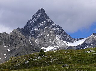
The Alps cover a large area. This article describes the delimitation of the Alps as a whole and of subdivisions of the range, follows the course of the main chain of the Alps and discusses the lakes and glaciers found in the region.

La Dôle is a mountain of the Jura, overlooking Lake Geneva in the westernmost part of the canton of Vaud. Rising to an altitude of 1677 meters, it is the second highest peak in the Swiss portion of the Jura, after Mont Tendre. Administratively, the summit is split between the municipalities of Gingins, Chéserex and La Rippe. The mountain is also close to and easily accessible from Saint-Cergue and the Col de la Givrine to the north, both above 1000 meters and connected to Nyon on Lake Geneva by road and by the Nyon–St-Cergue–Morez Railway. A paved road also climbs to the Chalet de la Dôle below the summit from Gingins.
Piz Kesch (German) or Piz d'Es-cha (Rumantsch) is a peak in the Albula Alps of the Rhaetian Alps in Switzerland. At 3,418 metres (11,214 ft), it is the highest peak in the Albula Alps and the municipality of Bergün, Grisons.
Piz Zupò is a mountain in the Bernina Range of the Alps, located on the border between Switzerland and Italy. It lies between the valleys of Morteratsch (Graubünden) and Malenco (Lombardy). Piz Zupò is the second highest peak in the range after Piz Bernina.

The Aiguille d'Argentière is a mountain in the Mont Blanc massif on the border between France and Switzerland.

Mont Ruan is a mountain in the Chablais Alps, overlooking the lake of Emosson in the Swiss canton of Valais. At 3,057 metres above sea level, its main summit is located 200 metres away from the French border, where lies a slightly lower summit.

The Dents de Bouquetins or just the Bouquetins are a multi-summited mountain of the Alps between Switzerland and Italy. They form a ridge composed of several summits above 3,600 metres, of which the highest is 3,838 metres. The Bouquetins are the highest mountain on the main watershed of the Pennine Alps west of the Dent d'Hérens.

The Giétro Glacier or Giétroz Glacier is a 4 km long valley glacier located in south-western Switzerland. The 1818 Giétro Glacier catastrophe, which led to lake outburst flood, is one of the most famous and most disastrous historical cases in the Swiss Alps.

Mont Tendre is a mountain of the Jura, located between the valley of Joux and the basin of Lake Geneva in the canton of Vaud. With an elevation of 1,679 metres above sea level, it is the highest summit of the Swiss portion of the Jura Mountains and, therefore, the highest summit of Switzerland outside the Alps. It is also the most isolated mountain of the canton. It is found in the community of Montricher.

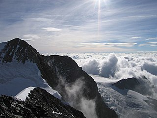
The High Alps are the parts of the Alps unsuitable for habitation or seasonal transhumance. This includes all regions higher than 3,000 m above sea level, as well as most regions between 2,500 m and 3,000 m. Alpine pastures are typically below 2,400 m but may exceptionally be located as high as 2,800 m.


