Bohemia is the westernmost and largest historical region of the Czech Republic. Bohemia can also refer to a wider area consisting of the historical Lands of the Bohemian Crown ruled by the Bohemian kings, including Moravia and Czech Silesia, in which case the smaller region is referred to as Bohemia proper as a means of distinction.

Moravia is a historical region in the east of the Czech Republic and one of three historical Czech lands, with Bohemia and Czech Silesia.
The history of the Czech lands – an area roughly corresponding to the present-day Czech Republic – starts approximately 800 years BCE. A simple chopper from that age was discovered at the Red Hill archeological site in Brno. Many different primitive cultures left their traces throughout the Stone Age, which lasted approximately until 2000 BCE. The most widely known culture present in the Czech lands during the pre-historical era is the Únětice Culture, leaving traces for about five centuries from the end of the Stone Age to the start of the Bronze Age. Celts – who came during the 5th century BCE – are the first people known by name. One of the Celtic tribes were the Boii (plural), who gave the Czech lands their first name Boiohaemum – Latin for the Land of Boii. Before the beginning of the Common Era the Celts were mostly pushed out by Germanic tribes. The most notable of those tribes were the Marcomanni and traces of their wars with the Roman Empire were left in south Moravia.

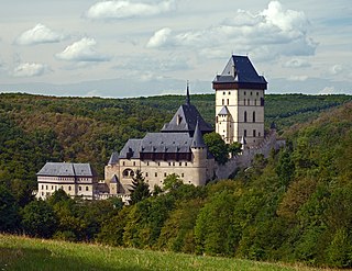
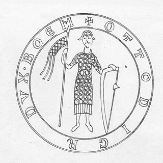
Ottokar II, the Iron and Golden King, was a member of the Přemyslid dynasty who reigned as King of Bohemia from 1253 until his death in 1278. He also held the titles of Margrave of Moravia from 1247, Duke of Austria from 1251, and Duke of Styria from 1260, as well as Duke of Carinthia and landgrave of Carniola from 1269.

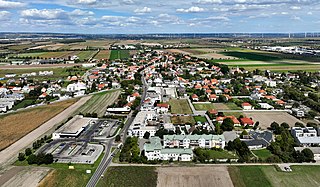
Znojmo is a town in the South Moravian Region of the Czech Republic. It has about 34,000 inhabitants. Znojmo is the historical and cultural centre of southwestern Moravia and the second most populated town in the South Moravian Region. The historic centre of Znojmo is well preserved and is protected by law as an urban monument reservation.
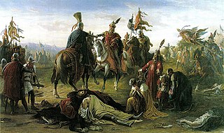
The Battle on the Marchfeld ; Polish: Bitwa pod Suchymi Krutami at Dürnkrut and Jedenspeigen took place on 26 August 1278 and was a decisive event for the history of Central Europe for the following centuries. The opponents were a Bohemian (Czech) army led by the Přemyslid king Ottokar II of Bohemia and the German army under the German king Rudolph I of Habsburg in alliance with King Ladislaus IV of Hungary. With 15,300 mounted troops, it was one of the largest cavalry battles in Central Europe during the Middle Ages. The Hungarian cavalry played a significant role in the outcome of the battle.

Břeclav is a town in the South Moravian Region of the Czech Republic. It has about 25,000 inhabitants.

The Lands of the Bohemian Crown were the states in Central Europe during the medieval and early modern periods with feudal obligations to the Bohemian kings. The crown lands primarily consisted of the Kingdom of Bohemia, an electorate of the Holy Roman Empire according to the Golden Bull of 1356, the Margraviate of Moravia, the Duchies of Silesia, and the two Lusatias, known as the Margraviate of Upper Lusatia and the Margraviate of Lower Lusatia, as well as other territories throughout its history. This agglomeration of states nominally under the rule of the Bohemian kings was referred to simply as Bohemia. They are now sometimes referred to in scholarship as the Czech lands, a direct translation of the Czech abbreviated name.
Conrad II Otto, a member of Přemyslid dynasty, was the first margrave of Moravia from 1182 to 1189 and duke of Bohemia from 1189 until his death.

Alland is a market town in the district of Baden in the Austrian state of Lower Austria.

Weitra is a small town in the district of Gmünd in the Austrian state of Lower Austria.

Hardegg is a town in the district of Hollabrunn in Lower Austria, Austria. It is situated in the Waldviertel region on the river Thaya, directly on the border with the Czech Republic. The Thaya valley is protected as the Thayatal National Park, adjacent to the Podyjí National Park on the Czech shore.
Nappersdorf-Kammersdorf is a town in the district of Hollabrunn in Lower Austria, Austria.
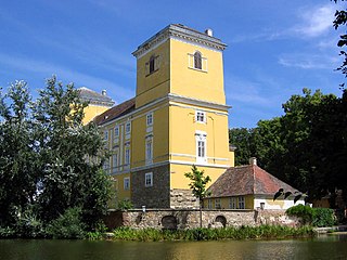
Wolkersdorf im Weinviertel is a town in the district of Mistelbach in the Austrian state of Lower Austria. It is situated in the Weinviertel, about 15 km north of Vienna, on the main road from Vienna to Brno. The municipality consists of the subdivisions Wolkersdorf, Riedenthal, Pfösing, Obersdorf and Münichsthal. It was elevated to town status in 1969.
The history of Moravia, one of the Czech lands, is diverse and characterized by many periods of foreign governance.
Gerasdorf bei Wien is a town in the district of Korneuburg in the Austrian state of Lower Austria. The city has 10,862 inhabitants.

Neighborly relations exist between Austria and the Czech Republic, two member states of the European Union. Austria gave full support to the Czech Republic's membership of the European Union. The Czech Republic is a member state of NATO, while Austria is not.

The Margraviate of Moravia was one of the Lands of the Bohemian Crown within the Holy Roman Empire and then Austria-Hungary, existing from 1182 to 1918. It was officially administered by a margrave in cooperation with a provincial diet. It was variously a de facto independent state, and also subject to the Duchy, later the Kingdom of Bohemia. It comprised the historical region called Moravia, which lies within the present-day Czech Republic.
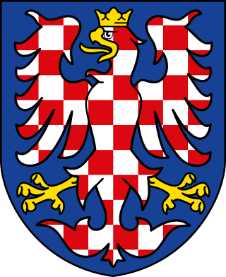
The coat of arms of Moravia has been used for centuries to represent Moravia, a traditional province in the present-day Czech Republic. The coat of arms is also present in a field of the coat of arms of the Czech Republic.

The Laaer Ostbahn is a railway line in Lower Austria. It runs 82.6 kilometres (51.3 mi) from Wien Hauptbahnhof to Laa an der Thaya, on the Czech–Austrian border. The line formerly continued to Brno. Austrian Federal Railways (ÖBB) owns and operates the line.


