
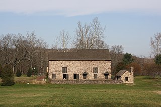
Buckingham Township is a township in Bucks County, Pennsylvania, United States. The population was 20,075 at the 2010 census. Buckingham takes its name from Buckingham in Buckinghamshire, England. Buckingham Township was once known as Greenville and was once the historic county seat of the English Bucks County.
Solebury Township is a township in Bucks County, Pennsylvania, United States. Solebury Township is located in the Philadelphia Metropolitan Area. The population was 8,709 at the 2020 census.
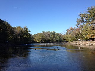
Neshaminy Creek is a 40.7-mile-long (65.5 km) stream that runs entirely through Bucks County, Pennsylvania, rising south of the borough of Chalfont, where its north and west branches join. Neshaminy Creek flows southeast toward Bristol Township and Bensalem Township to its confluence with the Delaware River.

Pennsylvania Route 263 (PA 263) is a north–south state highway located in southeast Pennsylvania. The southern terminus of the route is at PA 611 in Willow Grove, Montgomery County. The northern terminus is at the Centre Bridge–Stockton Bridge over the Delaware River in Centre Bridge, Bucks County, where the road continues into Stockton, New Jersey, as Bridge Street to an intersection with Route 29. PA 263 follows the routing of Old York Road, a historic road that connected Philadelphia to New York City, and carries the name York Road from the southern terminus to Lahaska and Upper York Road north of there. From Willow Grove to Buckingham, PA 263 runs mostly through suburban areas as a four-lane road, passing through Hatboro, Warminster, and Jamison. The route forms a concurrency with U.S. Route 202 (US 202) in Buckingham and narrows to a two-lane road, splitting with that route in Lahaska. From here, the route continues through rural areas to Centre Bridge.

Lahaska is an unincorporated community in central Bucks County, Pennsylvania, United States. It lies east of Buckingham and west of New Hope on Route 202 and Route 263. While most of it is in Buckingham Township, it also extends into Solebury Township.
Mill Creek is a tributary of Neshaminy Creek rising in Upper Southampton Township in Bucks County, Pennsylvania, United States. It is one of at least six creeks in Bucks County bearing the same name. The upper portion of Mill Creek was formerly known as Broad Axe Creek.
Pine Creek is a tributary of Mill Creek, which, in turn, is a tributary of the Neshaminy Creek, part of the Delaware River watershed.
Ironworks Creek is a tributary of Mill Creek in Northampton Township, Bucks County, Pennsylvania, part of the Neshaminy Creek, and of the Delaware River watersheds.
Mill Creek is a tributary of Neshaminy Creek, one of three tributaries of the Neshaminy which all share the same name, and one of six in Bucks County, Pennsylvania which share the name. The Geographic Name Information System I.D. is 1181118, U.S. Department of the Interior Geological Survey I.D. is 02596.
Robin Run is a dammed headwater major tributary of the Delaware River with a drainage area of 22.69 square miles that is 1.69 miles north 1.69 miles north of Mill Creek's Confluence with the Neshaminy Creek on the border of Buckingham and Wrightstown Townships), The headwaters originate in Buckingham Township, Bucks County, Pennsylvania and the stream flows generally southeast to its confluence with Mill Creek in Wrightstown Township.
Watson Creek is a tributary of Mill Creek, Bucks County, Pennsylvania., contained totally in Buckingham Township, Bucks County, Pennsylvania flows to its confluence with Lahaska Creek to form Mill Creek. The Geographic Name Information System I.D. is 1190689, U.S. Department of the Interior Geological Survey I.D. is 02626.
Pine Run is a tributary of the North Branch Neshaminy Creek, part of the Delaware River watershed. Pine Run flows entirely in Bucks County, Pennsylvania, rising in Plumstead Township, passing through Buckingham Township and New Britain Township, meeting its confluence with the North Branch in the Borough of Chalfont.

Pidcock Creek is a tributary of the Delaware River in Bucks County, Pennsylvania. Rising in Buckingham Township, it flows into the Delaware in Solebury Township after a short side trip within Upper Makefield Township.

Aquetong Creek is a tributary of the Delaware River in Solebury Township and New Hope, Bucks County, Pennsylvania. Rising from the Aquetong Spring, now known as Ingham Spring, just south of the intersection of U.S. Route 202, Lower Mountain Road, and Ingham Road, it runs about 10.75 miles (17.30 km) to its confluence with the Delaware.
Cuttalosa Creek is a tributary of the Delaware River in Bucks County, Pennsylvania.
Paunnacussing Creek is a tributary of the Delaware River contained wholly within Bucks County, Pennsylvania, in the United States. It rises from a pond north of Mechanicsville in Buckingham Township and drains into the Delaware at Bull Island just upstream of Lumberville in Solebury Township.
Core Creek is a tributary of the Neshaminy Creek in Bucks County, Pennsylvania. Rising in Lower Makefield Township, it flows in the Stockton Formation until it meets its confluence with the Neshaminy in Middletown Township. At one time it powered seven mills along its length.
Deep Run is a tributary of the Tohickon Creek in Bedminster Township, Bucks County, Pennsylvania in the United States.

Cooks Creek is a tributary of the Delaware River in Bucks County, Pennsylvania, in the United States, rising in Springfield Township and passing through Durham Township before emptying into the Pennsylvania Canal and the Delaware.
Aquetong is populated place in Solebury Township, Bucks County, Pennsylvania, United States, situated along U.S. Route 202, approximately 2.9 miles (4.7 km) west of New Hope.
