
Russia is the largest country in the world, covering over 17,125,191 km2 (6,612,073 sq mi), and encompassing more than one-eighth of Earth's inhabited land area. Russia extends across eleven time zones, and has the most borders of any country in the world, with sixteen sovereign nations.

The Yenisey is the fifth-longest river system in the world, and the largest to drain into the Arctic Ocean.

Chukotka, officially the Chukotka Autonomous Okrug, is the easternmost federal subject of Russia. It is an autonomous okrug situated in the Russian Far East, and shares a border with the Sakha Republic to the west, Magadan Oblast to the south-west, and Kamchatka Krai to the south, as well as a maritime border on the Bering Strait with the U.S. state of Alaska to the east. Anadyr is the largest town and the capital, and the easternmost settlement to have town status in Russia. It is the closest point from Russia to the United States, measuring at 88.51 kilometres or 55 miles.

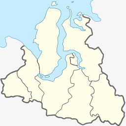
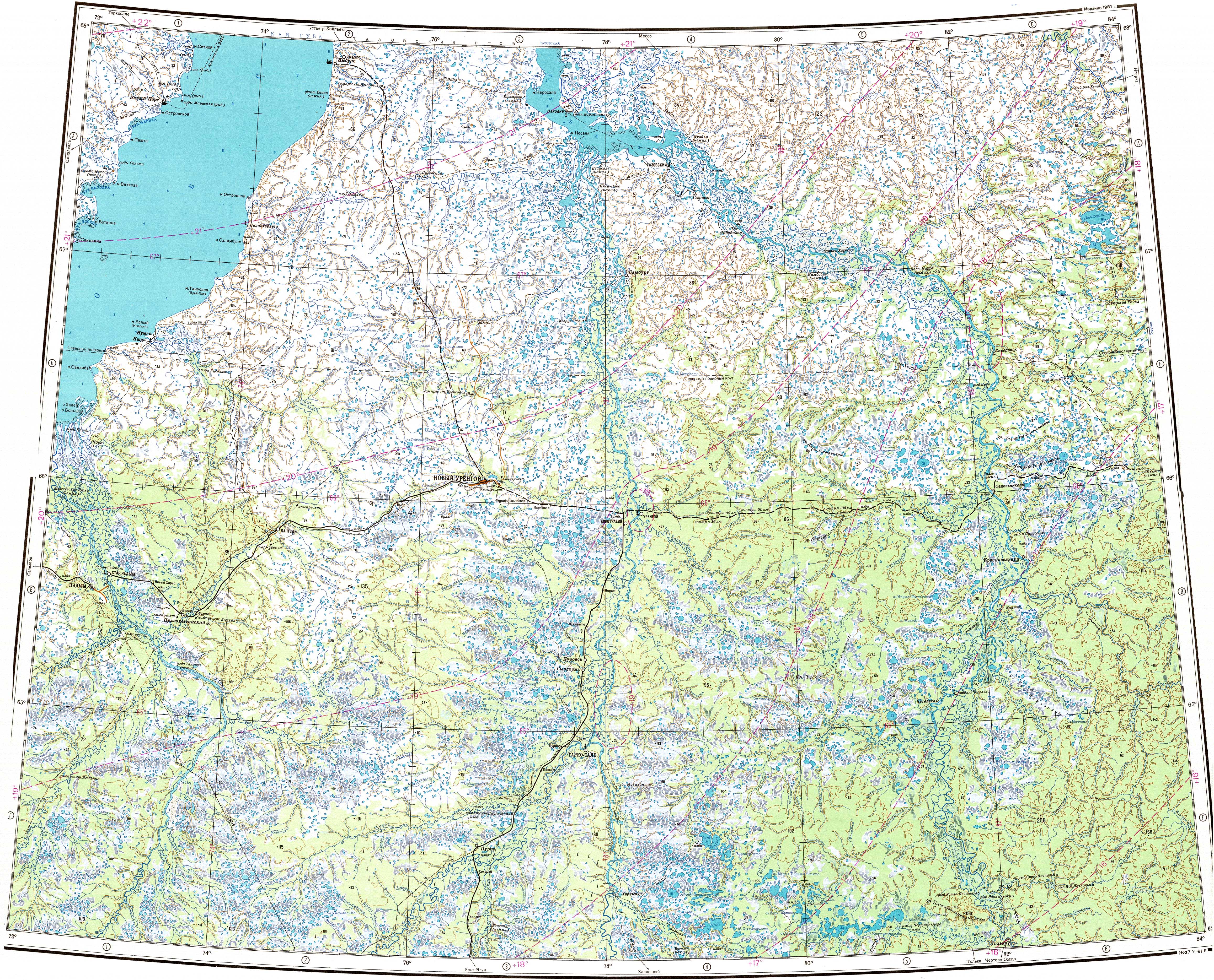
The Yamalo-Nenets Autonomous Okrug also known as Yamalia is a federal subject of Russia and an autonomous okrug of Tyumen Oblast. Its administrative center is the town of Salekhard, and its largest city is Novy Urengoy. The 2021 Russian Census recorded its population as 510,490.

Salekhard is a town and the administrative centre of Yamalo-Nenets Autonomous Okrug, Russia. The town lies on the Arctic Circle, with the town centre being about 1 kilometer (0.62 mi) south and suburbs stretching to the north of the circle. The population is 47,910 (2021 Census).

The Tatta is a river in the Sakha Republic (Yakutia), Russia, a left tributary of the Aldan, part of the Lena basin.

Chaunsky District is an administrative and municipal district (raion), one of the six in Chukotka Autonomous Okrug, Russia. It is located on the northern shore of the autonomous okrug and borders with Iultinsky District in the northeast, Anadyrsky District in the southeast, and with Bilibinsky District in the south and west. The area of the district is 67,091 square kilometers (25,904 sq mi). Its administrative center is the town of Pevek. Population: 5,148 (2010 Census); 6,962 (2002 Census); 32,167 (1989 Soviet census). The population of Pevek accounts for 80.8% of the district's total population.
Anadyrsky District is an administrative and municipal district (raion), one of the six in Chukotka Autonomous Okrug, Russia. It is located in the central and southern parts of the autonomous okrug and borders with Chaunsky District in the northwest, Iultinsky District in the north and northeast, the Gulf of Anadyr in the east, Koryak Okrug in the south, and with Bilibinsky District in the west and northwest. It also completely surrounds the territory of the town of okrug significance of Anadyr. The area of the district is 287,900 square kilometers (111,200 sq mi). Its administrative center is the town of Anadyr. Population: 8,161 (2021 Census); 6,935 (2010 Census); 8,007 (2002 Census); 40,475 (1989 Soviet census).
Providensky District is an administrative and municipal district (raion), one of the six in Chukotka Autonomous Okrug, Russia. It is located in the northeast of the autonomous okrug, in the southern half of the Chukchi Peninsula with a northwest extension reaching almost to the Kolyuchinskaya Bay on the Arctic. It borders with Chukotsky District in the north, the Bering Sea in the east and south, and with Iultinsky District in the west. The area of the district is 26,800 square kilometers (10,300 sq mi). Its administrative center is the urban locality of Provideniya. Population: 3,923 (2010 Census); 4,660 (2002 Census); 9,778 (1989 Soviet census). The population of Provideniya accounts for 50.2% of the district's total population.

Shmidtovsky District was an administrative district (raion) of Chukotka Autonomous Okrug, Russia, which existed in 1973–2011. As a municipal division, it was, together with Iultinsky Administrative District, incorporated as Iultinsky Municipal District. It was located in the far north of the autonomous okrug and bordered with Iultinsky District in the east, Anadyrsky District in the south, and with Chaunsky District in the west. The area of the district was 70,900 square kilometers (27,400 sq mi). Its administrative center was the urban locality of Mys Shmidta. Population: 1,469 (2010 Census); 2,660 (2002 Census); 15,726 (1989 Soviet census). The population of Mys Shmidta accounted for 33.5% of the district's total population.

Zapolyarny District is an administrative and municipal district (raion), the only one in Nenets Autonomous Okrug, Russia. It encompasses all of the territory of the autonomous okrug, with the exception of the territory of the town of okrug significance of Naryan-Mar, the only other top-level administrative division of the autonomous okrug. The area of the district is approximately 170,000 square kilometers (66,000 sq mi). Its administrative center is the urban locality of Iskateley. Population: 20,432. The population of Iskateley accounts for 33.7% of the district's total population.
Krasnoselkupsky District is an administrative and municipal district (raion), one of the seven in Yamalo-Nenets Autonomous Okrug of Tyumen Oblast, Russia. It is located in the southeast of the autonomous okrug. The area of the district is 106,270 square kilometers (41,030 sq mi). Its administrative center is the rural locality of Krasnoselkup. Population: 6,204 ; 6,384 (2002 Census); 7,940 (1989 Soviet census). The population of Krasnoselkup accounts for 64.1% of the district's total population.
Lake Varsh is a freshwater lake, shared by Mezensky District of Arkhangelsk Oblast and the Nenets Autonomous Okrug in Russia, just below the Arctic Circle. It is one of the biggest lakes in Arkhangelsk Oblast and the biggest one in Mezensky District. The area of the lake is 44.2 square kilometres (17.1 sq mi), and the area of its basin is 428 square kilometres (165 sq mi).
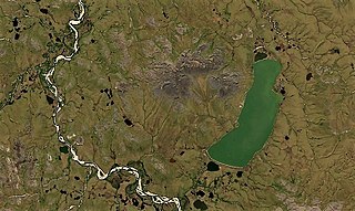
Lake Ioni, also known as Yonai, is a large freshwater lake in Chukotsky District, Chukotka Autonomous Okrug, Russia. It has an area of 27.8 km2 (10.7 sq mi). Currently there are no permanent settlements on the shores of the lake, but there are remains of Stone Age dwellings. Reindeer herders occasionally visit the area, as well as fishermen. The nearest inhabited place is Lorino, located 102 km (63 mi) away.

The Peleduy is a river in Yakutia, Russia. It is the 22nd longest tributary of the Lena with a length of 398 kilometres (247 mi) and a drainage basin area of 14,300 square kilometres (5,500 sq mi).

Neito is a freshwater lake group in Yamalo-Nenets Autonomous Okrug, Russia.

The Tolka is a river in the Yamalo-Nenets Autonomous Okrug, Russia. It has a length of 391 kilometres (243 mi) and a drainage basin area of 13,300 square kilometres (5,100 sq mi).

The Synya is a river in Yamalo-Nenets Autonomous Okrug, Russia. The river is 217 kilometres (135 mi) long —304 km (189 mi) from the source of the Mokraya Synya at its head— and has a catchment area of 13,500 square kilometres (5,200 sq mi).

Achchyon, is a lake in Providensky District, Chukotka Autonomous Okrug, Russian Federation.
