Lake Murray of Richland, South Carolina

Last updated

Lake Murray of Richland
Richland County South Carolina incorporated and unincorporated areas Lake Murray of Richland highlighted.svg
Location in Richland County and the state of South Carolina.
Coordinates: 34°7′20″N81°15′44″W / 34.12222°N 81.26222°W / 34.12222; -81.26222
Country United States
State South Carolina
County Richland
Area
[1]
  Total8.67 sq mi (22.47 km2)
  Land5.56 sq mi (14.40 km2)
  Water3.11 sq mi (8.06 km2)
Elevation
[2]
371 ft (113 m)
Population
 (2020) [3]
  Total8,110
  Density1,458.11/sq mi (563.03/km2)
Time zone UTC-5 (Eastern (EST))
  Summer (DST) UTC-4 (EDT)
FIPS code 45-39475 [4]
GNIS feature ID2403200 [2]

Lake Murray of Richland is a census-designated place (CDP) in Richland County, South Carolina, United States. The population was 8,110 at the 2020 census. It is part of the Columbia, South Carolina Metropolitan Statistical Area.

Contents

Geography

Lake Murray of Richland is located at 34°7′20″N81°15′44″W / 34.12222°N 81.26222°W / 34.12222; -81.26222 (34.122323, -81.262235). [5]

According to the United States Census Bureau, the CDP has a total area of 8.7 square miles (22.5 km2), of which 5.6 square miles (14.5 km2) is land and 3.1 square miles (8.1 km2), or 35.80%, is water. [6]

Demographics

Historical population
CensusPop.Note
2020 8,110
U.S. Decennial Census [7]

2020 census

Lake Murray of Richland racial composition [8]
RaceNum.Perc.
White (non-Hispanic)6,87684.78%
Black or African American (non-Hispanic)4645.72%
Native American 80.1%
Asian 2142.64%
Pacific Islander 30.04%
Other/Mixed 2943.63%
Hispanic or Latino 2513.09%

As of the 2020 United States census, there were 8,110 people, 2,495 households, and 1,909 families residing in the CDP.

2000 census

As of the census [4] of 2000, there were 3,526 people, 1,251 households, and 982 families residing in the CDP. The population density was 613.0 inhabitants per square mile (236.7/km2). There were 1,353 housing units at an average density of 235.2 per square mile (90.8/km2). The racial makeup of the CDP was 97.82% White, 0.85% African American, 0.06% Native American, 0.85% Asian, 0.09% from other races, and 0.34% from two or more races. Hispanic or Latino of any race were 0.94% of the population.

There were 1,251 households, out of which 31.2% had children under the age of 18 living with them, 72.1% were married couples living together, 4.2% had a female householder with no husband present, and 21.5% were non-families. 19.2% of all households were made up of individuals, and 7.8% had someone living alone who was 65 years of age or older. The average household size was 2.46 and the average family size was 2.80.

In the CDP, the population was spread out, with 19.2% under the age of 18, 3.3% from 18 to 24, 21.8% from 25 to 44, 31.0% from 45 to 64, and 24.7% who were 65 years of age or older. The median age was 48 years. For every 100 females, there were 86.2 males. For every 100 females age 18 and over, there were 84.7 males.

The median income for a household in the CDP was $73,875, and the median income for a family was $90,753. Males had a median income of $66,838 versus $36,406 for females. The per capita income for the CDP was $35,083. About 0.8% of families and 1.6% of the population were below the poverty line, including 2.4% of those under age 18 and 4.5% of those age 65 or over.

Related Research Articles

<span class="mw-page-title-main">South Gull Lake, Michigan</span> Census-designated place & unincorporated community in Michigan, United States

South Gull Lake is a census-designated place (CDP) in Ross Township, Kalamazoo County, in the U.S. state of Michigan. It includes the unincorporated communities of Yorkville, Gull Lake, and Midland Park and does not have any legal status as an incorporated municipality. The population of the CDP was 1,182 at the 2010 census, down from 1,526 at the 2000 census.

<span class="mw-page-title-main">Seneca Knolls, New York</span> Census-designated place in New York, United States

Seneca Knolls is a hamlet in Onondaga County, New York, United States. The population was 2,011 at the 2010 census.
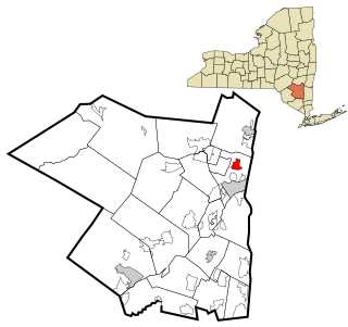
<span class="mw-page-title-main">Valley Hill, North Carolina</span> Census-designated place in North Carolina, United States

Valley Hill is an unincorporated community and census-designated place (CDP) in Henderson County, North Carolina, United States. The population was 2,070 at the 2010 census. It is part of the Asheville Metropolitan Statistical Area.

<span class="mw-page-title-main">Portage Lakes, Ohio</span> Census-designated place in Ohio, United States

Portage Lakes is a census-designated place in Summit County, Ohio, United States. The population was 6,407 at the 2020 census. A suburb directly south of Akron, the community takes its name from the encompassing Portage Lakes.

<span class="mw-page-title-main">Homeland Park, South Carolina</span> CDP in South Carolina, United States

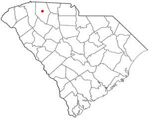
Homeland Park is a census-designated place (CDP) in Anderson County, South Carolina. The population was 6,445 at the 2020 census.

<span class="mw-page-title-main">Northlake, South Carolina</span> CDP in South Carolina, United States

Northlake is a census-designated place (CDP) in Anderson County, South Carolina. The population was 3,818 at the 2020 census.

<span class="mw-page-title-main">Eureka Mill, South Carolina</span> Census-designated place in South Carolina, United States

Eureka Mill is a census-designated place (CDP) in Chester County, South Carolina, United States. The population was 1,476 at the 2010 census, down from 1,737 at the 2000 census.

<span class="mw-page-title-main">Winnsboro Mills, South Carolina</span> Census-designated place in South Carolina, United States

Winnsboro Mills is an unincorporated community and census-designated place (CDP) in Fairfield County, South Carolina, United States. The population was 1,898 at the 2010 census, down from 2,263 at the 2000 census. It is part of the Columbia, South Carolina Metropolitan Statistical Area.

<span class="mw-page-title-main">Mountville, South Carolina</span> Census-designated place in South Carolina, United States

Mountville is an unincorporated community and census-designated place (CDP) in Laurens County, South Carolina, United States. The population was 108 at the 2010 census, down from 130 at the 2000 census. It is part of the Greenville–Mauldin–Easley Metropolitan Statistical Area.

<span class="mw-page-title-main">Oak Grove, South Carolina</span> Census-designated place in South Carolina, United States

Oak Grove is a census-designated place (CDP) in Lexington County, South Carolina, United States. The population was 10,291 at the 2010 census. It is part of the Columbia Metropolitan Statistical Area.

<span class="mw-page-title-main">Red Bank, South Carolina</span> Census-designated place in South Carolina, United States

Red Bank is an unincorporated community and census-designated place (CDP) in Lexington County, South Carolina, United States. The population was 9,617 at the 2010 census, up from 8,811 at the 2000 census. It is part of the Columbia, South Carolina Metropolitan Statistical Area.

Seven Oaks is a census-designated place (CDP) in Lexington County, South Carolina, United States, 8 miles (13 km) northwest of downtown Columbia, the state capital. The population of the CDP was 15,144 at the 2010 census. It is part of the Columbia Metropolitan Statistical Area.

<span class="mw-page-title-main">Dentsville, South Carolina</span> Census-designated place in South Carolina, United States

Dentsville is a census-designated place (CDP) in Richland County, South Carolina, United States. The population was 14,062 at the 2010 census. It is part of the Columbia, South Carolina, Metropolitan Statistical Area.

<span class="mw-page-title-main">Forest Acres, South Carolina</span> City in South Carolina, United States

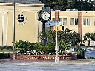
Forest Acres is a city in Richland County, South Carolina, United States. The population was 10,606 at the 2020 census. It is part of the Columbia, South Carolina, Metropolitan Statistical Area and is an enclave of the city of Columbia.

<span class="mw-page-title-main">St. Andrews, South Carolina</span> Census-designated place in South Carolina, United States

St. Andrews is a census-designated place (CDP) in Richland County, South Carolina, United States. The population was 20,493 at the 2010 census. It is part of the Columbia, South Carolina Metropolitan Statistical Area.

<span class="mw-page-title-main">Woodfield, South Carolina</span> Census-designated place in South Carolina, United States

Woodfield is a census-designated place (CDP) in Richland County, South Carolina, United States. The population was 9,303 at the 2010 census. It is part of the Columbia, South Carolina Metropolitan Statistical Area.

Southern Shops is a census-designated place (CDP) in Spartanburg County, South Carolina, United States. The population was 3,767 at the 2010 census.

<span class="mw-page-title-main">India Hook, South Carolina</span> CDP in South Carolina, United States

India Hook is a census-designated place (CDP) in York County, South Carolina, United States. The majority of India Hook is annexed into the city of Rock Hill, but as of 2010 India Hook is still considered to be a CDP. It is one of the three communities located on Lake Wylie.

<span class="mw-page-title-main">Newport, South Carolina</span> CDP in South Carolina, United States

Newport is a census-designated place in York County, South Carolina. Most of Newport is annexed into the city of Rock Hill, while parts are still located in unincorporated York County, but Newport is still considered to be a census-designated place. The census of 2010 showed the population to be 4,136. During the 2000 Census, the population was 4,033.

<span class="mw-page-title-main">Eagle Lake, Wisconsin</span> CDP in Wisconsin, United States

Eagle Lake is a census-designated place (CDP) in the town of Dover, Racine County, Wisconsin, United States. The population was 1,251 at the 2020 census.

References

  1. "ArcGIS REST Services Directory". United States Census Bureau. Retrieved October 15, 2022.
  2. 1 2 U.S. Geological Survey Geographic Names Information System: Lake Murray of Richland, South Carolina
  3. "Census Population API". United States Census Bureau. Retrieved October 15, 2022.
  4. 1 2 "U.S. Census website". United States Census Bureau . Retrieved January 31, 2008.
  5. "US Gazetteer files: 2010, 2000, and 1990". United States Census Bureau. February 12, 2011. Retrieved April 23, 2011.
  6. "Geographic Identifiers: 2010 Demographic Profile Data (G001): Lake Murray of Richland CDP, South Carolina". U.S. Census Bureau, American Factfinder. Archived from the original on February 12, 2020. Retrieved January 15, 2013.
  7. "Census of Population and Housing". Census.gov. Retrieved June 4, 2016.
  8. "Explore Census Data". data.census.gov. Retrieved December 13, 2021.