Gadsden, South Carolina

Last updated

Gadsden, South Carolina
Richland County South Carolina incorporated and unincorporated areas Gadsden highlighted.svg
Location in Richland County and the state of South Carolina.
Coordinates: 33°50′44″N80°45′57″W / 33.84556°N 80.76583°W / 33.84556; -80.76583
Country United States
State South Carolina
County Richland
Area
[1]
  Total11.51 sq mi (29.80 km2)
  Land11.51 sq mi (29.80 km2)
  Water0.00 sq mi (0.00 km2)
Elevation
[2]
154 ft (47 m)
Population
 (2020) [3]
  Total1,301
  Density113.07/sq mi (43.66/km2)
Time zone UTC-5 (Eastern (EST))
  Summer (DST) UTC-4 (EDT)
ZIP code
29052
FIPS code 45-27970 [4]
GNIS feature ID1249488 [2]

Gadsden is a census-designated place in Richland County, South Carolina, United States. The population was 1,632 at the 2010 census. [5] It is part of the Columbia, South Carolina metropolitan area.

Contents

History

The John J. Kaminer House, Magnolia, Oakwood, and Richland Presbyterian Church are listed on the National Register of Historic Places. [6]

Geography

Gadsden is located at latitude 33.846 North and longitude 80.766 West. The elevation is 148 feet (45 m) above sea level. [7] According to the U.S. Census Bureau, the town has an area of 11.5 square miles (29.8 km2), of which 0.008 square miles (0.02 km2), or 0.06%, is water. [5] The community is located at the intersection of state highways 48 and 769.

Demographics

Historical population
CensusPop.Note
2020 1,301
U.S. Decennial Census [8]

2020 census

Gadsden racial composition [9]
RaceNum.Perc.
White (non-Hispanic)836.38%
Black or African American (non-Hispanic)1,15488.7%
Native American 20.15%
Asian 10.08%
Other/Mixed 372.84%
Hispanic or Latino 241.84%

As of the 2020 United States census, there were 1,301 people, 546 households, and 425 families residing in the Town.

Related Research Articles

<span class="mw-page-title-main">Richland County, South Carolina</span> County in South Carolina, United States

Richland County is located in the U.S. state of South Carolina. As of the 2020 census, its population was 416,147, making it the second-most populous county in South Carolina, behind only Greenville County. The county seat and largest community is Columbia, the state capital. The county was established on March 12, 1785. Richland County is part of the Columbia, SC Metropolitan Statistical Area. In 2020, the center of population of South Carolina was located in Richland County, in the city of Columbia. The county is also the location of the geographic center of South Carolina, southeast of Columbia.

<span class="mw-page-title-main">Richland, Georgia</span> City in Georgia, United States

Richland is a city in Stewart County, Georgia, United States. Per the 2020 census, the population was 1,370.

<span class="mw-page-title-main">Mount Pleasant, North Carolina</span> Town in North Carolina, United States

Mount Pleasant is a town located in eastern Cabarrus County, North Carolina, United States. As of the 2010 census, the town population was 1,652. The town center is located at the crossroads of Mount Pleasant Road and North Carolina Highway 73. NC Highway 49 skirts the town to the north on its way from Charlotte to Asheboro.

<span class="mw-page-title-main">Kenansville, North Carolina</span> Town in North Carolina, United States

Kenansville is a town in Duplin County, North Carolina, United States. Its population was 770 at the 2020 census. It is the county seat of Duplin County. The town was named for James Kenan, a member of the North Carolina Senate. Liberty Hall, his early 1800s era historic home, is located within Kenansville.

<span class="mw-page-title-main">Warsaw, North Carolina</span> Town in North Carolina, United States

Warsaw is a town in Duplin County, North Carolina, United States. The population was 3,054 at the 2010 census.

<span class="mw-page-title-main">Troutman, North Carolina</span> Town in North Carolina, United States

Troutman is a town in Iredell County, North Carolina, United States. The town is located roughly 35 miles (56 km) north of Charlotte. As of the 2020 census the town's population was 3,698. Due to substantial residential growth in the area, as well as neighborhood annexation, the town is experiencing dramatic population growth. Approved residential developments, when completed, are forecast to increase town population to more than 11,000 residents.

<span class="mw-page-title-main">Richlands, North Carolina</span> Town in North Carolina, United States

Richlands is a town in Onslow County, North Carolina, United States. In the 2020 U.S. census, the population was 2,287. It is included in the Jacksonville, North Carolina Metropolitan Statistical Area. Incorporated on March 29, 1880, it was the first town in Onslow County to have its own library and museum. Richlands was also the first town in Onslow County to have a female mayor, Annette Hargett.

<span class="mw-page-title-main">Jackson, South Carolina</span> Town in South Carolina, United States of America

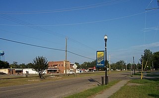
Jackson is a town in Aiken County, South Carolina, United States. The population was 1,700 at the 2010 census. It is part of the Augusta, Georgia metropolitan area.

<span class="mw-page-title-main">Fairfax, South Carolina</span> Town in South Carolina, United States

Fairfax is a town in Allendale and Hampton counties, South Carolina, United States. The population was 2,025 at the 2010 census, a decline of over one-third of its population of 3,206 from 2000.

Ulmer is a town in Allendale County, South Carolina, United States. The population was 88 at the 2010 census.

<span class="mw-page-title-main">Great Falls, South Carolina</span> Town in South Carolina, United States

Great Falls is a town in Chester County, South Carolina, United States and is located fourteen miles southwest of Lancaster, South Carolina. The population was 1,951 at the 2020 census.

<span class="mw-page-title-main">Chesterfield, South Carolina</span> Town in South Carolina, United States

Chesterfield is a town in Chesterfield County, South Carolina, United States. The population was 1,472 at the 2010 census. It is the county seat of Chesterfield County. At the time of the 2010 census, Chesterfield was the least populous of all of South Carolina's county seats.

<span class="mw-page-title-main">Kershaw, South Carolina</span> Town in South Carolina, United States

Kershaw is a town in Lancaster County, South Carolina, United States. It was incorporated in 1888. As of the 2010 census, the population was 1,803, and as of 2019 the estimated population was 2,321. The Haile Gold Mine, where gold was discovered in 1825, is 3 miles (5 km) from town and was at one time the largest single producer of gold in the Appalachian region.

<span class="mw-page-title-main">Cayce, South Carolina</span> City in South Carolina, United States

Cayce is a city in the U.S. state of South Carolina, along the Congaree River. The population was 12,528 at the 2010 census and rose to 13,789 in the 2020 United States Census, and it is the third-most populated municipality in Lexington County. The city is primarily in Lexington County, with additional, predominantly rural land to the east in Richland County. Cayce is part of the Columbia Metropolitan Statistical Area and is within South Carolina's Midlands region.

<span class="mw-page-title-main">Eastover, South Carolina</span> Town in South Carolina, United States

Eastover is a town in Richland County, South Carolina, United States. The population was 813 at the 2010 census, down from 830 in 2000. It is part of the Columbia, South Carolina, Metropolitan Statistical Area.

<span class="mw-page-title-main">St. Andrews, South Carolina</span> Census-designated place in South Carolina, United States

St. Andrews is a census-designated place (CDP) in Richland County, South Carolina, United States. The population was 20,493 at the 2010 census. It is part of the Columbia, South Carolina Metropolitan Statistical Area.

<span class="mw-page-title-main">Richlands, Virginia</span> Town in Virginia, United States

Richlands is a town in Tazewell County, Virginia, United States. The population was 5,261 at the 2020 census. It is part of the Bluefield, WV-VA micropolitan area which has a population of 107,578.

<span class="mw-page-title-main">Blythewood, South Carolina</span> Town in South Carolina, United States

Blythewood is a town in Richland and Fairfield counties, South Carolina, United States. It is a suburb of Columbia, South Carolina. The 2020 United States census puts the population at 4,772. It is part of the Columbia, South Carolina, Metropolitan Statistical Area. It is located around 15 miles from downtown Columbia.

<span class="mw-page-title-main">Irmo, South Carolina</span> Town in South Carolina, United States

Irmo is a town in Lexington and Richland counties, South Carolina, United States and a suburb of Columbia. It is part of the Columbia Metropolitan Statistical Area and is located 12 miles (19 km) northwest of the city center. The population of Irmo was 11,097 at the 2010 census.

<span class="mw-page-title-main">Hopkins, South Carolina</span> Census-designated place in South Carolina, United States

Hopkins is a census-designated place (CDP) in Richland County, South Carolina, United States. It was founded circa 1836 and named after John Hopkins (1739–1775). It is located 11 miles (18 km) southeast of downtown Columbia and is part of the Columbia Metropolitan Statistical Area. As of the 2010 census, the population of the Hopkins CDP was 2,882.

References

  1. "ArcGIS REST Services Directory". United States Census Bureau. Retrieved October 15, 2022.
  2. 1 2 U.S. Geological Survey Geographic Names Information System: Gadsden, South Carolina
  3. "Census Population API". United States Census Bureau. Retrieved October 15, 2022.
  4. "U.S. Census website". United States Census Bureau . Retrieved January 31, 2008.
  5. 1 2 "Geographic Identifiers: 2010 Demographic Profile Data (G001): Gadsden CDP, South Carolina". U.S. Census Bureau, American Factfinder. Archived from the original on February 12, 2020. Retrieved January 14, 2013.
  6. "National Register Information System". National Register of Historic Places . National Park Service. July 9, 2010.
  7. "Gadsden, South Carolina". HomeTownLocator.
  8. "Census of Population and Housing". Census.gov. Retrieved June 4, 2016.
  9. "Explore Census Data". data.census.gov. Retrieved December 13, 2021.