
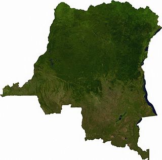
Katanga was one of the eleven provinces of the Democratic Republic of the Congo between 1966 and 2015, when it was split into the Tanganyika, Haut-Lomami, Lualaba and Haut-Katanga provinces. Between 1971 and 1997, its official name was Shaba Province.

The Congo River, formerly known as the Zaire River under the Mobutu regime, is the second longest river in Africa, shorter only than the Nile, as well as the second largest river in the world by discharge volume, following only the Amazon. It is also the world's deepest recorded river, with measured depths in excess of 220 m (720 ft). The Congo-Lualaba-Chambeshi River system has an overall length of 4,700 km (2,920 mi), which makes it the world's ninth-longest river. The Chambeshi is a tributary of the Lualaba River, and Lualaba is the name of the Congo River upstream of Boyoma Falls, extending for 1,800 km (1,120 mi).
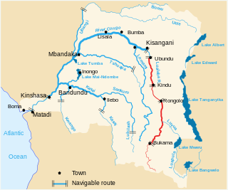
The Lualaba River flows entirely within the eastern Democratic Republic of the Congo. It is the greatest river source (headstream) of the Congo River by volume of water. The Lualaba is 1,800 kilometres (1,100 mi) long. Its headwaters are in the country's far southeastern corner near Musofi and Lubumbashi in Katanga Province, next to Zambia. The Chambeshi River is the longest river source (headstream) of the Congo.
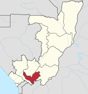
Bouenza is a department of the Republic of the Congo in the southern part of the country. It borders the departments of Lékoumou, Niari, and Pool, and internationally, the Democratic Republic of the Congo. The regional capital is Madingou. Towns and cities include Loudima, Mouyondzi, Loutété and Nkayi.

Kolwezi or Kolwesi is the capital city of Lualaba Province in the south of the Democratic Republic of the Congo, west of Likasi. It is home to an airport and a railway to Lubumbashi. The population is approximately 453,000.

The Ruzizi is a river, 117 kilometres (73 mi) long, that flows from Lake Kivu to Lake Tanganyika in Central Africa, descending from about 1,500 metres (4,900 ft) to about 770 metres (2,530 ft) above sea level over its length. The steepest gradients occur over the first 40 kilometres (25 mi), where hydroelectric dams have been built. Further downstream, the Ruzizi Plain, the floor of the Western Rift Valley, has only gentle hills, and the river flows into Lake Tanganyika through a delta, with one or two small channels splitting off from the main channel.
The Lufira River is a tributary of the Lualaba River in the Democratic Republic of the Congo (DRC).
The Luama River is a tributary of the Lualaba River in the Democratic Republic of the Congo (DRC).
The Ulindi River is a tributary of the Lualaba River in the Democratic Republic of the Congo (DRC). There is a proposal to build a hydroelectric power plant on the river to power a gold mining project.
Upemba National Park is a large national park in Haut-Lomami, Lualaba Province & Haut-Katanga Province of the southeastern Democratic Republic of Congo, formerly Zaire.
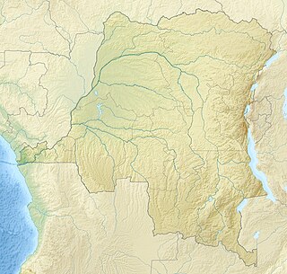
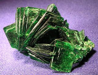
The Katanga, or Shaba, Plateau is a farming and ranching region in the Democratic Republic of the Congo. Located in the southeastern Katanga Province, it is 1220 m above sea level and is rich in copper and uranium deposits. The altitude makes it cooler than the surrounding area, with a mean annual temperature of 19-20° C.
Articles related to the Democratic Republic of the Congo include:

Noqui is a town and municipality in Zaire Province in Angola. It is on the Congo River, just across the border from the city of Matadi in the Democratic Republic of the Congo.
The Cerrón Grande Hydroelectric Dam spans the Lempa River 78 km north of San Salvador in the municipalities of Potonico, (Chalatenango) and Jutiapa (Cabañas) in El Salvador.
The Musonoi mine is a set of open-cut pits near Kolwezi from which copper and other metals have been extracted since the 1940s. The mining complex is located in the Lualaba Province of the Democratic Republic of the Congo. Kolwezi is about 320 kilometres (200 mi) northwest from Lubumbashi, the provincial capital.

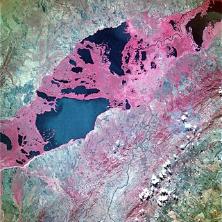
Lake Kisale is a lake in the Democratic Republic of the Congo (DRC), in Bukama Territory, Haut-Lomami District. At about 300 square kilometres (120 sq mi) in area, it is the second largest of the lakes in the Upemba Depression, an extensive marshy area partly within the Upemba National Park.

Alexandre Delcommune, or del Commune, was a Belgian officer of the armed Force Publique of the Congo Free State who undertook extensive explorations of the country during the early colonial period of the Congo Free State. He explored many of the navigable waterways of the Congo Basin, and led a major expedition to Katanga between 1890 and 1893.
Lake Zimbambo is a lake in the Malemba-Nkulu Territory of Haut-Lomami Province, in the southern Democratic Republic of the Congo.
Mwadingusha is a community in the Kambove Territory of Haut Katanga District in the Democratic Republic of the Congo.

Tumba-Ngiri-Maindombe is the largest Wetland of International Importance in the world as recognized by the Ramsar Convention. The site covers an area of 65,696 square kilometres (25,365 sq mi) in the region around Lake Tumba in the western Congo Basin in the Democratic Republic of the Congo (DRC). This is more than twice the size of Belgium or Maryland.
