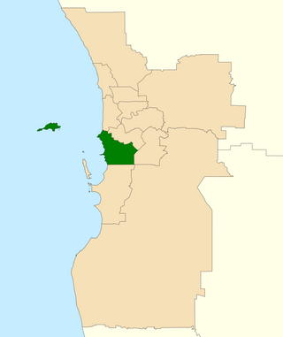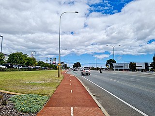
The City of Cockburn is a local government area in the southern suburbs of the Western Australian capital city of Perth about 8 kilometres (5 mi) south of Fremantle and about 24 kilometres (15 mi) south of Perth's central business district. The City covers an area of 167.5 square kilometres (64.7 sq mi) and had a population of over 104,000 as at the 2016 Census.

Yangebup is a southern suburb of Perth, Western Australia in the City of Cockburn. It takes its name from the nearby Yangebup Lake.

The Division of Fremantle is an electoral division of the Australian House of Representatives in Western Australia.

Jandakot is a southern suburb of Perth, Western Australia, located within the City of Cockburn local government area. It is best known for Jandakot Airport that is situated entirely within the suburb, the airport being "the busiest general aviation airport in Australia in terms of aircraft movements", the sixth-busiest civilian airport in Australia in the fiscal year ending 30 June 2018, and in the 2011 fiscal year even the busiest civilian airport in Australia.

Atwell is a suburb within the metropolitan area of Perth, Western Australia, situated 21 kilometres (13 mi) south of Perth City, and located in the City of Cockburn local government area.

Beeliar is a suburb of Perth, Western Australia, located within the City of Cockburn. The name refers to the Beeliar people, a group of Aboriginal Australians who had land rights over the southern half of Perth's metropolitan area. The suburb contains the Thomsons Lake Nature Reserve.
North Lake is a suburb located 18 kilometres (11 mi) south of the central business district of Perth, the capital of Western Australia, and 8 kilometres (5 mi) from the Indian Ocean. Named after the eponymous lake, the suburb and lake are located within the City of Cockburn local government area.

Applecross Senior High School is a public co-educational high school, located in Ardross, a southern suburb of Perth, Western Australia.

Canning Vale College is a public co-educational high day school in the City of Gosnells, located in Canning Vale, a suburb of Perth, Western Australia.

Cockburn is an electoral district of the Legislative Assembly in the Australian state of Western Australia.
The Beeliar Wetlands is a wetland located in the southwest portion of Western Australia. It is made up of two chains of lakes and wetlands that run parallel to the west coast of Australia. They are situated on the Swan Coastal Plain between the Darling Escarpment and the Indian Ocean. Beeliar was the name given to the area by the Aboriginal people that lived and hunted in the area.
Northam Senior High School is a comprehensive public co-educational high school, located in Northam, a regional centre in the Wheatbelt region, 97 kilometres (60 mi) east of Perth, Western Australia.
Manjimup Senior High School is a comprehensive independent public co-educational high day school, located in Manjimup, a regional centre in the South West region of Western Australia, 307 kilometres (191 mi) south of Perth.
Newton Moore Senior High School is a comprehensive independent public co-educational high day school, located in South Bunbury, a suburb of Bunbury, 175 kilometres (109 mi) south of Perth, Western Australia.
Warnbro Community High School is a public co-educational high day school, located in Warnbro, 50 kilometres (31 mi) south of Perth, Western Australia.
Leeming Senior High School is a public co-educational high day school, located in the City of Melville on Aulberry Parade in the Perth suburb of Leeming, Western Australia.
Atwell College is an independent public secondary school in the southern Perth suburb of Atwell, Western Australia.

Treeby is a southern suburb of Perth, Western Australia, located within the City of Cockburn. It is located on the east side of the Kwinana Freeway, close to Cockburn Central.

Yangebup Lake is a freshwater lake in the suburb of Yangebup, 18 kilometres (11 mi) south-west of the central business district of Perth, the capital of Western Australia. It is part of Beeliar Regional Park.

Beeliar Drive is a major arterial road in the southwestern part of the Perth Metropolitan Area. It provides an important and unbroken east-west link between Kwinana Freeway and Stock Road providing access to residential developments in Beeliar, Yangebup and Lake Coogee in the west to commercial and industrial development in Cockburn Central, Jandakot and Success in the east. It is one of Perth's more recent arterial road constructions with development of the road occurring between the early 1990s and early 2020s.


