Lamar Municipal Airport (Missouri)

Last updated
Lamar Municipal Airport
Summary
Airport typePublic
OwnerCity of Lamar
ServesLamar, Missouri
Time zone CST (UTC−06:00)
  Summer (DST)CDT (UTC−05:00)
Elevation  AMSL 1,010 ft / 308 m
Coordinates 37°29′10″N094°18′43″W / 37.48611°N 94.31194°W / 37.48611; -94.31194
Map
USA Missouri relief location map.svg
Airplane silhouette.svg
LLU
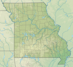
Location of airport in Missouri
Usa edcp relief location map.png
Airplane silhouette.svg
LLU
LLU (the United States)
Lamar Municipal Airport (Missouri)
Runways
Direction LengthSurface
ftm
17/354,0001,220Concrete
3/212,900885Asphalt
Statistics
Aircraft operations (2019)5,320
Based aircraft (2024)21

Lamar Municipal Airport( ICAO : KLLU, FAA LID : LLU) is a public airport located two miles southwest of the town of Lamar, in Barton County, Missouri, United States. [1]

Contents

It is included in the Federal Aviation Administration (FAA) National Plan of Integrated Airport Systems for 2025–2029, in which it is categorized as a local general aviation facility. [2]

Most U.S. airports use the same three-letter location identifier for the FAA and IATA, but Lamar Municipal Airport is LLU to the FAA and has no IATA code. [3] (IATA assigned LLU to Alluitsup Paa, Greenland [4] ).
Facilities

The Citation M2 has small winglets. N862MT C525(Citation M2) Cessna Aircraft VKO UUWW (33471434942).jpg
The Citation M2 has small winglets.

Lamar Municipal Airport covers 105 acres (42 ha) at an elevation of 1,010 feet (308 m) above mean sea level. It has two runways, the primary runway 17/35 is a concrete runway 4,000 by 75 feet (1,220 x 23 m) and the crosswind runway 3/21 is a 2,900 by 60 feet (885 x 18 m) asphalt runway. Runways 17/35 and 3 have approved GPS approaches.

For the 12-month period ending December 31, 2019 the airport had 5,320 aircraft operations, an average of 15 per day: 94% general aviation, 6% air taxi and less than 1% military.

In August 2024, there were 21 aircraft based at this airport: 19 single-engine and 2 jet. [1]

See also

Related Research Articles

<span class="mw-page-title-main">Watertown Municipal Airport (Wisconsin)</span> Airport

Watertown Municipal Airport is a public use airport located in and owned by the city of Watertown, in Jefferson County, Wisconsin, United States. It is included in the Federal Aviation Administration (FAA) National Plan of Integrated Airport Systems for 2025–2029, in which it is categorized as a regional general aviation facility.

Shell Lake Municipal Airport is a city owned public use airport located one nautical mile (2 km) southeast of the central business district of Shell Lake, a city in Washburn County, Wisconsin, United States. It is included in the Federal Aviation Administration (FAA) National Plan of Integrated Airport Systems for 2025–2029, in which it is categorized as a basic general aviation facility.

Taylor County Airport is a county-owned public-use airport located three nautical miles southeast of the central business district of Medford, a city in Taylor County, Wisconsin, United States.

<span class="mw-page-title-main">Boscobel Airport</span> Airport

Boscobel Airport, also known as Boscobel Municipal Airport, is a city owned public use airport located two nautical miles (4 km) northeast of the central business district of Boscobel, a city in Grant County, Wisconsin, United States.

<span class="mw-page-title-main">Platteville Municipal Airport</span> Airport

Platteville Municipal Airport is a city owned public use airport located three nautical miles (6 km) southeast of the central business district of Platteville, a city in Grant County, Wisconsin, United States. It is included in the Federal Aviation Administration (FAA) National Plan of Integrated Airport Systems for 2025–2029, in which it is categorized as a local general aviation facility.

Black River Falls Area Airport is a public use airport located three nautical miles (6 km) south of the central business district of Black River Falls, a city in Jackson County, Wisconsin, United States. It is owned by the city of Black River Falls and Jackson County.

<span class="mw-page-title-main">Prairie du Chien Municipal Airport</span> Airport

Prairie du Chien Municipal Airport is a city owned public use airport located two nautical miles (4 km) southeast of the central business district of Prairie du Chien, a city in Crawford County, Wisconsin, United States. It is included in the Federal Aviation Administration (FAA) National Plan of Integrated Airport Systems for 2025–2029, in which it is categorized as a local general aviation facility.

<span class="mw-page-title-main">Clintonville Municipal Airport</span> Airport

Clintonville Municipal Airport is located two miles southeast of Clintonville, in Waupaca County, Wisconsin, United States. The Federal Aviation Administration (FAA) National Plan of Integrated Airport Systems for 2025–2029 categorized it as a basic general aviation facility.

<span class="mw-page-title-main">Waupaca Municipal Airport</span> Airport

Waupaca Municipal Airport is a city owned public use airport located three nautical miles (6 km) southeast of the central business district of Waupaca, a city in Waupaca County, Wisconsin, United States. The airport is also known as Brunner Field, which opened in November 1944. It is located adjacent to U.S. Route 10. It is included in the Federal Aviation Administration (FAA) National Plan of Integrated Airport Systems for 2025–2029, in which it is categorized as a local general aviation facility.

Shawano Municipal Airport is a city and county-owned public-use airport located one nautical mile (2 km) northeast of the central business district of Shawano, a city in Shawano County, Wisconsin, United States. It is included in the Federal Aviation Administration (FAA) National Plan of Integrated Airport Systems for 2025–2029, in which it is categorized as a local general aviation facility. The airport is located on Shawano Lake and has a landing area for seaplanes.

Burnett County Airport is a county-owned public use airport located three nautical miles (6 km) north of the central business district of Siren, in Burnett County, Wisconsin, United States. It is included in the Federal Aviation Administration (FAA) National Plan of Integrated Airport Systems for 2025–2029, in which it is categorized as a local general aviation facility.

Cumberland Municipal Airport is a city owned public use airport located three nautical miles (6 km) southeast of the central business district of Cumberland, a city in Barron County, Wisconsin, United States.

Kings Land o' Lakes Airport is a public use airport located one nautical mile (1.85 km) southeast of the central business district of the unincorporated community of Land o' Lakes in the town of Land o' Lakes, Vilas County, Wisconsin, United States. It is owned by the town of Land o' Lakes. It is included in the Federal Aviation Administration (FAA) National Plan of Integrated Airport Systems for 2025–2029, in which it is categorized as a basic general aviation facility.

Monroe Municipal Airport is a city owned public use airport located three nautical miles (6 km) northeast of the central business district of Monroe, a city in Green County, Wisconsin, United States. It is included in the Federal Aviation Administration (FAA) National Plan of Integrated Airport Systems for 2025–2029, in which it is categorized as a regional general aviation facility.

<span class="mw-page-title-main">Price County Airport</span> Airport

Price County Airport is a county owned public airport located one mile northwest of Phillips, in Price County, Wisconsin, United States. It is included in the Federal Aviation Administration (FAA) National Plan of Integrated Airport Systems for 2025–2029, in which it is categorized as a local general aviation facility.

<span class="mw-page-title-main">Neillsville Municipal Airport</span> Airport

Neillsville Municipal Airport is a city owned public use airport located three nautical miles (6 km) east of the central business district of Neillsville, a city in Clark County, Wisconsin, United States. It is also known as Kurt Listeman Field. It is included in the Federal Aviation Administration (FAA) National Plan of Integrated Airport Systems for 2025–2029, in which it is categorized as a local general aviation facility.

Hartford Municipal Airport is a public use airport in Washington County, Wisconsin, United States. The airport is owned by and located two nautical miles (4 km) northwest of the central business district of the city of Hartford. It is included in the Federal Aviation Administration (FAA) National Plan of Integrated Airport Systems for 2025–2029, in which it is categorized as a local general aviation facility.

Oconto – J. Douglas Bake Municipal Airport (KOCQ) is a public use airport located two nautical miles (4 km) southwest of the central business district of Oconto, a city in Oconto County, Wisconsin, United States. It is owned by Oconto City and County. It is included in the Federal Aviation Administration (FAA) National Plan of Integrated Airport Systems for 2025–2029, in which it is categorized as a local general aviation facility.

Solon Springs Municipal Airport is a public use airport located three nautical miles (6 km) south of the central business district of Solon Springs, in Douglas County, Wisconsin, United States. It is included in the Federal Aviation Administration (FAA) National Plan of Integrated Airport Systems for 2025–2029, in which it is categorized as a local general aviation facility.

Crivitz Municipal Airport, is a city owned public use airport located 3 miles (5 km) southwest of the central business district of Crivitz, Wisconsin, a city in Marinette County, Wisconsin, United States. It is included in the Federal Aviation Administration (FAA) National Plan of Integrated Airport Systems for 2025–2029, in which it is categorized as an unclassified general aviation facility.

References

  1. 1 2 3 FAA Airport Form 5010 for LLU PDF , effective August 8, 2024.
  2. "NPIAS Report 2025-2029 Appendix A" (PDF). Federal Aviation Administration . October 28, 2024. Retrieved November 11, 2024.
  3. Great Circle Mapper: KLLU - Lamar, Missouri (Lamar Municipal Airport)
  4. Great Circle Mapper: LLU / BGAP - Alluitsup Paa, Greenland