LeChee is a census-designated place (CDP) in Coconino County, Arizona, United States. The population was 1,443 at the 2010 census.

Harris Township is a civil township of Menominee County in the U.S. state of Michigan. The population was 2,113 at the 2020 census.

Tunas is an unincorporated rural hamlet in northern Dallas County, Missouri, United States. It lies fourteen miles north of Buffalo on Route 73 and approximately seven miles east of Urbana on Route D. The town is located on Route 73, just southwest of the Little Niangua River. There is a post office at Tunas, and no other businesses or services. Tunas is part of the Springfield, Missouri Metropolitan Statistical Area.
Chadwick is an unincorporated community in eastern Christian County, Missouri, United States. It is located approximately six miles southeast of Sparta along Missouri Route 125. The community of Oldfield is approximately three miles to the north along Route 125. It is part of the Springfield, Missouri Metropolitan Statistical Area. Its ZIP code is 65629.

Pottersville is an unincorporated hamlet in Howell County, Missouri, United States. It is located approximately ten miles west of West Plains. Besides a few homes, only a post office and fire station are located there. The ZIP Code for Pottersville is 65790.
Dora is an unincorporated community in Ozark County, in the U.S. state of Missouri. The ZIP Code for Dora is 65637.

Couch is a small, unincorporated community in Oregon County, Missouri, United States. It is located six miles south of Alton on Missouri Route A. The ZIP Code for Couch is 65690.
Ridgedale is an unincorporated community in southern Taney County, Missouri, United States. It lies approximately ten miles south of Branson on U.S. Route 65, about one-half mile north of the Arkansas state line. The community is part of the Branson, Missouri Micropolitan Statistical Area.

Walnut Shade is an unincorporated community in Taney County, Missouri, United States. It is located approximately six miles northwest of Forsyth on U.S. Route 160. The town sits at the confluence of Bull and Bear Creeks. Walnut Shade is part of the Branson, Missouri Micropolitan Statistical Area. The ZIP Code for Walnut Shade is 65771.

Kissee Mills is a census-designated place in Taney County, Missouri, United States. It is located on U.S. Route 160, approximately five miles east of Forsyth. Kissee Mills is part of the Branson, Missouri Micropolitan Statistical Area.
Cape Fair is an unincorporated community in Stone County, Missouri, United States. It is located on Route 76 and the southern terminus of Route 173. Cape Fair is on the west side of the James River arm of Table Rock Lake. The community is part of the Branson, Missouri Micropolitan Statistical Area. The ZIP Code for Cape Fair is 65624.

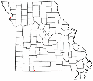
Brighton is an unincorporated community in southern Polk County, Missouri, United States. It is located at the intersection of Missouri Routes 13 and 215. Bolivar is eleven miles to the north and Springfield is approximately fifteen miles south.
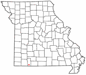
Dunnegan is an unincorporated community in western Polk County, Missouri, United States. It is located on Route 123, approximately five miles north of Fair Play and 5.5 miles south of to Humansville.

Pittsburg is an unincorporated community in Hickory County, Missouri, United States. It is located approximately ten miles south of Hermitage on Route 64. The community lies on the shores of Pomme de Terre Lake. The ZIP Code for Pittsburg is 65724.

Valles Mines is an unincorporated community in southern Jefferson County, Missouri, United States. It is located approximately seven miles south of De Soto. It is located on Missouri Route V less than one mile west of U.S. Route 67. Joachim Creek flows past the north side of the community. The ZIP Code for Valles Mines is 63087.
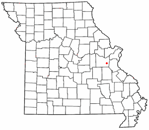
Lonedell is an unincorporated community in southeastern Franklin County, Missouri, United States. It is at the intersection of Route 30 and routes N and FF and approximately eight miles east of St. Clair. The Little Meramac River flows just south of the community.

Wheelerville is an unincorporated community in northeastern Barry County, Missouri, United States. It is located at the intersection of Route 248 and Route D, approximately eight miles west-northwest of Galena in adjacent Stone County.

Cape Porpoise is a small coastal village in the town of Kennebunkport, Maine, United States, and was the original English settlement of the town. It is located northeast of Dock Square and southwest of Goose Rocks Beach. The village occupies the mainland adjacent to Cape Porpoise Harbor. More than a dozen islands protect the deep natural harbor. The ZIP Code for Cape Porpoise is 04014.

Strong is a census-designated place in southeastern Northumberland County, Pennsylvania, United States. It is located in Mt. Carmel Township at the junction of Routes 54 and 61. The North Branch Shamokin Creek flows southwestward through Strong into the Shamokin Creek, a tributary of the Susquehanna River. It is served by the Mount Carmel post office, which uses the zip code of 17851. As of the 2010 census, the population was 147 residents.
Locust is an unincorporated community in Ozark County, Missouri, United States. The community is located on South Fork Bratten Spring Creek, approximately one mile east of a northeast arm of Bull Shoals Lake. Access is via a county road south from U.S. Route 160, southwest of Gainesville.