The Great River Road is a collection of state and local roads that follow the course of the Mississippi River through ten states of the United States. They are Minnesota, Wisconsin, Iowa, Illinois, Missouri, Kentucky, Tennessee, Arkansas, Mississippi and Louisiana. It formerly extended north into Canada, serving the provinces of Ontario and Manitoba. The road is designated as both a National Scenic Byway and an All-American Road in several states along the route.

Route 100, also named Manchester Road through St. Louis County and Manchester Avenue and Chouteau Avenue through St. Louis City, is a state highway in the U.S. state of Missouri. It runs from Linn, Missouri at U.S. Route 50 to Interstate 55 in St. Louis. The highway is 121 miles (195 km) long.
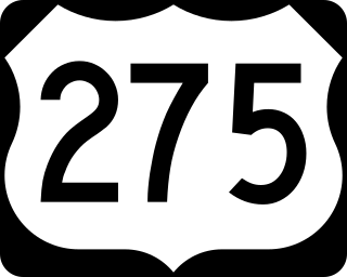
U.S. Route 275 (US 275) is a north–south United States highway that is a branch of US 75. It originally terminated at US 75 in Council Bluffs, Iowa. The highway's northern terminus is in O'Neill, Nebraska, at an intersection with U.S. Highway 20 and U.S. Highway 281. Its southern terminus is near Rock Port, Missouri, at an intersection with U.S. Highway 136.

A supplemental route is a state secondary road in the U.S. state of Missouri, designated with letters. Supplemental routes were various roads within the state which the Missouri Department of Transportation was given in 1952 to maintain in addition to the regular routes, though lettered routes had been in use from at least 1932. The four types of roads designated as Routes are:

Route 125 runs between U.S. Route 65 at Fair Grove and the Arkansas state line, where it continues as Highway 125. After the road crosses into Marion County, Arkansas, the highway crosses Bull Shoals Lake via a free ferry. It is a two-lane road its entire length. Near Chadwick, the highway enters the Mark Twain National Forest and passes through this most of the way to Arkansas. It also overlaps U.S. Route 160 for several miles at Rueter. It overlaps Route 14 through most of Sparta. It crosses US 60 near Rogersville. It cross I-44 near Strafford, Missouri. The roads ends at U.S. Route 65 at Fair Grove and the road continues as Missouri Route CC.

Missouri Route 5 is the longest state highway in Missouri and the only Missouri state highway to traverse the entire state. It is part of a three state, 650 mile highway 5. To the north, it continues into Iowa as Iowa Highway 5 and to the south it enters Arkansas as Arkansas Highway 5. With only a few exceptions, it is two-lane for its entire length. Business Route 5 serves Milan and Ava. There is Business Route 5 in Camdenton.

Route 39 is a two-lane highway in southwestern Missouri. Its northern terminus is at U.S. Route 54 between Collins and El Dorado Springs at the community of Cedar Springs; its southern terminus is at the Arkansas state line where it continues as Highway 221.

Route 291 is a state highway in the western part of the U.S. state of Missouri. Its southern terminus is at I-49/US 71 in Harrisonville; its northern terminus is at I-435 in Kansas City. The route was once designated as US 71 Bypass. Route 291 serves as a main arterial road and commercial strip in Liberty and Independence.

Route 87 is a highway in central Missouri. Its southern terminus is at U.S. Route 54 in Eldon, and its northern terminus is at Route 5/240 in Glasgow. Parts of the road are overlapped by the Lewis and Clark Trail and Santa Fe Trail.

Route 165 and County Road 165 (CR 165) form a loop around the west side of Branson, Missouri, in Taney and Stone counties. The highway's southern terminus is at U.S. Route 65 (US 65) south of Branson, in Hollister. Even though the county road designation belongs to Taney County, it briefly enters Stone County at Table Rock State Park. Upon re-entering Taney County, it crosses the Table Rock Lake Dam, along with Route 265, at Table Rock Lake. Its northern terminus is at US 65 along the Red Route in north Branson.

The Niangua River is a 125-mile-long (201 km) tributary of the Osage River in the Ozarks region of southern and central Missouri in the United States. Via the Osage and Missouri rivers it is part of the watershed of the Mississippi River.
Crossroads, crossroad, cross road(s) or similar may refer to:
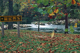
Bennett Spring State Park is a public recreation area located in Bennett Springs, Missouri, twelve miles (19 km) west of Lebanon on Highway 64 in Dallas and Laclede counties. It is centered on the spring that flows into the Niangua River and gives the park its name. The spring averages 100 million gallons of daily flow. The park offers fly fishing, camping, canoeing, hiking, and other activities.
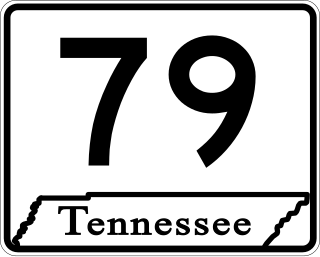
State Route 79 is a 10.37-mile-long (16.69 km) state highway in southwestern Lake County, Tennessee. SR 79 has a dual primary and secondary designation and is one of a few state routes in Tennessee to have an aggregate (gravel) road surface.
Route 84 is a state highway in the Missouri bootheel. The route starts at Arkansas Highway 90 over the St. Francis River on the Arkansas–Missouri state line. The road travels eastward to Kennett, where it becomes concurrent with U.S. Route 412. East of Kennett, the concurrent routes travel eastward on a divided highway to Hayti Heights, where the concurrency ends. Route 84 travels through Hayti Heights and Hayti, and it crosses Interstate 55 (I-55) and US 61. The route then travels southeastwards to Caruthersville, and bypasses the central area of the city. In the southern part of Caruthersville, Route 84 ends at an interchange with I-155 and US 412.

A ford is a shallow place with good footing where a river or stream may be crossed by wading, or inside a vehicle getting its wheels wet. A ford may occur naturally or be constructed. Fords may be impassable during high water. A low-water crossing is a low bridge that allows crossing over a river or stream when water is low but may be treated as a ford when the river is high and water covers the crossing.

U.S. Route 54 in Missouri is a west-east highway that starts from the Kansas state line in Nevada to the Illinois state line in Louisiana.
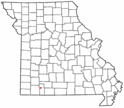
Cross Roads is an unincorporated community in Douglas County, Missouri, United States. Cross Roads is in the southwest corner of the county on Missouri Route DD, west of Missouri Route 76. It is located on the edge of the Mark Twain National Forest.
Cross Roads is an unincorporated community in St. Francois County, in the U.S. state of Missouri.