Possum Trot, Missouri

Last updated

Possum Trot is a former town in northeastern Stone County, Missouri, United States. [1] It is located approximately 5.5 miles (8.85 km) southwest of Nixa on Missouri Route M. [2] Only the remains of a school named Fairview and a house are left. Fairview was a one-room school which had grades 1 through 8 and was locally called Possum Trot School.

Stone County, Missouri County in the United States

Stone County is a county located in the southwestern portion of the U.S. state of Missouri. As of the 2010 census, the population was 32,202. Its county seat is Galena.

Missouri State of the United States of America

Missouri is a state in the Midwestern United States. With over six million residents, it is the 18th-most populous state of the Union. The largest urban areas are St. Louis, Kansas City, Springfield, and Columbia; the capital is Jefferson City. The state is the 21st-most extensive in area. In the South are the Ozarks, a forested highland, providing timber, minerals, and recreation. The Missouri River, after which the state is named, flows through the center of the state into the Mississippi River, which makes up Missouri's eastern border.

Nixa, Missouri City in Missouri, United States

Nixa is a city in Christian County, Missouri, United States. As of the 2010 census, the city population was 19,022. The population was estimated in 2016 at 21,201. It is also part of the Springfield, Missouri Metropolitan Statistical Area.

The general store at Possum Trot was operated by the descendants of Jackson B. and Emma Stewart Wilson, William Jasper Wilson, and his brother John Washington Wilson during the early part of the 20th century.[ citation needed ] Part of the community was once known as Self. [1]

Related Research Articles

Newton County, Missouri County in the United States

Newton County is a county located in the southwest portion of the U.S. state of Missouri. As of the 2010 census, the population was 58,114. Its county seat is Neosho. The county was organized in 1838 and is named in honor of John Newton, a hero who fought in the Revolutionary War.

Mercer County, Missouri County in the United States

Mercer County is a county located in the northwestern portion of the U.S. state of Missouri. As of the 2010 census, the population was 3,785, making it the second-least populous county in Missouri. Its county seat is Princeton. The county was organized February 14, 1845 and named for General John F. Mercer of the Revolutionary War.

Chidester, Arkansas City in Arkansas, United States

Chidester is a city in Ouachita County, Arkansas, United States. The population was 335 at the 2000 census. It is part of the Camden Micropolitan Statistical Area.

Walnut Grove, Missouri City in Missouri, United States

Walnut Grove is a city in Greene County, Missouri, United States. The population was 665 at the 2010 census. It is part of the Springfield, Missouri Metropolitan Statistical Area.

Fairview, Oklahoma City in Oklahoma, United States

Fairview is a city in Major County, Oklahoma, United States. The population was 2,579 at the 2010 census. It is the county seat of Major County.

Fairview, Texas Town in Texas, United States

Fairview is a town in Collin County, Texas, United States. It is part of the Dallas-Fort Worth metropolitan area. As of the 2010 census, the town population was 7,248. The estimated population in 2014 was 8,361. The town is adjacent to the 289-acre (1.17 km2) Heard Wildlife Sanctuary.

Shell Knob, Missouri Census-designated place in Missouri, United States

Shell Knob is a census-designated place (CDP) in White River Township in Barry County and Alpine Township in Stone County in the state of Missouri. The population was 1,379 at the 2010 census.

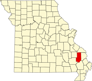
Competition is an unincorporated community in southern Laclede County, Missouri, United States. It is located approximately seventeen miles southeast of Lebanon.

Union City, Missouri unincorporated community in Missouri, United States

Union City is an unincorporated community in northern Stone County, Missouri, United States. It is located approximately 3.5 miles south of Clever at the intersection of routes M and K. Possum Trot is about two miles to the east on route M.

Possum Trot or Possumtrot may refer to:

Lone Oak Township, Bates County, Missouri Township in Missouri, United States

Lone Oak Township is one of twenty-four townships in Bates County, Missouri, USA. As of the 2000 census, its population was 293.

Fairview, Page County is an unincorporated community in Page County, in the U.S. state of Virginia.

Castor, Missouri unincorporated community in Missouri, United States

Castor is an unincorporated community in the northwestern part of Filmore Township in Bollinger County, Missouri. Castor is situated on the Castor River and is located about 16 miles west of Marble Hill, Missouri.

Possum Trot Creek is a stream in Crawford and Iron counties in the U.S. state of Missouri. It is a tributary of Huzzah Creek.

Fairview Township is a township in Henry County, in the U.S. state of Missouri.

Wolfpen Hollow is a valley in northern Oregon County in the Ozarks of southern Missouri.

Mungy Branch is a stream in northwestern Phelps and northeastern Pulaski counties in the Ozarks of the U.S. state of Missouri. It is a tributary of Duncan Creek.

Possum Creek is a small stream in northern Polk County, Missouri. Its source coordinates are 37°48′00″N93°18′02″W, and its confluence coordinates are 37°48′01″N93°21′58″W.

Jamesville, Missouri human settlement in United States of America

Jamesville is an unincorporated community in northeast Stone County, Missouri, United States. The community is located just west of the confluence of Finley Creek and the James River, along Missouri Route M.

References

  1. 1 2 U.S. Geological Survey Geographic Names Information System: Possum Trot, Missouri
  2. Missouri Atlas & Gazetteer, DeLorme, 2007, Third edition, p. 62, ISBN   0-89933-353-2

Coordinates: 36°58′43″N93°25′45″W / 36.97861°N 93.42917°W / 36.97861; -93.42917

Geographic coordinate system Coordinate system

A geographic coordinate system is a coordinate system that enables every location on Earth to be specified by a set of numbers, letters or symbols. The coordinates are often chosen such that one of the numbers represents a vertical position and two or three of the numbers represent a horizontal position; alternatively, a geographic position may be expressed in a combined three-dimensional Cartesian vector. A common choice of coordinates is latitude, longitude and elevation. To specify a location on a plane requires a map projection.