
Sibu is a landlocked city located in the central region of Sarawak, Malaysia. It serves as the capital of Sibu District within Sibu Division and is situated on the island of Borneo. Covering an area of 129.5 square kilometres (50.0 sq mi), the city is positioned at the confluence of the Rajang and Igan Rivers, approximately 60 kilometres from the South China Sea and 191.5 kilometres (119 mi) north-east of the state capital, Kuching.

Sarikei is a town, and the capital of Sarikei District in Sarikei Division, Sarawak, Malaysia. It is located on the Rajang River, near where the river empties into the South China Sea. The district population was 56,798.

The Rajang River is a river in Sarawak, northwestern Borneo, Malaysia. The river originates in the Iran Mountains, flows through Kapit, and then towards the South China Sea. At approximately 565 km long (351 mi), the river is the seventh-longest in Borneo and the longest in Malaysia.

Malaysian Federal Roads System, is the main national road network in Malaysia. All Federal Roads in Malaysia are under the purview of the Ministry of Works (MOW). According to the Ministerial Functions Act 1969, the MOW is responsible to plan, build and maintain all Federal Roads gazetted under the Federal Roads Act 1959. However, most of the Federal roads' projects were built and maintained by the Malaysian Public Works Department (JKR), which is also one of the implementing agencies under the MOW.
The Federal Route 1 is the first federal road in Malaysia, the oldest federal road in Malaysia, and among the nation's earliest public roadways ever constructed. The Federal Route 1 was the backbone of the road system in the western states of Peninsular Malaysia before being supplanted by the North–South Expressway.
Federal Route 5 is one of the three north–south oriented backbone federal roads running along the west coast of Peninsular Malaysia, Malaysia. The 655.85 kilometres (408 mi) federal highway runs from Jelapang, Perak in the north to Skudai, Johor in the south.

The Pan-Borneo Highway including the sections now known as the Pan Borneo Expressway, is a controlled-access highway on Borneo Island, connecting two Malaysian states, Sabah and Sarawak, with Brunei. The length of the entire highway is 2,083 kilometres (1,294 mi) for the Malaysian section, 168 kilometres (104 mi) for the Bruneian section.

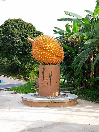
Bintangor is a town, and the capital of the Meradong District in Sarikei Division, of Sarawak, Malaysia. Situated along the Rejang River, Bintangor was an express boat services hub connecting between, Sarikei town and Sibu city in the 1970s up to the early 1990s. As road connections between these towns became a more prominent mode of transport, the waterway of the town died down.
Divisions are the primary subdivisions of Sabah and Sarawak, the states in East Malaysia. Each division is subdivided into districts — this is different in Peninsular Malaysia whereby districts are generally the primary subdivisions of a state. Each division is headed by a resident.
Pakan is a small town in Pakan District, Sarikei Division, Sarawak, Malaysia. The district population estimates was 17,600.
Bruit Island is an island in Daro District, Mukah Division, Sarawak, Malaysia. It is located in the Rejang Delta, 150 km northwest of Kuching. With a population of around 9,342 and an area of 417 square kilometres, it is the second largest island in Malaysia after Banggi Island. The mudflats at the northern end of the island have been designated an Important Bird Area by BirdLife International.

Selangau, Sarawak, is a small town located by the Pan Borneo Highway. It is also located by Batang Mukah, a river which flows to the South China Sea. It is located approximately 74 km (46 mi) from Sibu city, 84 km (52 mi) from Mukah town and 134 km (83 mi) from Bintulu town. Selangau town is the administrative centre for the Selangau District.
The Malaysian Expressway System is a network of national controlled-access expressways in Malaysia that forms the primary backbone network of Malaysian national highways. The network begins with the Tanjung Malim–Slim River tolled road which was opened to traffic on 16 March 1966, later North–South Expressway (NSE), and is being substantially developed. Malaysian toll road-expressways are built by private companies under the supervision of the government highway authority, Malaysian Highway Authority. While toll-free expressways are built by Malaysian Public Works Department or Jabatan Kerja Raya Malaysia (JKR) in Malay.
The Sarawak section of the Federal Route 1, Asian Highway Route AH 150, also known as Pan Borneo Highway Sarawak or Sarawak First Trunk Road, is a 1077-km federal highway in Sarawak, Malaysia, making the highway as the longest component of the Malaysian portion of the larger Pan Borneo Highway network. Construction of the highway began in 2014 after Sarawak government being pressured by Sarawakian to exit Malaysia when they see no proper big highway connecting Sarawak after became a member of the federation of Malaysia for 55 years with all the natural resources being extract and sell by Malaysia Federal Government.
Batu Kawah is a suburban area located right next to the 3rd Mile Roundabout in Kuching Division, State of Sarawak in Malaysia. The mukim is administratively under the Padawan Municipal Council. The Pan Borneo Highway passing through the area links Kuching City with Bau, Lundu and Sematan further west. This place is also known to have many hornet nests.

The Urban Transformation Centre (UTC) (Malay: Pusat Transformasi Bandar) is a public amenities centre located at some state capitals and urban areas in Malaysia. The rural counterpart of UTC is Rural Transformation Center(RTC). UTC can be found in the tallest building by state in Malaysia, such as City Plaza Tower in Kedah, KOMTAR Tower in Penang.

The Sibu Municipal Council is the municipal council which administers the district of Sibu in the state of Sarawak, Malaysia.

Durin Bridge or Sibu-Durin Bridge is a bridge connecting Sibu and Durin in Sarawak, Malaysia. The bridge is part of the Jalan Sibu-Durin of the Pan Borneo Highway.

The Sultan Abdul Halim Muadzam Shah Bridge, also known as the Penang Second Bridge, is a dual carriageway toll bridge in Penang, Malaysia. It connects Bandar Cassia in Seberang Perai on mainland Peninsular Malaysia with Batu Maung on Penang Island. It is the second bridge to link the island to the mainland after the first Penang Bridge.
Alice Lau Kiong Yieng is a Malaysian politician and pharmacist who has served as the Deputy Speaker of the Dewan Rakyat II under Speaker Johari Abdul since December 2022 and the Member of Parliament (MP) for Lanang since May 2013. She served as Chairperson of the National Institute of Occupational Safety and Health (NIOSH) from October 2019 to March 2020. She is a member of the Democratic Action Party (DAP), a component party of the Pakatan Harapan (PH) coalition.


