Related Research Articles
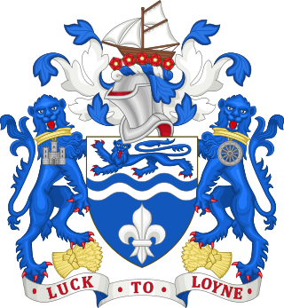
The City of Lancaster is a local government district of Lancashire, England, with the status of a city and non-metropolitan district. It is named after its largest settlement, Lancaster, but covers a far larger area, which includes the towns of Morecambe, Heysham, and Carnforth, as well as outlying villages, farms, rural hinterland and a section of the Yorkshire Dales National Park. The district has a population of 142,934 (2021), and an area of 222.5 square miles (576.2 km2).

Silverdale is a village and civil parish within the City of Lancaster district of Lancashire, England. The village stands on Morecambe Bay, near the border with Cumbria, 4.5 miles (7 km) north west of Carnforth and 8.5 miles (14 km) of Lancaster. The parish had a population of 1,519 recorded in the 2011 census.

Kingston on Soar is a village and civil parish in the Rushcliffe borough of Nottinghamshire, England.
Gloucester was, from 1894 to 1974, a rural district in the administrative county of Gloucestershire, England. The district did not include the City of Gloucester, which was a separate county borough. In 1935 Gloucester RD was more than double in size.
Burnley was a rural district of Lancashire, England from 1894 to 1974. It was named after but did not include the large town of Burnley, which was a county borough.

Thedwastre was a rural district in West Suffolk, England from 1894 to 1974. Thedwastre was formed under the Local Government Act 1894, from the part of the Stow Rural Sanitary District which was in West Suffolk. It was named after the historic hundred of Thedwastre.
Southwell was a rural district in Nottinghamshire, England from 1894 to 1974.
Newark was a rural district in Nottinghamshire, England from 1894 to 1974.
East Retford was a rural district in Nottinghamshire, England from 1894 to 1974.
Misterton was a rural district in Nottinghamshire, England from 1894 to 1935.

Warton is a village, civil parish and electoral ward in the City of Lancaster in north Lancashire in the north-west of England, close to the boundary with Cumbria, with a population of around 2,000, measured at the 2011 Census to be 2,360. It is a village steeped in history; its earliest recording as a settlement is made in Domesday Book written in 1086. The nearest town to Warton is Carnforth, which was originally part of Warton parish. It has connections to the first President of the United States, George Washington: Washington's ancestor of seven generations, Lawrence Washington, is rumoured to have helped build the village church of St Oswald. The parish covers an area in excess of 11,000 acres (45 km2) and is predominantly rural. The parish of Warton had a population of 2,315 recorded in the 2001 census, and 2,360 in the 2011 census.

Cockersand Abbey is a former abbey and former civil parish near Cockerham in the City of Lancaster district of Lancashire, England. It is situated near the mouth of the River Cocker.
Eastry Rural District was a rural district in the county of Kent, England, from 1894 to 1974. It was subject to a significant boundary reform in 1935 when several parishes were gained from the disbanded Isle of Thanet Rural District and other parishes were reorganised.
Clitheroe Rural District was a rural district in the county of Lancashire, England. It was created in 1894 and abolished in 1974 under the Local Government Act 1972.
Lunesdale Rural District was a rural district in the county of Lancashire, England. It was created in 1894 and abolished in 1974 under the Local Government Act 1972.
Fylde Rural District was a rural district in the county of Lancashire, England. It was created in 1894 and abolished in 1974 under the Local Government Act 1972.
Bulk is an area of Lancaster, Lancashire, England. It was formerly a township and a civil parish. The placename Bulke was recorded in 1346. The manor of Neuton was recorded in this area in the Domesday Book but by 1318 Newton was described as a hamlet within Bulk.
Ashton with Stodday is a former township and civil parish near Lancaster, Lancashire, England.

Scotforth is a civil parish in City of Lancaster district, Lancashire, England. It does not include the suburb Scotforth, but is further south, comprising areas to the west, north and north-east of Lancaster University. It has an area of 645.86 hectares.

Compton Wynyates or Compton Wyniates is an ancient parish and civil parish in Stratford-on-Avon District, Warwickshire, England. It includes the house and grounds of Compton Wynyates, and extends to the north-east and south-west of the house, with size of roughly 3.5 by 0.5 miles. The parish has an area of 1,038 acres (420 ha). Compton Wynyates was also a village, the earthworks of the village partly survive. It does not have a parish council but has a parish meeting. Population figures for the 2011 census are not available for this parish. Population figures from 1801 to 1961 ranged between 15 and 48, with a figure of 23 in 1961. The civil parish was within Brailes Rural District from 1894 to 1931 and within Shipston-on-Stour Rural District from 1931 to 1974.
References
- 1 2 3 "Lancaster RD: Relationships and changes". www.visionofbritain.org.uk. Retrieved 14 May 2020.
- ↑ "Lancaster RD: Total Population". www.visionofbritain.org.uk. Vision of Britain. Retrieved 14 May 2020.