Langlade (community), Wisconsin

Last updated

Langlade, Wisconsin
LangladeWisconsinDowntown2009WIS55.jpg
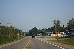
Looking north at downtown Langlade on WIS 55
USA Wisconsin location map.svg
Red pog.svg
Langlade
Usa edcp location map.svg
Red pog.svg
Langlade
Coordinates: 45°11′24″N88°43′56″W / 45.18997°N 88.73233°W / 45.18997; -88.73233
Country Flag of the United States.svg  United States
State Flag of Wisconsin.svg  Wisconsin
County Langlade
Town Wolf River
Time zone UTC-6 (Central (CST))
  Summer (DST) UTC-5 (CDT)
Area code(s) 715 & 534
GNIS feature ID1579627 [1]

Langlade is an unincorporated community located in the town of Wolf River in Langlade County, Wisconsin, United States. [2] It is located at the intersection of Wisconsin Highway 55 and Wisconsin Highway 64. [3] The Langlade post office was established in June 1873 by its first postmaster, Charles H. Lazelere. The post office was later discontinued in 1915. [4] The community is named for Charles Michel de Langlade, who established a trading post in the 1740s. [5]

Related Research Articles

<span class="mw-page-title-main">Shawano County, Wisconsin</span> County in Wisconsin, United States

Shawano County is a county located in the U.S. state of Wisconsin. As of the 2020 census, the population was 40,881. Its county seat is Shawano.

<span class="mw-page-title-main">Langlade County, Wisconsin</span> County in Wisconsin, United States

Langlade County is a county located in the U.S. state of Wisconsin. As of the 2020 census, the population was 19,491. Its county seat is Antigo.

<span class="mw-page-title-main">Langlade, Wisconsin</span> Town in Wisconsin, United States

Langlade is a town in Langlade County, Wisconsin, United States. The population was 473 at the 2010 census. The unincorporated communities of Choate, Freeman, Lily, and Pickerel are located within the town.

<span class="mw-page-title-main">Antigo, Wisconsin</span> City in Wisconsin, United States

Antigo is a city in and the county seat of Langlade County, Wisconsin, United States. The population was 8,100 at the 2020 census. Antigo is the center of a farming and lumbering district, and its manufactured products consist principally of lumber, chairs, furniture, sashes, doors and blinds, hubs and spokes, and other wood products.

<span class="mw-page-title-main">Wisconsin Highway 64</span> Highway in Wisconsin

State Trunk Highway 64 (WIS 64) is a 275.65-mile-long (443.62 km) highway in Wisconsin, which runs from the St. Croix Crossing bridge as a continuation of Minnesota State Highway 36 (MN 36) near Stillwater, Minnesota, and continues east to its eastern terminus in downtown Marinette, where it terminates at US Highway 41 (US 41) at an intersection on the corner of Marinette and Hall Avenue. Along the way, Highway 64 runs east–west through eight counties across northern Wisconsin.

<span class="mw-page-title-main">Greenleaf, Wisconsin</span> Village in Wisconsin, United States

Greenleaf is a village in Brown County, Wisconsin, United States, in the town of Wrightstown.

<span class="mw-page-title-main">Pickerel, Wisconsin</span> Unincorporated community in Wisconsin, United States

Pickerel is an unincorporated community in the northeast corner of Langlade County, Wisconsin, United States. The community is located on Wisconsin Highway 55, in the town of Langlade. Pickerel is 19 miles (31 km) northeast of Antigo, the county seat of Langlade County. Pickerel has a post office with ZIP code 54465. The Pickerel Volunteer Fire Department is located northwest of town on County Road T, and serves the town of Ainsworth, and part of the town of Nashville in Forest County.

<span class="mw-page-title-main">Pearson, Wisconsin</span> Unincorporated community in Wisconsin, United States

Pearson is an unincorporated community in the town of Ainsworth, Langlade County, Wisconsin, United States. Pearson is 5 miles (8 km) west of Pickerel and 17 miles (27 km) north-northeast of Antigo, the county seat of Langlade County. The community is situated on Pickerel Creek near its confluence with the Wolf River. County Highway T runs through Pearson; the closest state highway to the community is Wisconsin State Highway 55 in Pickerel.

<span class="mw-page-title-main">Lily, Wisconsin</span> Unincorporated community in Wisconsin, United States

Lily is an unincorporated community in Langlade County, Wisconsin, United States, located within the town of Langlade. Lily is at the intersection of Wisconsin State Highway 52 and Wisconsin State Highway 55.

Deerbrook is an unincorporated community in Langlade County, Wisconsin, United States. Deerbrook is on County Highway E north of Antigo in the town of Neva. It has a post office that has been operating since 1887 with ZIP code 54424.

Elton is an unincorporated community located in Langlade County, Wisconsin, United States. Elton is located on Wisconsin Highway 64 east of Antigo, in the town of Evergreen. Elton established a post office in 1883, and it still operates today.

<span class="mw-page-title-main">Hollister, Wisconsin</span> Unincorporated community in Wisconsin, United States

Hollister, Wisconsin is an unincorporated community located in the town of Wolf River, in Langlade County, Wisconsin, United States. The community is located on Wisconsin Highway 55. The village is named after Seymour W. Hollister, an Oshkosh lumberman and a partner in the Choate-Hollister Furniture Co. Hollister is served by the Wolf River Volunteer Fire Department, and City of Antigo EMS. The town established a post office in 1923, and it was eventually discontinued in 1961.

Harmony is an unincorporated community located in the town of Grover, Marinette County, Wisconsin, United States. Harmony is located 5 miles (8.0 km) northwest of Peshtigo.

Sprague is an unincorporated community located in the town of Necedah, Juneau County, Wisconsin, United States. Sprague is located on Wisconsin Highway 80 and the Canadian National Railway 8.5 miles (13.7 km) north-northwest of the village of Necedah. The community is likely named for John and Gleason Sprague, the owners and publishers of the Mauston Star newspaper in the late 19th century. The post office was established in February 1907 with Michael Anthony as postmaster.

Glandon is an unincorporated community located in the town of Hewitt, Marathon County, Wisconsin, United States. Glandon is located at the junction of County Highways G and Q 13.5 miles (21.7 km) northeast of Wausau. William C. Landon founded the community's post office in 1908. He named the community after either his father or son who are both named G. Landon.

Henrysville is an unincorporated community in the Town of Eaton, Brown County, Wisconsin, United States. It is located at the junction of Wisconsin Highway 29 and County Highway P 12 miles (19 km) east-southeast of Green Bay. In May 1879, John Henry Osterloh opened a post office in the community.

Kolb is an unincorporated community located in the town of Ledgeview, Brown County, Wisconsin, United States. Kolb is located at the junction of County Highways G, V, and MM 7 miles (11 km) south-southeast of Green Bay. The community is named after Peter Kolb, who was the first postmaster when the post office opened in May 1887.

Lawton is an unincorporated community located in the towns of Ellsworth and Martell, Pierce County, Wisconsin, United States. Lawton is located at the junction of U.S. Route 63 and County Highway N 4.5 miles (7.2 km) northeast of the city of Ellsworth. The community is most likely named for Lawton Peterson, who ran the store in which the first post office was located when it opened in 1894.

<span class="mw-page-title-main">National Register of Historic Places listings in Langlade County, Wisconsin</span>

This is a list of the National Register of Historic Places listings in Langlade County, Wisconsin. It is intended to provide a comprehensive listing of entries in the National Register of Historic Places that are located in Langlade County, Wisconsin. The locations of National Register properties for which the latitude and longitude coordinates are included below may be seen in a map.

References

  1. U.S. Geological Survey Geographic Names Information System: Langlade (community), Wisconsin
  2. Langlade County (PDF) (Map). Wisconsin Department of Transportation. 2011. Archived from the original (PDF) on June 14, 2011. Retrieved August 23, 2011.
  3. "Google maps for Langlade, Wisconsin". Google Maps. Retrieved December 20, 2009.
  4. https://www.postalhistory.com/postoffices.asp?task=display&state=WI&county=Langlade
  5. Callary, Edward (2016). Place Names of Wisconsin. Madison, WI: University of Wisconsin Press. pp. 149–50. ISBN   978-0-299-30964-0.