Larder River (Ontario)

Last updated
Larder River
Fourth Falls, Larder River, Timiskaming, Ontario.jpg
Fourth Falls on the Larder River
Canada Ontario relief location map.jpg
Red pog.svg
Location of the mouth of the Larder River in Ontario
Location
Country Canada
Province Ontario
Region Northeastern Ontario
District Timiskaming
Physical characteristics
Source Larder Lake
  locationMcFadden Township
  coordinates 48°02′12″N79°36′03″W / 48.036714178344404°N 79.6007949401155°W / 48.036714178344404; -79.6007949401155
  elevation274 m (899 ft)
Mouth Blanche River
  location
Evanturel
  coordinates
47°49′54″N79°48′55″W / 47.83167°N 79.81528°W / 47.83167; -79.81528 [1] Coordinates: 47°49′54″N79°48′55″W / 47.83167°N 79.81528°W / 47.83167; -79.81528 [1]
  elevation
180 m (590 ft)
Length54.0 km (33.6 mi)
Basin features
River system Saint Lawrence River drainage basin

The Larder River is a river in Timiskaming District, in Northeastern Ontario, Canada. [1] [2] [3] [4] It is in the Saint Lawrence River drainage basin, and flows from its source at Larder Lake in geographic McFadden Township to its mouth as a left tributary of the Blanche River in the municipal township of Evanturel.

Contents

The section of river from Raven Lake to Upper Wendigo Lake runs through a northeasterly-oriented geologic fault system, with mafic metavolcanic bedrock to the west and sedimentary and volcanic rock to the east. The Larder River has many wild rapids, making it suitable for experienced whitewater canoeists. [5]

Course

The river begins at the mouth of the Larder Lake (length: 15.6 kilometres (9.7 mi) altitude: 274 metres (899 ft)) in Rattray geographic township in the Timiskaming District. This lake has the following bays: Southwest Arm, Spoon Bay and Northeast Arm.

The mouth of Larder Lake is located at:

From the dam at the mouth of Larder Lake (located south of the lake), the river flows over 54.0 kilometres (33.6 mi), according to the following segments:

Upper Larder River (segment of 30.3 kilometres (18.8 mi))

Lower part of the Larder River (segment of 23.7 kilometres (14.7 mi))

The Blanche River flows via Lake Timiskaming and the Ottawa River to the Saint Lawrence River.

Provincial park

Larder River Waterway Provincial Park
Coordinates 47°58′21″N79°37′37″W / 47.97250°N 79.62694°W / 47.97250; -79.62694 [7]
Area4,044.00 ha (15.6140 sq mi) [5]
DesignationWaterway
Established1985
Governing body Ontario Parks
www.ontarioparks.com/park/larderriverwaterway

The Larder River Waterway Provincial Park protects a 30-kilometre-long (19 mi) section of the Larder River from Raven Lake to Upper Wendigo Lake, including the shores of the lakes it flows through, i.e. Raven, Corset, Ward, and Skead Lakes. Also part of the park is a tract of land south of Wendigo Lake that includes Beaver, Clear, Crystal, Little Moose, Miller, and Skeletonpup Lakes. The Larder River inside the park is characterized by scenic boreal forest, cliffs, outcrops, and plateaus. [8] [9]

The park was originally established in 1985 and had 2,509 hectares (6,200 acres), only including the river corridor from Raven Lake to Upper Wendigo Lake, as well as the area around Clear Lake. [8] In 2002, the park was extended to the south of Wendigo Lake by 1,535 hectares (3,790 acres). [9]

The park provides important feeding and calving habitats for moose and nesting sites for birds of prey. Fish species found in the park include brook trout, golden shiner, northern pike, pumpkinseed, rock bass, spottail shiner, white sucker, and yellow perch. [9]

The Larder River Waterway Provincial Park is a non-operating park. There are no facilities or services provided. [5]

See also

Related Research Articles

<span class="mw-page-title-main">Timiskaming District</span> District in Ontario, Canada

Timiskaming is a district and census division in Northeastern Ontario in the Canadian province of Ontario. The district was created in 1912 from parts of Algoma, Nipissing, and Sudbury districts. In 1921, Cochrane District was created from parts of this district and parts of Thunder Bay District.

<span class="mw-page-title-main">York River (Ontario)</span> River in Ontario, Canada

The York River is a river in Renfrew County, Hastings County and Haliburton County in Ontario, Canada. The river is in the Saint Lawrence River drainage basin, and flows from the southern extension of Algonquin Provincial Park to the Madawaska River.

<span class="mw-page-title-main">Sturgeon River (Lake Nipissing)</span> River in Ontario, Canada

The Sturgeon River is a river that springs near Lady Evelyn-Smoothwater Provincial Park in the Timiskaming District in Ontario, Canada. It flows 230 kilometres (140 mi) in a mostly south-easterly direction through Sudbury and Nipissing Districts before it empties into Lake Nipissing on the north shore. The town of Sturgeon Falls is located on the river about 3 kilometres (1.9 mi) north of its mouth.

<span class="mw-page-title-main">Larder Lake</span> Lake in Timiskaming District, Ontario

Larder Lake is a freshwater lake in Timiskaming District in Northeastern Ontario, Canada. The lake straddles the incorporated (municipal) townships of Larder Lake and McGarry and geographic McFadden Township. It is part of the Saint Lawrence River drainage basin and is the source of the Larder River.

<span class="mw-page-title-main">Sturgeon River Provincial Park</span> Provincial park in Ontario, Canada

The Sturgeon River Provincial Park is a provincial park in northern Ontario, Canada, that protects about 70 kilometres (43 mi) long section of the Sturgeon River and its banks, from Woods Lake to the Sudbury-Nipissing District boundary. It was established in 1989 and expanded in 2005. It protects outstanding water routes that provide recreational canoe camping opportunities. Other activities include hunting and fishing.

<span class="mw-page-title-main">Englehart River</span> River in Ontario, Canada

The Englehart River is a river in Timiskaming District in northeastern Ontario, Canada. It is in the Saint Lawrence River drainage basin and is a right tributary of the Blanche River.

<span class="mw-page-title-main">Blanche River (Lake Timiskaming)</span> River in Ontario, Canada

The Blanche River is a river in the Saint Lawrence River drainage basin in Timiskaming District in northeastern Ontario, Canada. The river is a tributary of Lake Timiskaming and its name is from the French for the colour "white".

<span class="mw-page-title-main">Groundhog River</span> River in Northeastern Ontario, Canada

The Groundhog River is a river in Cochrane District and Sudbury District in Northeastern Ontario, Canada. The river is in the James Bay drainage basin and is a left tributary of the Mattagami River.

<span class="mw-page-title-main">Kap-Kig-Iwan Provincial Park</span> Provincial park in Ontario, Canada

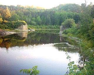
Kap-Kig-Iwan Provincial Park is a protected area in the incorporated townships of Charlton and Dack and Evanturel in Timiskaming District in Northeastern Ontario, Canada. Established in 1957, the 325-hectare (803-acre) park is located along the Englehart River, off Ontario Highway 11 about 2 kilometres (1.2 mi) south of the town of Englehart. Kap-Kig-Iwan is classified as a Natural Environment park and is a provincial park of Ontario.

The Little Misema River is a river in Timiskaming District and Cochrane District in Northeastern Ontario, Canada. It is in the Saint Lawrence River drainage basin and is a left tributary of the Misema River.

The Little White River is a river in the Unorganized North Part of Algoma District in Northeastern Ontario, Canada. It is in the Great Lakes Basin and is a left tributary of the Mississagi River.

Lillord Creek is a creek in the Unorganized West Part of Timiskaming District in northeastern Ontario, Canada. It is in the Saint Lawrence River drainage basin and is a right tributary of the Blanche River.

Lillord Lake is a lake in geographic Lee Township in the Unorganized West Part of Timiskaming District, in northeastern Ontario, Canada. The lake is in the Saint Lawrence River drainage basin and is the source of Lillord Creek. The nearest community is Sesekinika, 5.2 kilometres (3.2 mi) to the east.

Berube Lake is a lake in geographic Lee Township in the Unorganized West Part of Timiskaming District, in northeastern Ontario, Canada. The lake is in the Saint Lawrence River drainage basin and is on Lillord Creek. The nearest community is Sesekinika, 5 kilometres (3.1 mi) to the east.

The Makobe River is a river in northeastern Ontario, Canada. It is in the Saint Lawrence River drainage basin, and is a left tributary of the Montreal River.

The Dufay River is a tributary of Lake Buies, flowing in the Northwestern part of the territory of the city of Rouyn-Noranda, in administrative region of Abitibi-Temiscamingue, in Quebec, in Canada.

The Laberge River is a tributary of Lake Hebert, flowing in Canada, in:

Raven Lake is a freshwater body of Canada that straddles the boundary between:

<span class="mw-page-title-main">Opawica River</span> River in Quebec, Canada

The Opawica River is a tributary of the Waswanipi River, which is a tributary of Matagami Lake which in turn flows into the Nottaway River which flows into the south of James Bay. The Opawica River flows in the municipality of Eeyou Istchee Baie-James (municipality), in the administrative region of Nord-du-Québec, in Quebec, the Canada.

References

  1. 1 2 3 "Larder River". Geographical Names Data Base . Natural Resources Canada . Retrieved 2017-12-17.
  2. "CLAIMaps IV". Ontario Ministry of Northern Development and Mines. 2016. Retrieved 2017-12-17.
  3. Map 15 (PDF) (Map). 1 : 1,600,000. Official road map of Ontario. Ministry of Transportation of Ontario. 2016-01-01. Retrieved 2017-12-17.
  4. Restructured municipalities - Ontario map #4 (Map). Restructuring Maps of Ontario. Ontario Ministry of Municipal Affairs and Housing. 2006. Retrieved 2017-12-17.
  5. 1 2 3 "Larder River Waterway Provincial Park". www.ontarioparks.com. Ontario Parks. Retrieved 5 May 2023.
  6. River segments measured from the Atlas of Canada (published on the Internet) from the Department of Natural Resources Canada.
  7. "Larder River Waterway Provincial Park". Geographical Names Data Base . Natural Resources Canada . Retrieved 5 May 2023.
  8. 1 2 "Policy Report P1625e: LARDER RIVER WATERWAY PROVINCIAL PARK (WATERWAY CLASS)". Crown Land Use Policy Atlas. Ministry of Natural Resources Ontario. 31 January 2006. Retrieved 5 May 2023.
  9. 1 2 3 "Larder River Waterway Provincial Park Management Statement". ontario.ca. Ontario Ministry of the Environment, Conservation and Parks. 26 May 2006. Retrieved 5 May 2023.