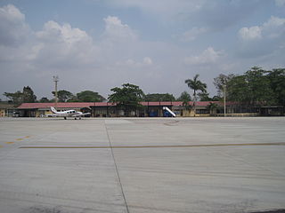
The Las Brujas Airport is a domestic airport located in the town of Corozal, Sucre in Colombia. The airport is located 10 minutes from the capital of the department, the city of Sincelejo. In emergency situations, it serves as the alternate airport of the city of Montería. It has regional and national operations with regular passenger services to Bogotá and Medellín.
Las Brujas Airport may refer to:

Mocopulli Airport is an airport serving Dalcahue, a port city on Chiloé Island in the Los Lagos Region of Chile, as well as the city of Castro. The airport is 6 kilometres (3.7 mi) northwest of Dalcahue.
Pupelde Airport is an airport serving Ancud, a Pacific port city in the Los Lagos Region of Chile. Ancud is on the northern shore of Chiloé Island.
Chaitén Airfield was an airport serving Chaitén, a town in the Los Lagos Region of Chile. The airport was damaged and closed after the 2008 eruption of Chaitén Volcano.
Chañaral Airport Spanish: Aeropuerto de Chañaral, is an airport serving Chañaral, a Pacific coastal city in the Atacama Region of Chile.
Chile Chico Airport Spanish: Aeródromo Chile Chico, is an airport serving Chile Chico, a lakeside town in the Aysén Region of Chile. Chile Chico is on the south shore of General Carrera Lake, 3 kilometres (1.9 mi) west of the Argentina border. The airport is 5 kilometres (3.1 mi) southeast of the town.

Cochrane Airport Spanish: Aeródromo Cochrane, is an airport serving Cochrane, a town in the Aysén Region of Chile. The airport is just northwest of the town, at the foot of Cerro Tamanguito (sv).
Caleta Blanco Airport Spanish: Aeropuerto Caleta Blanco, is an airport serving the villages of Puerto Aguirre (es) and Caleta Andrade (es) on Isla Las Huichas (es), an island in the Aysén Region of Chile.
Las Bandurrias Airport Spanish: Aeropuerto Las Bandurrias, is an airstrip serving Riñinahue (es), a scattered community 22 kilometres (14 mi) east of Lago Ranco, a town in the Los Lagos Region of Chile.
Las Tacas Airport Spanish: Aeropuerto de Las Tacas, is an airport serving Las Tacas (es), a Pacific coastal resort in the Coquimbo Region of Chile. The airport is 24 kilometres (15 mi) south of La Serena.
San Rafael Airport Spanish: Aeródromo de San Rafael de Los Andes, is an airport serving Los Andes, a city in the Valparaíso Region of Chile. The airport is 5 kilometres (3.1 mi) west-northwest of the city.
Las Araucarias Airport is an airport located 19 kilometres (12 mi) east of Puerto Octay, a town on the northern shore of Llanquihue Lake in the Los Lagos Region of Chile.
Las Agullas Airport, is one of several airstrips serving communities on the western side of Rapel Lake in the O'Higgins Region of Chile. The runway is 4 kilometres (2.5 mi) west of the lake.
Las Alpacas Airport is a small airport serving Parral, a city in the Maule Region of Chile. The runway is 5 kilometres (3.1 mi) east of Parral.
Los Pelambres Airport is an airport serving the town of Salamanca and the Los Pelambres copper mine in the Coquimbo Region of Chile.
Panguilemo Airport is an airport 5 kilometres (3.1 mi) northeast of Talca, capital of the Maule Region of Chile.
Las Breas Airport is an airport 20 kilometres (12 mi) south-southeast of Taltal, a Pacific coastal town in the Antofagasta Region of Chile.
Barriles Airport Spanish: Aeropuerto Barriles is an airport 15 kilometres (9.3 mi) east-southeast of Tocopilla, a Pacific coastal town in the Antofagasta Region of Chile.
Vallenar Airport (Spanish: Aeródromo de Vallenar, is an airport serving Vallenar, a city in the Atacama Region of Chile.

