Chatsworth is a suburban neighborhood in Los Angeles, California, in the San Fernando Valley.

The Santa Monica Mountains are a coastal mountain range in Southern California, next to the Pacific Ocean. It is part of the Transverse Ranges. The Santa Monica Mountains National Recreation Area encompasses this mountain range. Because of its proximity to densely populated regions, it is one of the most visited natural areas in California.

The Santa Susana Mountains are a transverse range of mountains in Southern California, north of the city of Los Angeles, in the United States. The range runs east-west, separating the San Fernando and Simi valleys on its south from the Santa Clara River Valley to the north and the Santa Clarita Valley to the northeast. The Oxnard Plain is to the west of the Santa Susana Mountains.

The Santa Susana Pass, originally Simi Pass, is a low mountain pass in the Simi Hills of Southern California, connecting the San Fernando Valley and Los Angeles neighborhood of Chatsworth, to the city of Simi Valley and eponymous valley.

El Escorpión Park is a three-acre park located in the Simi Hills of the western San Fernando Valley, in the West Hills district of Los Angeles, California. The park contains the geographic landmark known as Escorpión Peak or Castle Peak, a 1,475-foot-tall rocky peak seen from most parts of the park and the surrounding community.

Rocky Peak, located in Rocky Peak Park, is the fourth-highest point in the Santa Susana Mountains, and overlooks the San Fernando Valley and Chatsworth, the Simi Hills, and the Simi Valley in Southern California. The peak, which is 2,715 feet (828 m) in elevation, sits on the Los Angeles County–Ventura County line.

The Simi Hills are a low rocky mountain range of the Transverse Ranges in eastern Ventura County and western Los Angeles County, of southern California, United States.

The Upper Las Virgenes Canyon Open Space Preserve is a large open space nature preserve owned and operated by the Santa Monica Mountains Conservancy spanning nearly 3,000 acres (1,200 ha) in the Simi Hills of western Los Angeles County and eastern Ventura County.

The Santa Monica Mountains National Recreation Area is a United States national recreation area containing many individual parks and open space preserves, located primarily in the Santa Monica Mountains of Southern California. The SMMNRA is in the greater Los Angeles region, with two thirds of the parklands in northwest Los Angeles County, and the remaining third, including a Simi Hills extension, in southeastern Ventura County.
Bell Canyon Park is a large open-space regional park located in the Simi Hills at the western end of the San Fernando Valley in West Hills, Los Angeles and Bell Canyon, California. Bell Creek, a primary tributary to the Los Angeles River, flows through the park with riparian zone vegetation along its natural banks. The geographic landmark Escorpión Peak is high above it to the south in adjacent El Escorpión Park.

Santa Susana Pass State Historic Park is a California State Park of 670.68 acres (2.7141 km2) located in the city of Los Angeles, in Los Angeles County on the boundary between Ventura and Los Angeles counties, between the communities of Chatsworth and Simi Valley. Geologically, the park is located where the Simi Hills meet the Santa Susana Mountains. Here in the western part of the Transverse Ranges, the land is dominated by high, narrow ridges and deep canyons covered with an abundant variety of plant life. The park offers panoramic views of the rugged natural landscape as a striking contrast to the developed communities nearby. The park is also rich in archaeological, historical, and cultural significance.

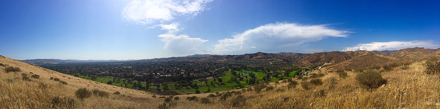
Simi Valley is a city in the valley of the same name in the southeast region of Ventura County, California, United States. Simi Valley is 40 miles (65 km) from Downtown Los Angeles, making it part of the Greater Los Angeles Area. The city borders Thousand Oaks, Moorpark, and the Chatsworth neighborhood of Los Angeles. As of the 2020 U.S. Census the population was 126,356, up from 124,243 in 2010. The city of Simi Valley is surrounded by the Santa Susana Mountains and the Simi Hills, west of the San Fernando Valley, and northeast of the Conejo Valley. It grew as a bedroom community for the cities in the Los Angeles area and the San Fernando Valley when a freeway was built over the Santa Susana Pass.

Simi Valley is a synclinal valley in Southern California in the United States. It is an enclosed or hidden valley surrounded by mountains and hills. It is connected to the San Fernando Valley to the east by the Santa Susana Pass and the 118 freeway, and in the west the narrows of the Arroyo Simi and the Reagan Freeway connection to Moorpark. The relatively flat bottom of the valley contains soils formed from shales, sandstones, and conglomerates eroded from the surrounding hills of the Santa Susana Mountains to the north, which separate Simi Valley from the Santa Clara River Valley, and the Simi Hills.

Santa Susana is a former railroad town located mostly within the City of Simi Valley. A small portion of the community, outside the Simi Valley city limits to the south of the Ventura County Metrolink rail line, is an unincorporated area and census-designated place (CDP). The community is in the eastern part of the Simi Valley.
China Flat is a plateau in the north−central Simi Hills, in Ventura County, Southern California.

Challenger Park is a 141.55-acre open-space park (57.28 ha) located in southern portion of Simi Valley, California in the Simi Hills. The park is owned and maintained by the Rancho Simi Recreation and Park District. Challenger Park is used for mountain hiking, mountain biking, jogging, and horseback riding but with a focus on the preservation of wildlife habitat. The scenery lining the trails includes extensive oak woodlands, chaparral, and coastal sage scrub. The terrain varies greatly with rolling green hills and steep mountainous hills and canyons. The park offers miles of trails connecting to Long Canyon, Oak Canyon, Trough Canyon, Lone Oak Canyon, and other adjoining open-space nature areas in the southern section of the Simi Valley. There is a fairly easy hike to Thousand Oaks, CA via Long Canyon trails. To get to Oak Canyon, Old Windmill Park and Coyote Hills Park, you must cross Long Canyon Road. Fences run along the Long Canyon Road with dirt paths. There are also lights at the signals with push buttons for hikers, and raised buttons for equestrians. Adjacent to Challenger Park is also Bridle Trails, a private hiking area. There are scenic views of the City of Simi Valley from the park and it is a native habitat for numerous species of animals, including mule deer, mountain lions, coyotes, rattlesnakes, crawdads, California king-snakes, grey foxes, bobcats, as well as red-tailed hawks, barn owls, and numerous other raptors.

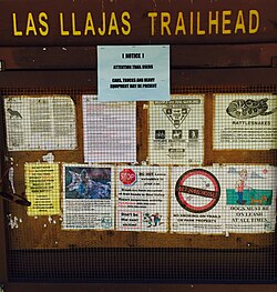
The Arroyo Simi is a 19-mile (31 km) westwards-running creek, located in California, United States, running from the city of Simi Valley and crosses the valley from east to west, before entering the city of Moorpark. It originates at Corriganville Park by the Santa Susana Pass, travels for 12 miles (19 km) through Simi Valley, leaves the city limits of Oak Park at the western end of Simi Valley, continues for seven miles in Moorpark where it merges with Arroyo Las Posas by Hitch Road. It is a tributary to the Calleguas Creek, which enters the Pacific Ocean by its estuary at Mugu Lagoon by Naval Air Station Point Mugu. Arroyo Simi drains an area of 343 square miles in southern Ventura County. In its natural state, it is an ephemeral creek, which is only seasonally filled during winter time and periods of heavy rain. Today it is for the most part a concrete lined water drain that flows year round. Tributaries to the Arroyo Simi include the Alamos, Sycamore, Dry, Tapo, Las Llajas, White Oak, Runkle, and Bus Canyon Creeks, as well as the Erringer Road and North Simi Drains.

Sage Ranch Park is a 625-acre park (253 ha) and wildlife corridor located at a 2,000 feet (610 m) height in the northwestern Simi Hills on the northwestern plateau of the Simi Valley, bordering Los Angeles County and its San Fernando Valley. The campground area used to be a cattle ranch and later a filmset for Western movies. Sage Ranch Park is today an intermountain wildlife corridor, which links the Simi Hills with the Santa Susana- and Santa Monica Mountains. The mountainous park is mostly known for its unique sandstone rock formations, maybe particularly on its western side where the Sandstone Ridge and Turtle Rock are situated. On its northern side, there are great panoramic rural and metropolitan views of the Simi Valley, as well as surrounding Simi Hills, Santa Susana Mountains and beyond. It is home to numerous sandstone formations, caves, outcroppings, tilted rock formations, several hiking trails, a camping ground, as well as native flora and wildlife. The area is lined with coastal sage scrub and other flora includes chaparral, bush lupine, California poppy, sunflowers, Cream Cups, bracken, sword fern, prickly pear cactus, eucalyptus trees, oak woodland of ceanothus, coffee berry, California buckwheat, sycamore, Walnut Tree, ferns, orange- and avocado trees. It is a critical cross-mountain wildlife corridor and is home to fauna such as mountain lions, bobcats, eagles, vultures, owls, rattle snakes, coyotes, hawks, grey fox, king snakes, and more. Bordering Sage Ranch to the south is the Rocketdyne Santa Susana Field Laboratory, in which the nearby Burro Flats Painted Cave is located.
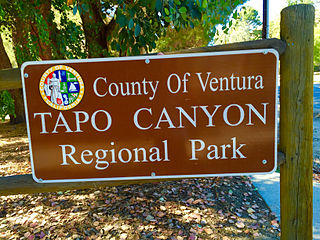
Tapo Canyon is a series of canyons and a wildlife corridor in the western Santa Susana Mountains, north of Simi Valley in Ventura County, Southern California. It's the main filming location of the well-known TV show Little House on the Prairie in the 1970s.

Arroyo Conejo carries part of the longest creek in the Conejo Valley which sprawls past the cities of Thousand Oaks and Camarillo, and the communities of Newbury Park, Casa Conejo and Santa Rosa Valley. Arroyo Conejo is the primary drainage for the City of Thousand Oaks. Its watershed covers 57 square miles (150 km2) of which 43 square miles (110 km2) are in the Conejo Valley and 14 square miles (36 km2) in the Santa Rosa Valley.