Killyran is a townland in the civil parish of Templeport, County Cavan, Ireland. It lies in the Roman Catholic parish of Templeport and barony of Tullyhaw.
Moherloob is a small townland in the civil parish of Templeport, County Cavan, Ireland. It is 0.45 square kilometres (0.17 sq mi) in area and lies in the barony of Tullyhaw. As of the 2011 census, there were no people living in Moherloob.
Cloncurkney is a townland in the civil parish of Templeport, County Cavan, Ireland. It lies in the Roman Catholic parish of Templeport and barony of Tullyhaw.

Killywaum is a townland in the civil parish of Templeport, County Cavan, Ireland. It lies in the Roman Catholic parish of Templeport and barony of Tullyhaw.
Ardvagh is a townland in the civil parish of Templeport, County Cavan, Ireland. It lies in the Roman Catholic parish of Corlough and barony of Tullyhaw.
Raleagh is a townland in the civil parish of Kildallan, barony of Tullyhunco, County Cavan, Ireland. The townland is also called Derrinaherk, according to the Tithe Applotment Books 1823-1837.

Callaghs is a townland in the civil parish of Kildallan, barony of Tullyhunco, County Cavan, Ireland. The locals pronounce the name as- The Callas.
Altshallan either Alt Sealáin, meaning The Gorge of the Water Channel or Alt Sealán meaning the Height of the Gallows, is a townland in the civil parish of Templeport, County Cavan, Ireland. It lies in the Roman Catholic parish of Glangevlin and barony of Tullyhaw.
Carnmaclean, an Anglicisation of the Irish ‘Carn Mhic Giolla Éain’, meaning McClean’s Cairn, is a townland in the civil parish of Templeport, barony of Tullyhaw, County Cavan, Ireland.
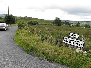
Carrick West,, is a townland in the civil parish of Templeport, County Cavan, Ireland. It is named Carrick West or Carrick Hassard to distinguish it from Carrick East or Carrick Fisher townland which is in Templeport parish. It lies in the Roman Catholic parish of Glangevlin and barony of Tullyhaw.
Corneenflynn, an Anglicisation of the Gaelic, either ‘Coirnín Flann’ meaning Flann’s Little Corner, or Coirnín Uí Fhloinn meaning Flynn’s Little Corner, or Cairnin Uí Fhloinn meaning Flynn’s Little Cairn or Cairn-Shaped Hill, is a townland in the civil parish of Templeport, County Cavan, Ireland. It lies in the Roman Catholic parish of Glangevlin and barony of Tullyhaw.

Corratawy, an Anglicisation of the Gaelic, ‘Corr an tSamhaidh’ meaning The Round Hill of the Sorrel Herb, is a townland in the civil parish of Templeport, County Cavan, Ireland. It lies in the Roman Catholic parish of Glangevlin and barony of Tullyhaw. The local pronunciation is Curratavy.

Curraghvah, an Anglicisation of the Gaelic, either ‘Currach Bheathach’, meaning The Moor of the Birches, or ‘Currach a’ Mhagh’, meaning The Moor of the Plain, or ‘Currach Mheádh’ meaning The Moor of the Spicy Mead Drink, is a townland in the civil parish of Templeport, County Cavan, Ireland. It lies in the Roman Catholic parish of Glangevlin and barony of Tullyhaw.

Derrylahan, an Anglicisation of the Gaelic, ‘Doire Leathan’ meaning The Wide Oak-wood, is a townland in the civil parish of Templeport, County Cavan, Ireland. It lies in the Roman Catholic parish of Glangevlin and barony of Tullyhaw.

Derrynananta Lower, an Anglicisation of the Gaelic, ‘Doire na Neannta Íochtar’, meaning The Lower Oak-wood of the Nettles, is a townland in the civil parish of Templeport, County Cavan, Ireland. It lies in the Roman Catholic parish of Glangevlin and barony of Tullyhaw.

Drumhurrin, an Anglicisation of the Gaelic ‘Droim Shoirn’, meaning The Hill-Ridge of the Lime-Kiln or Furnace, is a townland in the civil parish of Templeport, County Cavan, Ireland. It lies in the Roman Catholic parish of Glangevlin and barony of Tullyhaw.
Gowlat, an Anglicisation of the Gaelic, 'Gabhla', meaning The Forks, is a townland in the civil parish of Templeport, County Cavan, Ireland. It lies in the Roman Catholic parish of Glangevlin and barony of Tullyhaw.
Knockgorm, an Anglicisation of the Gaelic 'Cnoc Gorm', meaning The Blue Hill, is a townland in the civil parish of Templeport, County Cavan, Ireland. It lies in the Roman Catholic parish of Glangevlin and barony of Tullyhaw.
Legatraghta, an Anglicisation of the Gaelic ‘Lag an tSneachta’, meaning The Hollow of the Snow, is a townland in the civil parish of Templeport, County Cavan, Ireland. It lies in the Roman Catholic parish of Glangevlin and barony of Tullyhaw.
Mullaghlea Glen, is a townland in the civil parish of Templeport, County Cavan, Ireland. It lies in the Roman Catholic parish of Glangevlin and barony of Tullyhaw.


