Latty Township, Paulding County, Ohio

Last updated

Latty Township, Paulding County, Ohio
Between Grover Hill and Haviland, wheat field.jpg
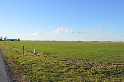
Farmland between Grover Hill and Haviland
Flag of Latty Township, Ohio.png
Latty Paulding.PNG
Location of Latty Township in Paulding County
Coordinates: 41°1′35″N84°30′19″W / 41.02639°N 84.50528°W / 41.02639; -84.50528
Country United States
State Ohio
County Paulding
Area
  Total
36.4 sq mi (94.3 km2)
  Land36.4 sq mi (94.3 km2)
  Water0 sq mi (0.0 km2)
Elevation
[1]
725 ft (221 m)
Population
 (2020) [2]
  Total
978
  Density26.9/sq mi (10.4/km2)
Time zone UTC-5 (Eastern (EST))
  Summer (DST) UTC-4 (EDT)
ZIP code
45855
Area code 419
FIPS code 39-42000 [3]
GNIS feature ID1086775 [1]

Latty Township is one of the twelve townships of Paulding County, Ohio, United States. The 2020 census found 978 people in the township.

Contents

Geography

Located in the southern part of the county, it borders the following townships:

The village of Grover Hill is located in southeastern Latty Township.

Name and history

It is the only Latty Township statewide. [4]

Government

The township is governed by a three-member board of trustees, who are elected in November of odd-numbered years to a four-year term beginning on the following January 1. Two are elected in the year after the presidential election and one is elected in the year before it. There is also an elected township fiscal officer, [5] who serves a four-year term beginning on April 1 of the year after the election, which is held in November of the year before the presidential election. Vacancies in the fiscal officership or on the board of trustees are filled by the remaining trustees.

References

  1. 1 2 "US Board on Geographic Names". United States Geological Survey. October 25, 2007. Retrieved January 31, 2008.
  2. "Latty township, Paulding County, Ohio - Census Bureau Profile". United States Census Bureau. Retrieved August 4, 2023.
  3. "U.S. Census website". United States Census Bureau . Retrieved January 31, 2008.
  4. "Detailed map of Ohio" (PDF). United States Census Bureau. 2000. Retrieved February 16, 2007.
  5. §503.24, §505.01, and §507.01 of the Ohio Revised Code. Accessed 4/30/2009.